GTAM - Stage 17: Gola di Gouta refuge - Rochetta Nervina
Apricale
17. GTAM - Stage 17: Gola di Gouta refuge - Rochetta Nervina
Hard
6h
17,2km
+502m
-1493m
Longer treks
Embed this item to access it offline
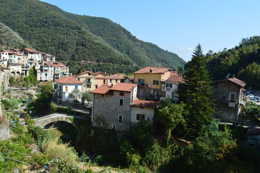
The village of Roccheta denotes the entrance into the Ligurian villages with their singular atmosphere: colourful facades, olive groves, intertwined houses, stone bridges etc.
Description
When you leave the refuge, turn right onto the tarmacked forest road towards Rochetta Nervina from the marker (path 125). Go down the tarmacked road for 1.73 kilometres, reaching an altitude of 1102 metres and crossing the temporary mountain stream via a bridge and continuing left along the track which can be used by vehicles. You will then rise along the forest track and pass quickly over another bridge. At 1142 metres, take the track on the right following the direction for Margheria Gion. At 1236 metres altitude, take the track on the left as indicated by the marker following the same direction. Head alongside a private property. At an altitude of 1316 metres, when you reach an intersection with a wider track, turn right for a few metres and reach another intersection. There, at the Margheria Gion marker, 1320 metres altitude, turn left onto the wide forest track. A few minutes afterwards, when you reach marker 171, continue along the track on the left towards L'Arpette. Further along, where a small bridge crosses a temporary river, continue towards marker 26 Alta Via Dei Monti Liguri. Go past a sign for the Tête d'Alpe Ecological Reserve. At marker 111, continue straight on along the track which can be used by vehicles towards Le Pas de Sausson. At 1464 metres, at the crossroads of the tracks, turn right onto the track with white and red markers and then turn right again a few minutes later. Keep following the white and red markers, heading along the boundary of the cross-border Tête de l'Alpe Ecological Reserve (several signs and white marks with a green line inside them), also following the regular red and white markers of the Alta Via Dei Monti Liguri. At 1195 metres, at the marker, turn left following the direction for Rochetta Nervina (path 156 with white and red markers). At 1064 metres, head alongside a long building which is closed (Pau refuge, no sign). Cross a forest track following the direction for Rochetta Nervina and go down some well-maintained hairpin bends through the forest until you reach the mountain stream. Go across the fine stone bridge. Head uphill for a few minutes, reaching an intersection. Continue straight on; do not take the other path to the left. At 448 metres, continue straight on (bear left) and finish in the alleys of the village.
- Departure : Gola di Gouta refuge
- Arrival : Rochetta Nervina
- Towns crossed : Apricale, Pigna, Rocchetta Nervina, Saorge, and Breil-sur-Roya
Altimetric profile
Report a problem or an error
If you have found an error on this page or if you have noticed any problems during your hike, please report them to us here: