GTAM - Stage 1: Col de Larche - Refuge Gardetta
Argentera
1. GTAM - Stage 1: Col de Larche - Refuge Gardetta
Medium
6h
16,8km
+1236m
-1049m
Longer treks
Embed this item to access it offline
The site of Gardetta is considered by experts to be one of the best places in Europe to clearly observe the stars. No light pollution is present to disturb the view of the night sky.
Description
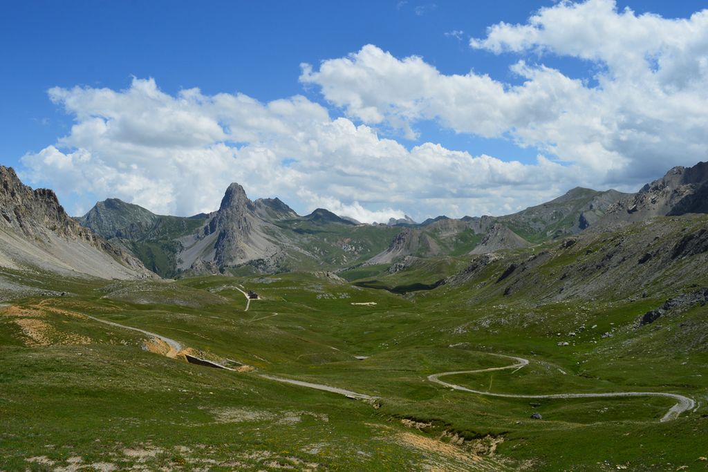
From the Colle Della Maddalena carpark (Larche), opposite Auberge de la Paix, take the wooden stairway from where a well-defined path – which does not have markers – begins, going up the left bank of the mountain stream. At an altitude of 2155 metres, cross the mountain stream by following several cairns. Go onto the wider Pays La Frontière Fortifiée GR with yellow and red markers. At 2270 metres, on a flat section, do not take the path on the right and continue straight on along the GR following the marker’s indication towards Lac de l'Oronaye. Go close to a spring below the path and then, close to a sheep pen, turn right, following the markers. Continue straight on, following the indication of the marker which is at an intersection with a narrow path arriving from the right. You will gradually climb along a well-defined path to reach the lake. Take the path on the left when the surface of the lake becomes visible. At the 2470 metres altitude Lac de l'Oronaye marker, go straight on following the direction for Col de Roburent. You will reach Col de Roburent and its 2502 metres altitude marker shortly afterwards thanks to a slightly less steep path with red and yellow markers. Continue along the Pays du Tour du Chambeyron GR. Bear left to remain on this GR and do not take the narrow paths which lead to the shores of Lac Supérieur de Roburent. Continue along the path cut into the rock face with the discreet orange markers, with a more obvious yellow marker further along. You will quickly reach an initial secondary peak (barbed wire on the ground). Bear left to discover Col de la Scaletta and continue along the flat, going beneath the ruins of Pas de Vanclava. You will quickly find a second Col de la Scaletta marker. Start the descent, indicated by orange S10 markers. A few metres later, do not take the path which climbs up to Bivouac Due Valli and instead continue straight on. Similarly, shortly afterwards, continue straight on along the path with S0 markers rather than taking the S20 path on the left. Head to the unobtrusive Passo Dell Escalon between the rocks before heading down a series of more clearly defined hairpin bends. At 2237 metres altitude, turn right onto the path with orange markers which heads into a grassy valley on the left bank of a mountain stream. Do not take the S27 Colle Vittorio path. Similarly, at 2078 metres, do not take the path on the right with the S27/S10 markers but continue straight on towards the bottom of the valley where you will quickly find a wooden oratory; continue to bear left. After a few hairpin bends heading downhill, you will reach a ruined building and a place which sells cheese and butter. At 1955 metres, cross the mountain stream via the path and go around two bends to reach the Prato Cioliero marker. Turn right, following the Passo Della Gardetta GTA/S8 markers. You will then rapidly climb up the right bank via the path with white and red markers. Yopu will then reach Passo Della Gardetta at 2440 metres. Turn left onto the track which can be used by vehicles to head downhill on wide hairpin bends (which can be bypassed via decent narrow pathways) to Gardetta refuge at an altitude of 2335 metres.
- Departure : Col de Larche
- Arrival : Gardetta refuge
- Towns crossed : Argentera, Val-d'Oronaye, Larche, and Canosio
Altimetric profile
Report a problem or an error
If you have found an error on this page or if you have noticed any problems during your hike, please report them to us here: