GTAM - Stage 2: Gardetta refuge - Sambuco
Canosio
2. GTAM - Stage 2: Gardetta refuge - Sambuco
Medium
6h
19,3km
+539m
-1685m
Longer treks
Embed this item to access it offline
The name Sambuco refers to the elderberry, which are particularly numerous in the commune. The elder flower can be dipped in batter and fried or drunk in the shape of a wine or cordial.
Description
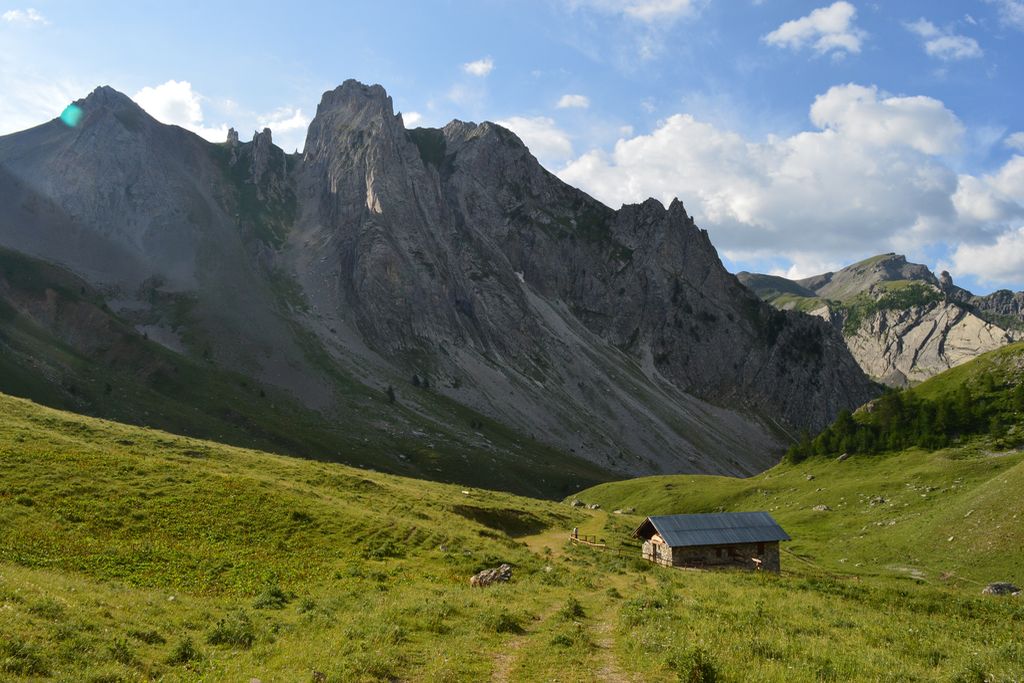
From the Gardetta refuge, head down the track towards the east. At the junction, turn left following directions for Agriturismo La Meja, with yellow markers to reach Colle Del Preit at 2066 metres. Take the track on the right and go past Agriturismo La Meja. You will go past a sheep pen at 2084 metres altitude. At 2134 metres altitude, continue straight on along the track; do not take the path which rises to the right. Cross a mountain stream via a bridge on the path on the left. Before the Gias de la Margherina cow barns, take the path on the left following the markers to rise up through the Alpine pastures. At the "Tour de la Rocca La Meja" marker, turn right for Colle Ancocia. Arrive at Col de la Margherina without any difficulty at 2420 metres then turn left onto the track which rises towards Colle Ancocia via the path with white and red TRM markers. You will go past some ruins close to a lake. Just after the lake, where there is a marker showing Colletto de la Meja to the left, bear right along the track where you will quickly reach Colle Ancocia at 2532 metres. From there, continue towards Colle del Malo taking a shortcut past the first two bends on the track by taking a narrow path. Subsequently, stay left on the track with orange markers and do not take the path which leads towards the lake. At 2472 metres altitude, go straight on along the track which can be used by vehicles (no visible markers). Do not take the path with white and red markers which rises on your left and instead continue along the track via a right-hand bend and you will reach a wide track that can be used by vehicles further below. You can take two shortcuts across this track via the narrow pathways with white and red markers. At the foot of the last bend, which provides access to Colle Valcavera, at an altitude of 2394 metres, turn right following the direction for GTA/P 34. After a few minutes along an ill-defined path, you will find a track and turn left. Leave this track on a right-hand bend to pick up a path with white and red markers. Go downhill through several hairpin bends and join a track which cannot be used by vehicles. Go past Grange Bastiera. At 1970 metres, continue straight on along the itinerary marked P34 towards Sambucco; do not take the path which rises to your left towards Colle Serour. Below Gias Mure, bear left and do not take the path which rises to the right towards Monte Bersaio. You will head steeply downhill along a well-marked path with a series of hairpin bends. At an altitude of 1344 metres, continue to your right and do not take the Colle Ciadoletta path. Then, do not turn right onto the 9 Borgate path with yellow and red markers but continue straight on following red and white markers. Go across the mountain stream via a wooden bridge then turn left onto the track which can be used by vehicles. At 1191 metres, do not cross the bridge on your left but continue straight on. When you reach an intersection with a paved road close to the church, turn right and head up to the central square in front of the townhall at an altitude of 1184 metres.
- Departure : Gardetta refuge
- Arrival : Sambuco
- Towns crossed : Canosio and Sambuco
Altimetric profile
Report a problem or an error
If you have found an error on this page or if you have noticed any problems during your hike, please report them to us here: