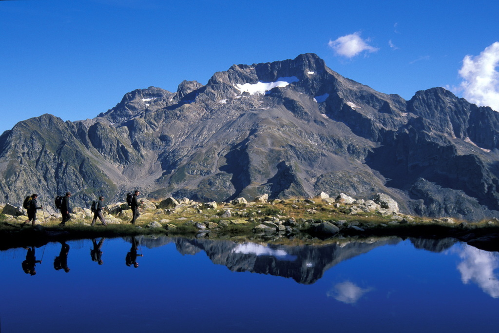
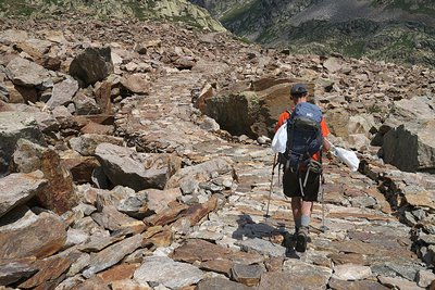
Alta Via dei Re
7 steps
15 points of interest
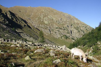
Il Vallone della Meris - Giorgio Bernardi  History and historical trail
The place name "Vallone della Meris"
The Vallone della Meris (or, in the masculine, the Vallone del Merìs, pronounced with an accent on the 'i', differently from the normal pronunciation) owes its name to its favorable exposure,"a meriggio", at the meridian, which provides warmth and light.
Il Chiot della Sella - Roberto Pockaj History and historical trailThe place name "Chiot de la Sela"
This place, known as Chiot de la Sela, probably dervied its name from the past presence of a small "sella", a stone structure with a barrel vault, usually partially underground, which was used to store food). Chiot de la Sela was the location of the Royal Hunting Lodges, used by the Savoys when they hosted hunting parties in the Vallone della Meris.
Il Lariceto - Cati Caballo  Flora
FloraThe larch
This type of forest is rather localized in the Maritime Alps, which notoriously represent the realm of the beech forest. It covers the slopes at the heads of the valleys with sparse and luminous populations, sometimes grazed by the herds that have climbed the mountain pastures. Most of the time their purity is not natural, but induced by man: in fact, over the centuries, man has favored this tree species to the detriment of others, such as the stone pine, for example, because they are less favorable for exercising the grazing due to the increased shading of the soil.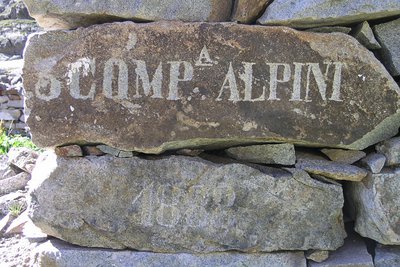
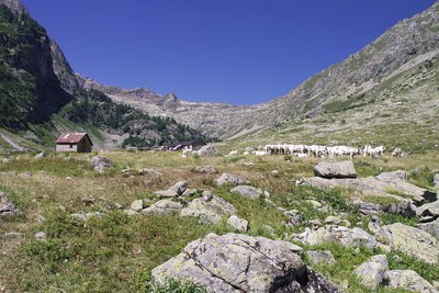
Iscrizione su un cantonale di un ricovero ottocentesco al Lago inferiore di Valscura - Roberto Pockaj History and historical trailThe Valscura Barracks
Since the end of the eighteen hundreds(an inscription on the remains of a shelter reads "3° Compagnia Alpini, 1888") Lower Lake Valscura was chosen as the site where troops were garrisoned to defend the strategic pass of Bassa del Druos. Beginning in 1888, when barracks were erected to house 140 soldiers and two officers, for almost fifty years buildings were constructed on this site, until the entire complex was finally transformed into an armory, officially known as A131,containing munitions, explosives and artillery pieces.
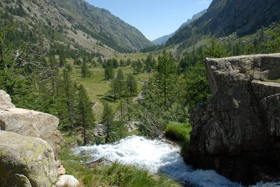
Il tratto lastricato della strada di arroccamento che collega Valscura a Fremamorta - Roberto Pockaj History and historical trailThe former military mule track "Valscura Barracks - Fremamorta Shelters"
The portion of the route that runs from Lower Lake Valscura to Lake Claus follows the former military mule track that linked Valscura and Fremamorta. The mule track is one of the best-preserved examples of the old military roads that ran through the Valle Gesso, as well as a true masterpiece of engineering. Realized sometime around the very first years of the nineteen hundreds, a decade prior to the start of the second world war, in 1929, it was preventively upgraded by the Dronero Battalion and maintained in perfect condition.
Over 10 km long, it never dips below an altitude of 2,000 meters and has a maximum incline of 18%. Portions of the road were skillfully paved with flagstones, still in place today.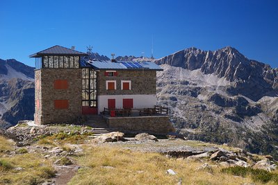
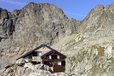
Il Rifugio Remondino - Roberto Pockaj History and historical trailThe Remondino Refuge
The Refuge is named for Franco Remondino, Jr. Lieutenant of the Alpine Corps and budding local climber, who died during an ascent on the Rocca Gialeo. A half-barrel bivuoac shelter that sleeps 12 was erected in his memory and inaugurated in 1934. It was later decided to build a real refuge on the spot, in masonry, erected thanks mostly to the financial sponsorship of the Saluzzo Battalion of the Alpine Corps, the Taurinense Division of the Army Corps of Engineers and the 1st Airborne Brigade and inaugurated in 1965. Additional restructuring and extensions were completed in the year 2000.
Saxifraga in fiore - Cati Caballo FloraThe saxifrage of Argentera
The Argentera saxifrage (Saxifraga florulenta) is a herbaceous species already present on the mountains of the Argentera-Mercantour group before the ice ages. It lives in the fissures of siliceous rocks above 1600 meters of altitude. One of its most interesting characteristics is its very slow development: every year it produces very few leaves, it blooms after an interminable vegetative phase producing a panicle full of a hundred pinkish-white flowers and then dies, not before having dispersed thousands of tiny seeds.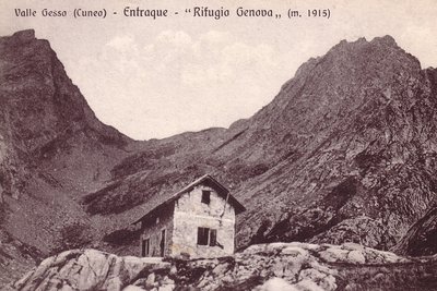
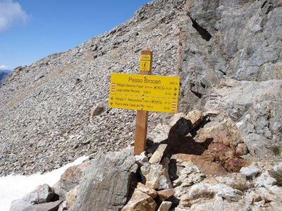
Il vecchio Rifugio Genova - Archivio EAM  Architecture
The Genova Figari Refuge
To valorize the hiking trails along the Argentera Massif, in the last years of the nineteenth century the Liguria chapter of CAI decided to build a refuge near the upper Gias del Monighet, in the Vallone della Rovina. The Genova Refuge, as it was named, was inaugurated on 15 August 1898.
But the fate of the first refuge in the Maritime Alps was definitively sealed in 1968: the reservoir of the new Chiotas dam would submerge it permanently. ENEL assumed the task of building another refuge, which was inaugurated in 1981.
The refuge is named for Bartolomeo Figari, who as Secretary General of CAI saw both the successful conquest of K2 and the birth of the National Alpine Rescue Corps, to which he bequeathed all his worldly goods.
Praterie di alta quota - Cati Caballo FloraThe cleared meadows
At the highest altitudes there are cleared meadows, the typical alpine pastures; they are composed of herbaceous species capable of covering soils normally closed to woody species, which, due to the very short vegetative period, cannot find suitable conditions for their development. Grazing by wild ungulates and, sometimes, by domestic sheep affects their composition, even if the most severe factor for species selection is represented by the climate.
Giovani stambecchi al Colle di Fenestrelle - Roberto Pockaj  FaunaColle di Fenestrelle, as well as the surrounding area, is very popular with the ibex.
The Alpine ibex (Capra ibex), frequents alpine meadows and rock faces even above 3000 m, reaching the valley floor (provided it is not wooded) only in early spring, to be able to refresh itself after the long winter. Both sexes have annual growth horns, but much larger in males. The coat, light beige in summer, darkens to dark brown in winter.
Sedentary, grazing, it essentially feeds on grass, integrated with mosses, lichens and leaves of mountain shrubs, especially in winter.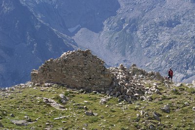
Il Ricovero Fenestrelle - Roberto Pockaj History and historical trailThe Fenestrelle shelter
The ruins near the pass mark the site of the Fenestrelle shelter, named for Lieutenant Angelo Bertolotti. Built in 1888 and in use until the Second World War, it could house a garrison of 10 on straw pallets. In their guidebook, entitled "La Valle Gesso", the Boggias indicate the shelter as being instead dedicated "to the memory of Angelo Bortolo, of the 1∞ Reg. of the Alpine Corps, who was killed on the Ortigara during the First World War".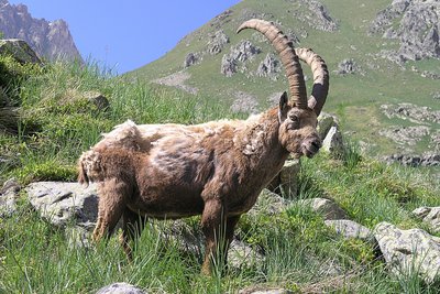
Stambecco maschio adulto, durante la muta primaverile del mantello - Roberto Pockaj FaunaThe Ibex of the Alps
Colle di Fenestrelle, as well as the surrounding area, is very popular with the ibex.
The Alpine ibex (Capra ibex), frequents alpine meadows and rock faces even above 3000 m, reaching the valley floor (provided it is not wooded) only in early spring, to be able to refresh itself after the long winter. Both sexes have annual growth horns, but much larger in males. The coat, light beige in summer, darkens to dark brown in winter.
Sedentary, grazing, it essentially feeds on grass, integrated with mosses, lichens and leaves of mountain shrubs, especially in winter.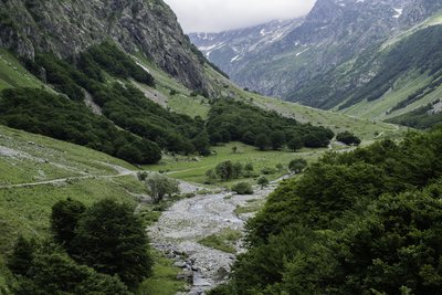
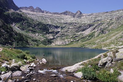
PIAN DEL RAZUR - gianluca.giordano  Geology
The Pra del Rasur
The ample meadow of the Pra del Rasur was formed towards the end of the last Ice Age, when rockslides from both sides of the valley blocked the course of the torrent. The detritus carried by the torrent itself, still quite impetuous today, gradually filled up the basin that was formed, thus creating the flat area.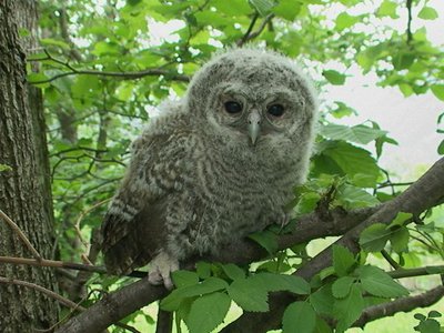
Allocco - Augusto Rivelli FaunaThe tawny owl
Among nocturnal birds of prey, the owl plays an important role, both from an ecological point of view and in the human imagination. It is in fact one of the most widespread species and therefore responsible for controlling the populations of rodents in wooded areas. For our part, often confused with the owl due to its shrill calls, it has a typical song that anyone recognizes: the typical mournful owl song. It can be recognized from owls and owls by the color of its eyes: the iris is completely dark.
La Palazzina Reale di Caccia di San Giacomo - Roberto Pockaj History and historical trailThe former Royal Hunting Lodges
The two large buildings, now owned by religious groups, are said to have been built between 1865 and 1870 at the behest of Vittorio Emanuele II, to be used during his sojourns in the Royal Hunting Reserve. The one on the left, with its attractive portico decorated in horizontal stripes with the colors of the House of Savoy, was the residence of the royal entourage, while the other housed the stables.
The stables were then given to the army, which expanded the building between 1897 and 1898, transforming it into the Princess Elena barracks.
Description
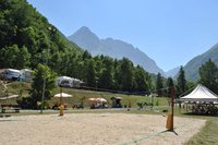
It starts in Sant' Anna di Valdieri and ends in San Giacomo di Entracque. Nights are always held in shelters that offer accommodation and, on request, lunch baskets. To return to Sant' Anna, you can use the shuttle service (on call). The ideal period is from mid-July to mid-September, subject to the possibility of encountering snow even in early summer and beyond.
- Departure : Sant'Anna di Valdieri (980 m)
- Arrival : San Giacomo di Entracque (1209 m)
- Towns crossed : Valdieri and Entracque
Altimetric profile
Recommandations
Transport
SNCF line TER Provence Alpes-Côte d'Azur For travel in the PACA region and towards Cuneo www.ter-sncf.com/pac
Trenitalia for travel in the Piedmont region https://www.trenitalia.com/it.html
Access and parking
Parking :
Report a problem or an error
If you have found an error on this page or if you have noticed any problems during your hike, please report them to us here:
Close by12
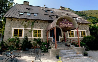
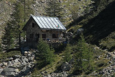
- Mountain Hut
Mountain Hut
Rifugio Balma Meris
The Balma Meris alpine inn is a refuge-hotel set in a recently renovated stone building.
The refuge is located in the center of the town of Sant'Anna, a typically mountain resort, gathered along the river at the confluence of the Meris valley, the starting point for excursions in the valley of the same name. - Mountain Hut
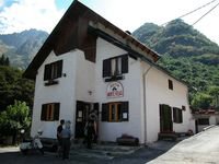
Mountain Hut
Rifugio Dante Livio Bianco
It was a group of mountaineering friends and partisans of "Giustizia e Libertà" who, with their families, wanted to take on
the initiative to remember with the construction of a refuge the Cuneo avv. Dante Livio Bianco, strong mountaineer,
appreciated jurist and valiant partisan commander. The new refuge was inaugurated on 18 September 1963. - Mountain Hut
- Mountain Hut
Mountain Hut
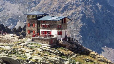
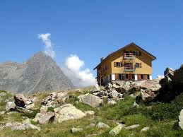
Rifugio Genova - Figari
The Genova-Figari refuge stands between two lakes: the Brocan, a natural alpine lake, and the artificial reservoir of Chiotàs, one of the largest in Europe. Easy to access, surrounded by meadows and the two lakes, it overlooks the walls of the peaks dell'Argentera, which with its 3300 m. it is the highest peak of the massif, and offers the opportunity to admire the numerous species of animals: ibexes, chamois, marmots, stoats, eagles, together with rare botanical species such as saxifrage florulenta, etc. - Mountain Hut
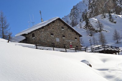
Mountain Hut
Rifugio Pagarì
It stands on a small rocky promontory, with a large dry stone wall on the north side to increase the flat space.
The construction is dominated to the west by the imposing wall of the Maledia peak. To the N the slope, made up of rocks sometimes covered with grassy vegetation of the nival type, descends to the underlying stream (Rio Pagarì), while on the horizon the view extends over the entire Alpine range: from Monviso (N - NW) to Gran Paradiso (N). - Mountain Hut
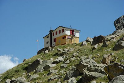
Mountain Hut
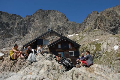
Rifugio Questa
The Emilio Questa refuge (2388 m) stands on a rocky peak located on the north shore of Lac des Portette, in the heart of a vast valley surrounded by the peaks of Portette, Claus and Prefouns. It is an ideal place for naturalist excursions: you can see chamois, ibexes, marmots and the emblematic bearded vulture.
- Mountain Hut
Mountain Hut
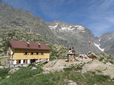
Rifugio Regina Elena
The Regina Elena Refuge, located in the Alpi Marittime Natural Park at 1,850 meters above sea level, equipped with 14 beds with use of the kitchen, operates in the summer period thanks to the voluntary work of the Members of the National Alpine Association - Genoa section. - Mountain Hut
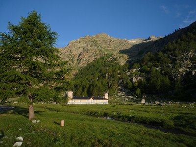
Mountain Hut
Rifugio Valasco
At the center of the Valasco plateau stands the beautiful Palazzina Reale di Caccia, commissioned by Vittorio Emanuele II for his chamois hunting and for some years now it has become an accommodation facility.
The Valasco Refuge, in the heart of the Alpi Marittime Park, stands at 1764 m in Valle Gesso, Terme di Valdieri (CN). - Mountain Hut
Mountain Hut
Rifugio escursionistico S. Giacomo e Baita Monte Gelas
Structure open only in the summer season.
The Baita Monte Gelas was born in 1953 thanks to Giovanni Gerbino and Caterina Mellano. Since then our family has been offering hospitality and refreshments to visitors to the upper Gesso Valley.