7. GTAM - Stage 7: Terme di Valdieri - Genova refuge
4 points of interest
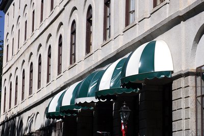
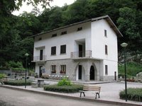
L'Hotel Royal a Terme di Valdieri - Roberto Pockaj  Architecture
The Valdieri Royal Hot Springs
First cited in the mid sixteenth century. When King Carlo Emanuele III decided to valorize the Valdieri hot springs, in 1755, a building and other appurtenances were quickly built in order to create a spa around the sulfurous waters. Cavour called Valdieri "the richest in health-preserving waters in all the nation, and perhaps in all of Europe as well". Vittorio Emanuele II, who first visited Val Gesso in 1855, became a frequent guest at the spa, and it was at his behest that, on 10 July 1857, the first stone was laid for the structure that was to become the Hotel Royal.
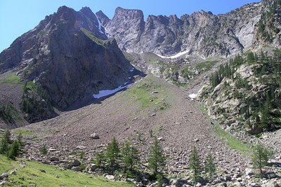
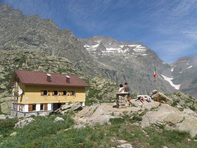
Panorama dai pressi del Lagarot di Lourousa; sullo sfondo al centro il Canalone di Lourousa e, a destra, il Corno Stella - Roberto Pockaj  Lake
LakeThe Lagarot di Lourousa
Springwater, welling up among meadows and larches, forms numerous limpid pools and streams; the water is at times turquoise, at times milky and at others perfectly transparent, making this a particularly striking location, perfect for a contemplative rest. The Canalone di Lourousa, bordered by Monte Stella and the Corno Stella and scoured by the Gelas di Lourousa, lies beyond the plateau of the same name, and a look over one's shoulder yields a view of the imposing outline of Monte Matto.

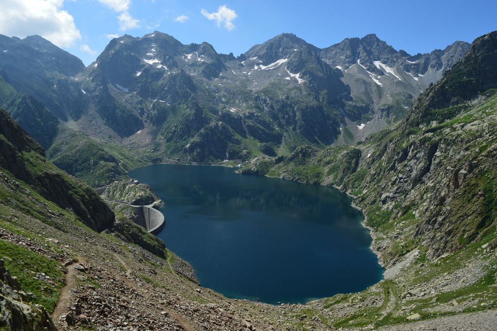
La diga del Chiotas - Roberto Pockaj LakeThe Chiotas Reservoir, the Della Piastra dam and the Lake della Rovina
The Chiotas Reservoir is closed off by two dams: the Chiotas dam and the Colle di Laura dam. The Chiotas dam, an arch-gravity structure, is 130 meters high and stretches for a length of 230 meters. Its thickness varies from 37.5 meters at its base to 5 meters at the top. The mass gravity Colle di Laura dam is smaller, rectilinear and only 30 meters at its maximum height. Its length is 70 meters. The Chiotas Reservoir has a carrying capacity of 27.3 million cubic meters of water.
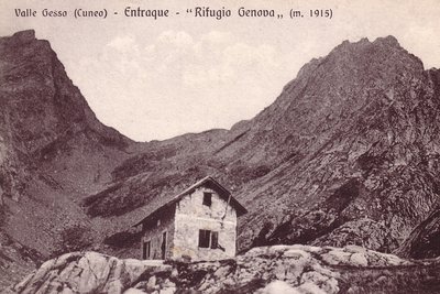
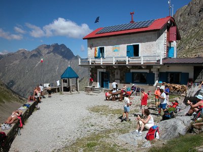
Il vecchio Rifugio Genova - Archivio EAM ArchitectureThe Genova Figari Refuge
To valorize the hiking trails along the Argentera Massif, in the last years of the nineteenth century the Liguria chapter of CAI decided to build a refuge near the upper Gias del Monighet, in the Vallone della Rovina. The Genova Refuge, as it was named, was inaugurated on 15 August 1898.
But the fate of the first refuge in the Maritime Alps was definitively sealed in 1968: the reservoir of the new Chiotas dam would submerge it permanently. ENEL assumed the task of building another refuge, which was inaugurated in 1981.
The refuge is named for Bartolomeo Figari, who as Secretary General of CAI saw both the successful conquest of K2 and the birth of the National Alpine Rescue Corps, to which he bequeathed all his worldly goods.
Description
- Departure : Terme di Valdieri
- Arrival : Genova refuge
- Towns crossed : Valdieri and Entracque
Altimetric profile
Report a problem or an error
If you have found an error on this page or if you have noticed any problems during your hike, please report them to us here:
Close by3
- Mountain Hut
Mountain Hut
Rifugio Genova - Figari
The Genova-Figari refuge stands between two lakes: the Brocan, a natural alpine lake, and the artificial reservoir of Chiotàs, one of the largest in Europe. Easy to access, surrounded by meadows and the two lakes, it overlooks the walls of the peaks dell'Argentera, which with its 3300 m. it is the highest peak of the massif, and offers the opportunity to admire the numerous species of animals: ibexes, chamois, marmots, stoats, eagles, together with rare botanical species such as saxifrage florulenta, etc.
- Mountain Hut
Mountain Hut
Rifugio Morelli Buzzi
The Morelli-Buzzi refuge is a structure built by the Cai of Cuneo in 1931, enlarged in 2000 and completely modernized in three phases between 2010 and 2012.
It is located in the enchanting Vallone di Lourousa at 2351m above sea level, in the heart of the Maritime Alps Park, at the foot of the north face of Monte Stella, the highest in the Maritime Alps. - Mountain Hut
Mountain Hut
Rifugio posto tappa Gta "Savoia"
The Casa Savoia refuge (GTA stopover) is located in Terme di Valdieri, in the heart of the spa area, at 1,368 meters above sea level. It is located along the itinerary of the Great Crossing of the Alps and is the starting point of numerous excursion itineraries.