GTAM - Stage 14: Refuge Don Barbera - Realdo
Briga Alta
14. GTAM - Stage 14: Refuge Don Barbera - Realdo
Hard
6h30
17,1km
+881m
-1366m
Longer treks
Embed this item to access it offline
Realdo is a hamlet of the commune of Triora, famous for its many legends about witchcraft. Indeed, certain women of Triora became, in 1588, victims of one of the bloodiest witchcraft trials in Liguria.
1 point of interest
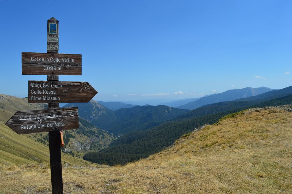
Palina segnaletica al Colle delle Selle Vecchie - Archivio EAM  Cross-border
The Colle delle Selle Vecchie
This was an important pass in past ages, probably on one of the salt routes, it was widely used by the shepherds from Briga in their transhumance towards the pastures at the foot of the Marguareis Massif.
The place name refers to the "selle", or "cellars" for the preservation of cheeses, once evidently present in the surrounding area. The cellars are generally stone buildings, with a barrel vault, covered and insulated with grass clods to ensure constant temperature and humidity inside.
[A. Parodi, R. Pockaj, A. Costa - Nel cuore delle Alpi Liguri, collana Sentieri e Rifugi, Andrea Parodi Editore, 2012, p.34]
Description
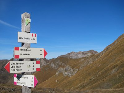
From Don Barbera refuge, head upwards for several metres to reach Collet Del Lago Dei Signori. Turn left at the wide track which can be used by vehicles which climbs as indicated by the marker towards Colla Rossa. A few minutes after, turn right onto the path with white, red and yellow markers. Reach marker 327a at Col Celle Vieille (2099 metres) and continue straight on towards Colla Rossa, heading up onto the ridge without going back down onto the track (tallow, white and red markers). Reach a secondary col at 2158 metres before heading up again into an area with more forest cover, following the white and red markers. At marker 327b, continue towards Colla Bassa. At 2372 metres, head alongside a ruin. At 2403 metres, take the flat narrow path on the left to pass by the foot of Mont Bertrand. At marker 293, continue straight on following directions for Pas du Tanarel. Keep going along this path - at times you will be on ridges and at others you will be next to the ridges – passing over a succession of rises and descents, reaching Col du Tanarel without hesitation or difficulty. Once you reach Pas Saccarel, turn right for Realdo on path 325. Go down a series of zigzags with yellow, white and red markers until you reach forest cover and you will quickly find a track which can be used by vehicles at marker 270a (altitude 1659 metres) and continue towards Pas Colle Ardente along a wide track. A few minutes later, as the track turns right, turn left onto a path, walk a short distance, then get back onto the track and continue straight on. After a short climb, you will reach marker 271 at Pas de Colle Ardente (1617 metres) and take the track on the left with blue markers. A few metres further on, turn left again; do not bear right towards La Brigue. At the sign for Passo di Colla Ardente 1586 metres, head toward Realdo on your right via San Antonio, do not turn left towards Verdeggia. You will reach the tarmacked road at 1201 metres altitude, head down it until the San Antonio sign 1191 metres. A few metres further on, turn left and go down a wide path with white and red markers to arrive in Realdo. There, head through the alleys towards the church to find Rifugio Realdo.
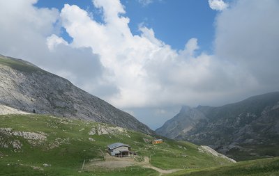
- Departure : Don Barbera refuge
- Arrival : Realdo
- Towns crossed : Briga Alta, La Brigue, Tende, and Triora
Altimetric profile
Report a problem or an error
If you have found an error on this page or if you have noticed any problems during your hike, please report them to us here: