Variation GTM Barcelonnette - Stage 1 : Barcelonnette - Bayasse
Barcelonnette
19. Variation GTM Barcelonnette - Stage 1 : Barcelonnette - Bayasse
Hard
6h30
20km
+1624m
-963m
Longer treks
Embed this item to access it offline
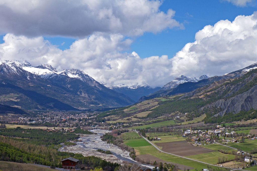
A stage of connection crossing the small family resort of Sauze, making it possible to join the hamlet of Bayasse, in the heart of the Vallon du Bachelard.
1 point of interest
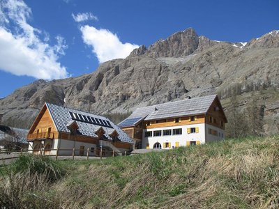
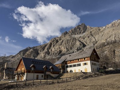
Refuge-Hôtel de Bayasse - PNM/DR  Refuge
Bayasse Refuge-Hotel
Mercantour National Park Refuge-Hotel
Refuge open all year
Restaurant open every day from May to September and upon reservation all year
Capacity: 11 bedrooms; 2 dormitories (6 to 8 people), 4 family rooms (2 to 4 people) and 5 double rooms.
Half-board from 44€, special prices for families, children and groups.
Tel: (0)4 92 32 20 79
+33 (0)6 38 83 21 42
Prices and complementary information: http://www.refuge-bayasse.fr/
Description
From Place Aimé Grassier head towards the river Ubaye by the road to Pra-Loup. Cross the Plan bridge. Take the road to the left and after the small bridge take the Chemin des Alpages. Cross straight on towards "la Gravette" and at N°22 turn right onto chemin des Alpages. Climb the slope steep enough to reach the road. Turn left on 75m and right on 1km.
In the 3rd curve, near the reservoir, continue straight ahead along the path. It runs along an old canal and begins a slight descent in bends in the forest. It leads to Sauze. Head south to join the departure of the chairlift Super Sauze and take the small road on the right parallel to the lift. In the turn altitude 1440m take the path direction super Sauze. At the first intersection turn left directly to the station 1700m.
Continue in front of you keeping the buildings on your right. The path rises on the croup dominating the station. Pass near the Pré Adroit ski lift. The path continues its ascent, crossing a wide valley and reaching a flat with huts. Climb across in the direction of the summits facing you. At the pass, go up the path on the left along the cliff and turn left at the crossing to reach the Gyp pass 2448m.
Go down to the other side in the rocky outcrop, cross the boulder-filled flat and continue down the narrow path that leads to a grassy flat. After a few tens of meters turn left following the markings and the cairns, the path being badly traced at this place. The path continues between the rocks and then descends a steep slope before a new flat. At the end, go up a little and reach a crossroads behind a rock. Leave on the left the ascent towards the Col de Fours and take on the right the path in bends in descent which loses altitude quickly and opens after 45 mn approximately on a track at the place known as the Collet.
Join the departmental road 902 and follow it on the left for 1.5km. Before crossing the Bachelard River, on the left marked by the Saint Louis Chapel is access to the hamlet of Bayasse and the Mercantour National Park refuge.
- Departure : Barcelonnette
- Arrival : Bayasse
- Towns crossed : Barcelonnette and Uvernet-Fours
Altimetric profile
Report a problem or an error
If you have found an error on this page or if you have noticed any problems during your hike, please report them to us here:
Close by3
- Guided walks & activities
- Information site
Information site
Maison du Parc national du Mercantour - Vallée de l'Ubaye
Lieu d'accueil et d'informations du public, la Maison du Parc propose de la documentation touristique, une boutique, des expositions, des projections et des animations en lien avec le patrimoine naturel et culturel du Parc national du Mercantour.