14. GTM - Stage 14 : Refuge de Nice - Refuge des Merveilles
1 point of interest
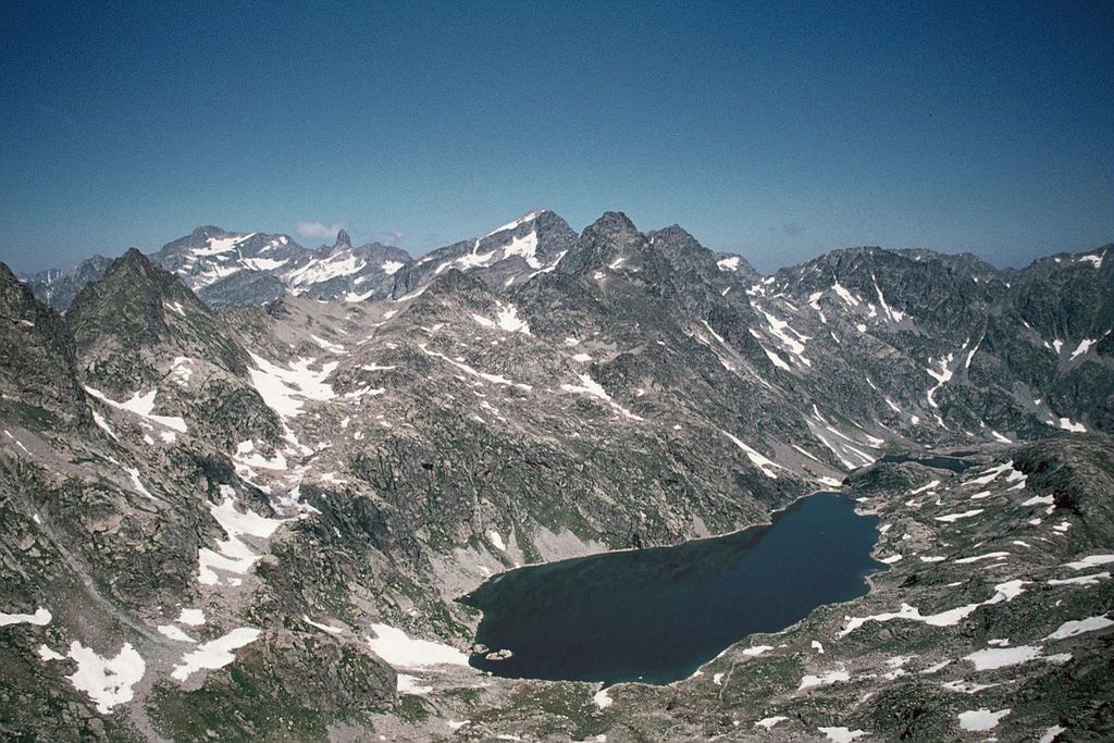
Le lac Niré, (2353 m), et la cime de Chamineye, (2921 m), le 29 septembre 2006, - GUIGO Franck  Geology
The eclogite of Lac Niré
Just above Lac Niré, on the right bank of the mountain stream, among the migmatite, can be found very dark rocks which take the shape of huge lentils (geologists call them “black puddings”).
When you look closely at these one of these lentil, you can see very different minerals to the ones you find in migmatite. The rusty red coloured ones are garnet and the darker ones are amphibole.
This very distinctive rock with characteristic fine and very dense crystals is eclogite; it is quite rare and a remainder from oceans which have disappeared. It is a metamorphic rock which springs from the transformation of basalts, ancient lava from the oceanic crust.
Description
Head north around the boulder which towers over the refuge and head down into the Vallon de la Fous (m418), then climb up the other side and onto the glacial polished rocks towards Lac Niré 2353m.
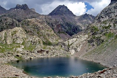
Head north around the lake and initially follow the right bank of the Chamineye valley and go alongside the three small lakes (or “lagarots”) which are located at the foot of the northern face of La Tête du lac Autier.
Cross the valley and wind through the screes heading south and going over the final climb of La Baisse du Basto (m401 - 2693m).
Take a small rocky corridor which has been worn by the footsteps of hikers to get over this steep climb. In the early part of the season, large patches of snow can be found here and there from the previous lake to the Baisse, which means that you need to take care over this section.
From the Baisse, you can see the mythical peak of Mont Bégo rising to the south-east and the famous Mont Gélas, along with its neighbour, La Malédie, to the north-east, standing out in the sky.
Continue along GR52 amid the hutches towards the east at the foot of Les Têtes du Basto, go past a small lake on the your left and continue the descent, reaching the path which leads to Lac du Basto (m95).
A few clearly drawn zigzags lead to La Baisse de Valmasque (m94 - 2549m). From the col enjoy the bird’s eye view over Vallée des Merveilles and its many lakes, then head down via a path which winds between two small lakes, cross Le Vallon des Merveilles and continue along the left bank.
Head east around Lac des Merveilles; close to its spillway is the famous rock carving of the tribal chief which can be seen from the GR.
Take some time to look at the information boards alongside the path and reach (m93) before the final descent to the refuge which is close at hand.- Departure : Nice refuge
- Arrival : Les Merveilles refuge
- Towns crossed : Belvédère and Tende
Altimetric profile
Recommandations
Specific regulations apply when you cross Vallée des Merveilles.
Signs on site.
· Do not leave the marked paths
· Do not touch or damage the rock carvings
· Do not use hiking poles without placing rubber tips on the ends.
Before heading off on a hike, ensure that you have studied the safety advice. If you are setting off on this hike in the early part of the season, you will need to take particular care as patches of snow can still be present in higher areas.Report a problem or an error
If you have found an error on this page or if you have noticed any problems during your hike, please report them to us here: