16. GTM - Stage 16 : Camp d'Argent - Sospel
Several different environments are on the menu along the itinerary of this stage through the Bévéra valley.
3 points of interest
A l'Authion, la piste de la Dea - CEVASCO Jean-Marie  History and historical trail
L'Authion
Glory and exaltation, but also suffering and death. L'Authion has seen the tragic end of many a life.
In April 1794, the Italian army, commanded by Generals Bonaparte and Masséna, fought against Austro-Sardinian troops: after extremely violent battles, L’Authion was taken. The Piedmont road was open to the French!
Then spring 1945 also saw L'Authion’s destiny being determined by more modern weapons. Despite the Operation Dragoon Provence landings in August 1944, the Alpine front, including the advanced post of L'Authion, was solidly held by the German army.On 1st March, General de Gaulle created the Alps Army detachment, which was responsible for defending communication lines.
L'Authion - GOURON Claude History and historical trailA natural fortress
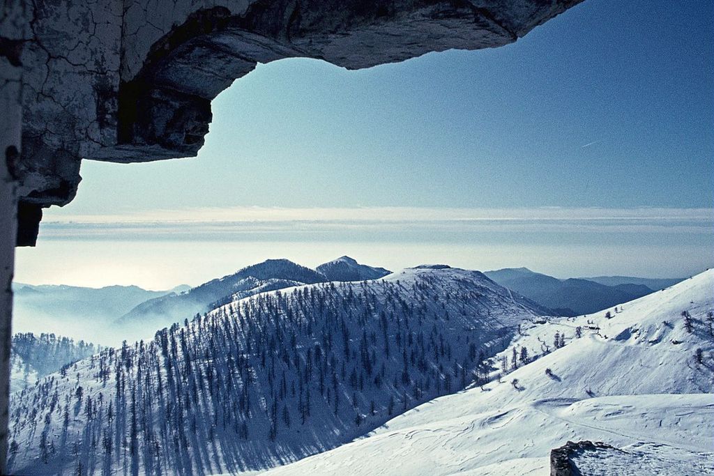
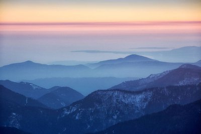
Authion is a natural fortress which is virtually unconquerable, protected by its immense and steep slopes which "tower 1500m above the valleys of Caïros, Roya and Bévéra".
The relief provides no refuge, no hiding place for attackers who are extremely vulnerable. “You only need a very few men in a dominant position to completely close off access”. (Général Y. Gras).
At the very top, the summits which tower over the 2000m mark are equipped with fortifications which the “the gigantic field work and network of mines” make impregnable.
Just one weak spot: the south!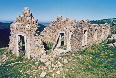
Les ruines de casernement de Cabanes vieilles à l'Authion, (2080 m). - pnm History and historical trail22nd March 1945
The order is received “to look into the possibilities of attacking the fortified mountain of L’Authion”. It would be “a powerful frontal attack on L'Authion that two columns, approaching from either side, would take it from behind, one via Col de Raus and the other via Ortighea Giagiabella ".
On 9th April, a general offensive by the Allies was launched on the Italian front. The enemy was to be pinned onto L'Authion.
The weather played its part: snow and mist enveloped L’Authion, forcing everyone to go through the anxiety caused by silence and expectation.
On 10th April, the bombing of the forts by military aircraft formed a brutal wakeup call, France launched an offensive and too the Forca ridge.
Description
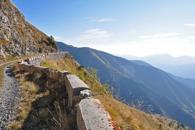
From Camp d’Argent (m.238), take the track (GR 52) which you will follow to its far edge; a long section on a virtually level path heads along the slope and leads to the Authion discovery route (m.28b) at the former barracks of Cabanes Vieilles and the remains of the US tank.
Follow GR52 to the right as it heads along the track to the cow barn before leaving it on the first hairpin bend, taking up a fine path which heads downhill, crosses the valley and then heads up the mountain slope and comes out on the track (m.151).
Continue due south along the GR which alternates between sections along the track and along the ridge; this sector which, in summer, is occupied by farm animals, requires you to be careful and calm, especially as you approach Baisse de Ventabren, where you will need to pass along the eastern slope (on the left) of the point of the same name to reach La Baisse de la Déa (m.141).
Cross the track, following the path (GR) which heads onto the other slope, heading by the bunkers towards La Cime de Mangiabo via markers 142 and 143. From this marker, make sure you stay on the ridge (south) to find marker 144 and reach the peak (1821m); the GR follows the mountain ridge (south) before heading steeply down the bare western flank to reach marker 23 below.
Continue along the rock face until Baisse de Linière (m.22), then head downhill until reach the Mercantour National Park boundary (m.7) and then further down La Baisse de Figuièra (m.76).
Cross the road and take a former military track which cuts across it again further down (m.75). Follow it for around 100m before heading steeply down a wide and regular path which brings you to a hairpin bend (m.74).
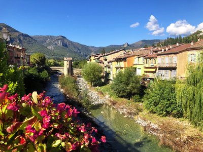
The narrow road brings you to the school; take the stairway opposite (m.72) which heads down to the small Serret road and the historical centre of Sospel (350m) with its bridge over the Bévéra, the end of this stage.
- Departure : Camp d'Argent
- Arrival : Sospel
- Towns crossed : Moulinet, Breil-sur-Roya, and Sospel
Altimetric profile
Recommandations
Before heading off on a hike, ensure that you have studied the safety advice.
During the summer months, the weather can become very hot along this medium-altitude stage. In order to avoid dehydration, ensure that you take enough water with you.
Report a problem or an error
If you have found an error on this page or if you have noticed any problems during your hike, please report them to us here: