10. GTM - Stage 10 : Isola 2000 - Refuge Questa
86km from Nice (airport).
Head up the Var valley on the RD6202 to La Mescla. Turn right into the Tinée valley (RD2205) until you reach Isola-village.
Take the right fork (RD97) and head along a winding road some 18km long to reach the upper hamlet of the Isola 2000 station.3 points of interest
La visuale da una delle gallerie che ospitavano la Batteria del Druos - Roberto Pockaj  History and historical trail
The Druos Artillery Battery
Near the Bassa del Druos there are the ruins of a shelter and the Druos Battery, a defensive military gun emplacement in a cave of the Vallo Alpino. The artillery battery, realized with minimum investment in the mid-thirties, consisted of 4 100/17 howitzers captured from the Austrians in WWI. The guns were positioned in the cave without any shielding whatsoever: there wasn't even a command room inside. Two of the 4 galleries where the cannons were placed can still be seen clearly, but the entrances to the other two have been obstructed by landslides.
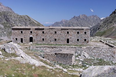
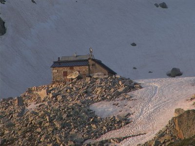
La caserma del Druos ai Laghi superiori di Valscura - Roberto Pockaj History and historical trailThe Massimo Longà Barracks
The barracks are named for Massimo Longà, Captain of the Alpine Corps, who died on Monte Ortigara on 10 June 1917 (to be precise, on an Army Corps of Engineers map, the Rifugio's name is indicated as Massimo Mongà, differently from the inscription on the plaque over the main entrance). The barracks building is an imposing structure, built, according to documents of the Engineering Corps, in 1903. Other sources give the date of its construction as between 1916 and 1917, thanks to the forced labor of Austrian prisoners captured on the Eastern front, but if the Engineering Corps documents can be believed, it is more probable that the barracks were only restructured during the WWI years.
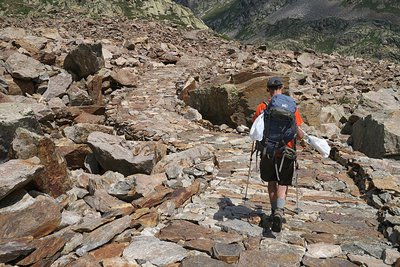
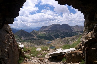
Il tratto lastricato della strada di arroccamento che collega Valscura a Fremamorta - Roberto Pockaj History and historical trailThe former military mule track "Valscura Barracks - Fremamorta Shelters"
The portion of the route that runs from Lower Lake Valscura to Lake Claus follows the former military mule track that linked Valscura and Fremamorta. The mule track is one of the best-preserved examples of the old military roads that ran through the Valle Gesso, as well as a true masterpiece of engineering. Realized sometime around the very first years of the nineteen hundreds, a decade prior to the start of the second world war, in 1929, it was preventively upgraded by the Dronero Battalion and maintained in perfect condition.
Over 10 km long, it never dips below an altitude of 2,000 meters and has a maximum incline of 18%. Portions of the road were skillfully paved with flagstones, still in place today.
Description
From the top of the Isola 2000 station (m.90), take the small Hôtel Diva road where, 300m further along, you will find the path towards Lacs de Terre Rouge on your left.
Head uphill along the slope which is scattered with larch trees until you come out onto a track (m.91).
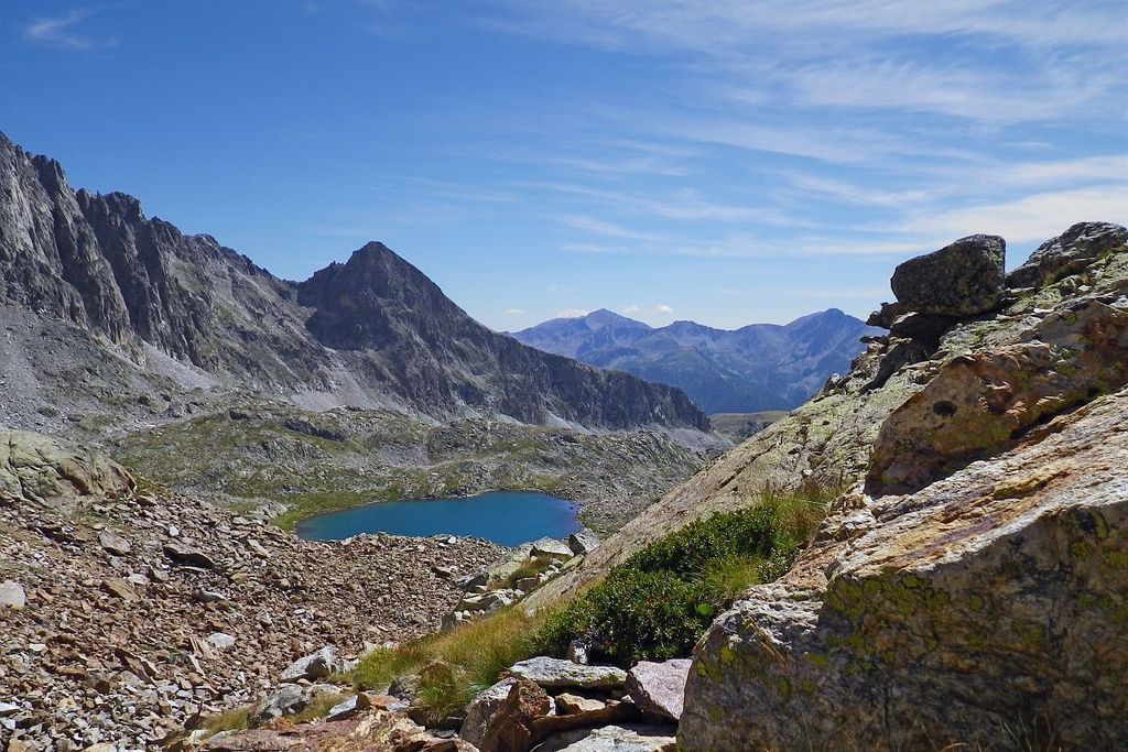
Continue opposite, heading between a few boulders and fording the Terre Rouge brook, all the while overlooking the earth dam which, in winter, ensures that the ski slopes remain covered in snow. At marker 92, take the military path down the Col Mercière and continue along it due north to reach the glacial rock bar (m.93) and discover the smaller lakes and the larger Lac deTerre Rouge (2452m).
Continue along a section which turns towards the west and head up a few hairpin bends, coming out at Baisse de Druos (2628m – m.94).
On the slope on the Italian side, you will discover a magnificent rocky cirque with the Valscura lakes and, to the north, the summit of Malinvern (2938m).
Head downhill towards the former barracks and the lakes until you reach the spillway of the latter (2265m), where there is the intersection with the path for Col de Valscura and the Malinvern refuge.
Turn right (south-east) along the magnificent paved path which rises gently towards Lago del Claus, alternating between grassy and paved sections, which were installed by soldiers to help the King of Italy travel along more easily.
Reach the spillway from Lac de Claus (2344m) which you need to go around via the east; further down the valley, you will have a bird’s eye view over Victor Emmanuel II’s former hunting lodge, which has recently been renovated as a refuge.
Continue heading uphill at the foot of the northern face of Tête de Claus before leaving this good path to head for the Questa refuge (2388m) which sits amid the boulders on an ancient moraine.- Departure : Isola 2000
- Arrival : Questa refuge
- Towns crossed : Isola and Valdieri
Altimetric profile
Recommandations
Report a problem or an error
If you have found an error on this page or if you have noticed any problems during your hike, please report them to us here:
Close by2
- Mountain Hut
Mountain Hut
Rifugio Questa 2388 m
The Emilio Questa mountain hut stands on a rocky peak on the northern shore of Lake Portette, in the heart of a vast valley surrounded by the peaks of Portette, Claus, and Prefouns. It is an ideal spot for nature hikes: visitors can spot chamois, ibex, marmots, and the iconic bearded vulture.