GTM - Stage 01 : Entraunes - Estenc
>>
Home
>
Hiking
>
Grande Traversée du Mercantour
>
GTM - Stage 01 : Entraunes - Estenc
Entraunes

1. GTM - Stage 01 : Entraunes - Estenc

Embed this item to access it offline
The municipality of Entraunes, capital of the Val d’Entraunes and nestled at the confluence between the Var and the Bourdous rivers, is a cosy village with well-restored houses, surrounded by green pastures and black marls that have been carried down from the summit of the Roche Grande (2742m).
You will ascend towards the Plateau d’Estenc (1800m) and the source of the Var along the old road leading to the hamlet of Estenc, isolated for months in times past due to the winter snow.

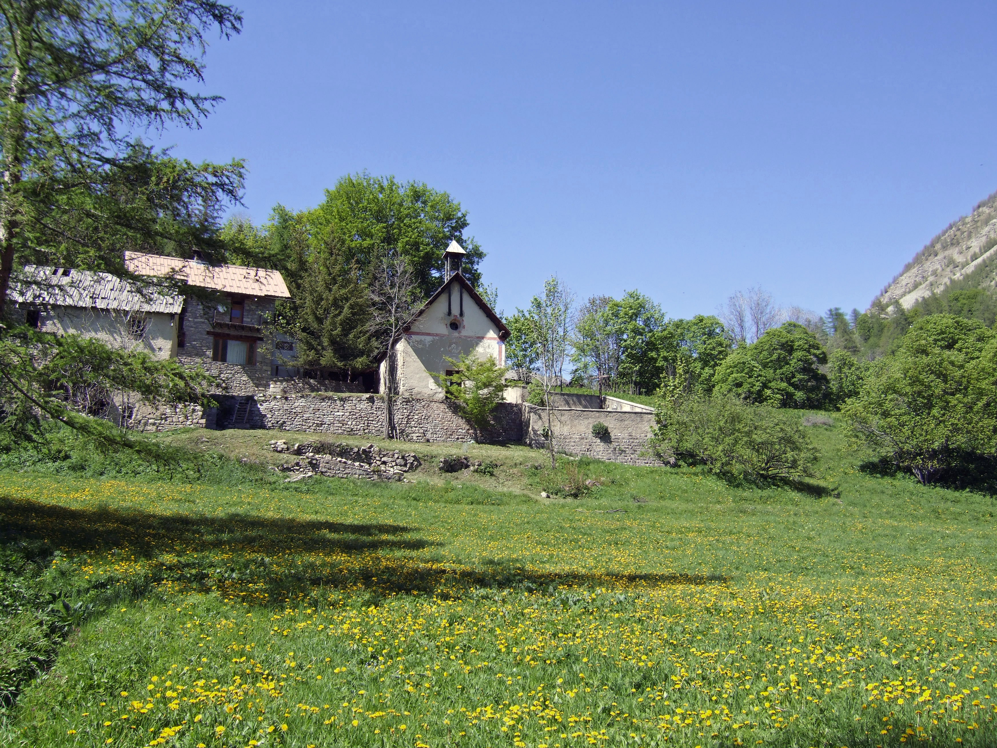
The route wends its way along a wild and harsh section in the hollow of a gorge. Superb waterfalls cascade down from the abrupt hillsides of the Tours du lac d’Allos (Garreton and Aiglière) which offer fabulous landscapes. Further on, the pastures claimed from the stony ground, the abandoned or still-exploited farms, chapels and oratories remind us that this place was once tamed by man

2 points of interest
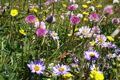
  • Pastoralism

    Estenc plateau hay meadows

    The term “hay meadows” means areas of production of fodder which was not deliberately planted and which are rich in variety of species. The hay is harvested to feed animals. These meadows are part of the non-intensive and environmentally friendly practices and they encourage a wide variety of plants to grow.

    Mercantour National Park has 1000ha of hay meadows, included in a pastoral and grassland domain covering around 120000ha. Within this, 90 professional farms are based in the Park’s communes and 268 transhumant farmers are present in summer.
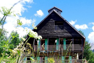
  • Refuge

    La Cantonnière refuge

    The history of the refuge is closely linked with the Route des Grandes Alpes connecting Lac Léman with the Mediterranean. It was built in the early 20th century by the French Touring Club with the very rudimentary means of the period by Italian workers, for whom the imposing Cantionnière house was built.

    Accessible in summer 1913 to the few automobiles which were around at the time, the road was to be inaugurated by President Poincaré in August 1914. But the declaration of war deprived the people of Entraunes of this visit.

    The building today serves as a refuge and has been fully renovated by Mercantour National Park.


    Capacity: 36 in dormitories of 2, 4, 5 and 18.

    Prices and opening periods: http://lacantonniere.wixsite.com/refugelacantonniere

    Tel: 04.93.05.51.36

    E-Mail: lacantonniere@gmail.com

Description

From  Entraunes,  cross  the  bridge  over the Var (w.33), just opposite the Chapelle  Saint-Sébastien, and  follow  the road that passes close to the road maintenance  services  premises.  Go  past  the  small  road  to  Oustamura  (w.34),  leaving  it  to  your  left,  and  continue  along  the  Var  up  to  a  little  oratory (w.35). Follow the earth track that  leads  to  a  dam  installed  in  the  stream bed near the confluence with the  Vallon  de  Garreton.  Gain  100m  in  height  to  cross  the  vallon  using  a  footbridge and turn off onto the path that  passes  below  the  rock  bands  of  the Baumette up to the Aiglière waterfall (1450m). Leave  the  right  bank  of  the  Var  (footbridges), catching some spray from the waterfall as you go, then continue along the ascending path and you will soon return to the right bank, where the valley widens.Cut across the road above the Saint-Roch bridge (w.36) and ascend a rough track that leads to the water reservoir.A  comfortable  path  follows  on  from  this, passing alongside a large field and reaching  the  Chapelle  Saint-Sauveur  (w.37).The  landscape  softens  and  the  easy  walking  will  take  you,  through  the  undergrowth or at the edge of fields, to  an  intersection  (w.39b).  Turn  right  to get to the group of houses named L'Avalanche,  from  which  you  can  nostalgically  admire  a  large  farm  and a small church with its adjoining cemetary.After crossing the Var, the path passes near  some  farmhouse  stopover  gites  (w.38), and from the drinking trough, ascends directly towards an oratory.Cross the torrent in the narrow gorge for  a  last  time  by  means  of  the  Pont  du Diable, and ascend up to the road (w.39a – 39), just before the Auberge de  la  Cayolle  and  the  Lac  d’Estenc  (w.40).Follow the path beside the lake to the left,  then  head  for  the  Cantonnière  hostel-hut  and  the  edge  of  the  Mercantour National Park by taking a direct path (w.41) across the hayfields.
  • Departure : Entraunes
  • Arrival : Estenc
  • Towns crossed : Entraunes

Altimetric profile


Report a problem or an error

If you have found an error on this page or if you have noticed any problems during your hike, please report them to us here: