GTM - Stage 04 : Bousiéyas - Ferrière
Saint-Dalmas-le-Selvage
4. GTM - Stage 04 : Bousiéyas - Ferrière
Medium
5h30
12,1km
+835m
-843m
Longer treks
Embed this item to access it offline
This day offers the opportunity to follow in the footsteps of French and Italian smugglers who, until the early 1960s, traded cattle, salt, tobacco, clothing and agricultural tools... sometimes risking their lives.
1 point of interest
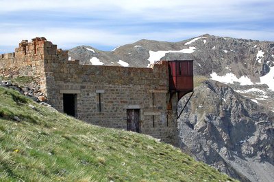
Le fort du Camp des Fourches avec sa tourelle métallique dite « Séré de Rivière ». - Anthony TURPAUD  History and historical trail
Removal zones
The depression on your right was one of the zones from where material was removed from to build Camp des Fourches at the start of the last century. The former military dry-stone track allows you to reach Cime de Pelousette.
Description
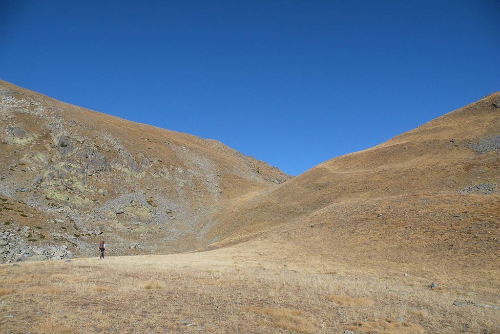
From the hamlet of Bousiéyas (1 883 m), go up the paved path (GR5) to reach "le café Martin" and turn left to join the M.64 road. Turn left and follow the road for about 250 meters.
At marker 40, turn right onto the path that crosses the Bonette road several times (M.64) to reach the former military camp of Les Fourches (2 250 m - b.41a). Take to the right the path and quickly join flat the Col des Fourches (2 261 m - b.41). Go down towards the wide alp of Salso-Morène by the GR5 route. At the crossroads of beacon 37 (2 100 m), take the path leading north to the Col de Pouriac and reach it by a long diagonal continuing in the same direction (2 506 m - b.39).
Topple on the Italian slope, by the small path, to reach a crossroads (old post) then to take on the right to join across, by a narrow path, the Bassa di Colombart (2 461 m) and its bell tower. Go down to the right hand by a wide path which leads to the Colombart flat recognizable by its water troughs.
A track coming from Ferrière ends at this place, take care not to follow it but to take on the right the original path which passes soon to the Gias di Colombart, (recently renovated pastoral hut). Continue eastwards and gradually down the path in the middle of old hay meadows bounded by low walls and earthworks. To arrive soon near the hamlet of Ferrière (cross). Turn left on the path that leads in a few steps to the centre of the hamlet. The Ferrière refuge (Becchi Rossi) is located to the right of the church and the central square.
- Departure : Bousiéyas
- Arrival : Ferrière
- Towns crossed : Saint-Dalmas-le-Selvage, Saint-Étienne-de-Tinée, and Argentera
Altimetric profile
Recommandations
Is in the midst of the park
The national park is an unrestricted natural area but subjected to regulations which must be known by all visitors.
Report a problem or an error
If you have found an error on this page or if you have noticed any problems during your hike, please report them to us here: