3. The 4 valleys circuit - Stura - Maira - Haute Tinée - Ubaye - Etape 3
3 points of interest
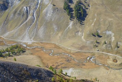
Sur le replat de Val Fourane, au niveau de la cabane Tardiez, l’Ubayette serpente tranquillement au milieu d’une zone humide. - François BRETON  Flora
FloraThe Tardieu hut prairies
The prairies which surround the Tardieu hut are called “tall-festuca grassland”. This name comes from the dominant plant species, a tall kind of grass which grow in tall, tough clumps. The list of plants which grow alongside this tall grass and form the combination of plants constituting tall-festuca areas is long, but one of the jewels in the crown is surely Alpine sea holly or Queen of the Alps with metallic blue shades. This is currently the last area with Alpine sea holly in Ubaye, the department and the National Park.
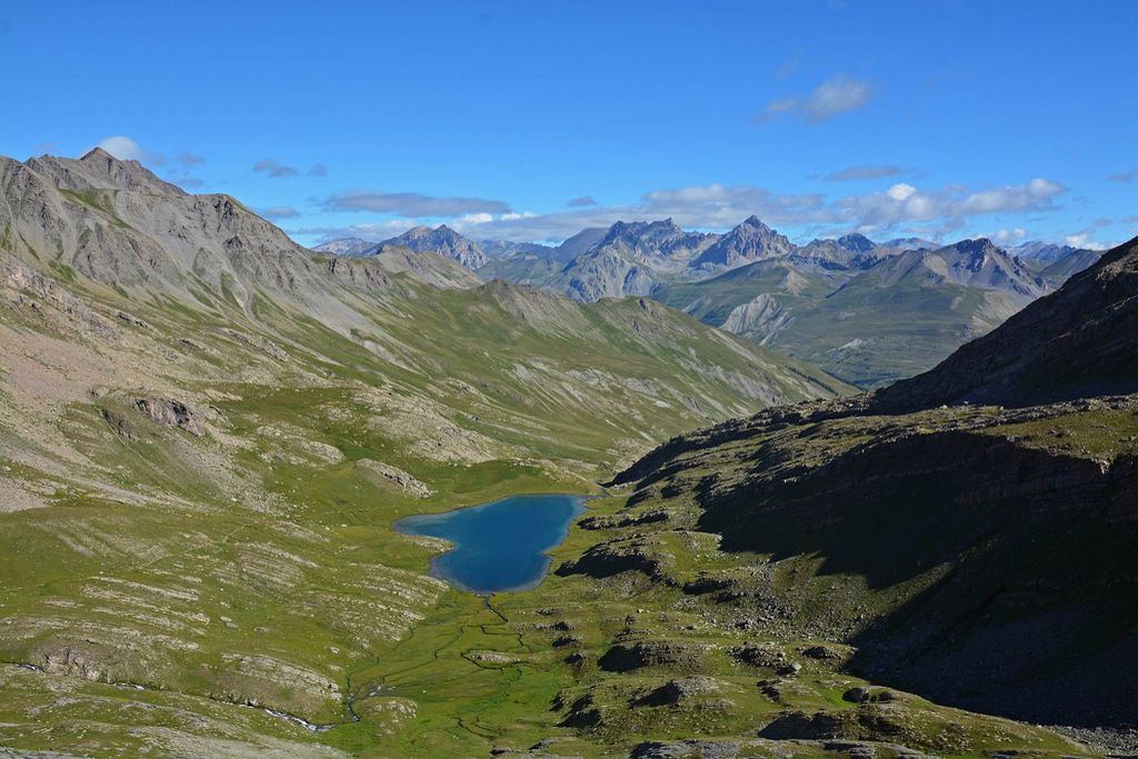
Le lac du Lauzanier dans l'Ubayette à Larche - BRETON François  Lake
LakeThe wetland zone
From the pastoral hut at Tardieu, the track, which is horizontal at this point, overlooks the great plateau where the winding Ubayette sparkles.
A few thousand years ago, you would not have had to go much further to find a deep lake. This great flat area with its tender green hues was covered by a lake, which was hollowed out by the Lauzanier glacier. It was not very deep and was filled in by the deposits which came off the brittle slopes.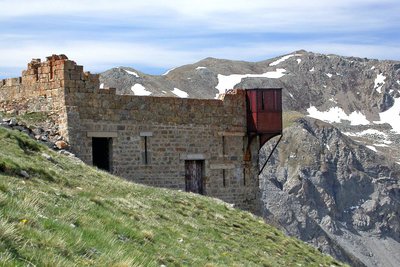
Le fort du Camp des Fourches avec sa tourelle métallique dite « Séré de Rivière ». - Anthony TURPAUD  History and historical trail
Removal zones
The depression on your right was one of the zones from where material was removed from to build Camp des Fourches at the start of the last century. The former military dry-stone track allows you to reach Cime de Pelousette.
Description
This stage heads into the Mercantour National Park by way of GR5 along the Lauzanier valley. From the D900 carpark, located on the French side of the col, take a path which is signposted to the left and which joins GR5 – GR58 at Pont Rouge. Continue on the GR alongside the left bank of L’Ubayette. A sign shows the way to “lac du Lauzanier 15 mn”, do not take the unmarked path which heads to the right of the Lacs des Hommes and continue along the GR to Lac du Lauzanier. After a return trip to the little chapel, continue along the marked GR path to reach the lake behind La Croix (2428m). The path heads left towards La Tête de l'Enchastraye. The GR rises over a series of hairpin bends along the grassy slopes and subsequently the screes, ascending towards Pas de la Cavale (2671m). The descent from the latter to the lakes of Agnel is delicate along a stony path which can be unstable.
Reach the intersection with the Salso Moreno valley and turn right onto GR5 towards Col des Fourches and Camp des Fourches located on the road to Col de la Bonette. The path provides a shortcut across the hairpin bends in the downhill road, quickly reaching the hamlet of Bouseiyas.- Departure : Col de Larche
- Arrival : Bousieyas
- Towns crossed : Val-d'Oronaye, Larche, Saint-Étienne-de-Tinée, and Saint-Dalmas-le-Selvage
Altimetric profile
Recommandations
Report a problem or an error
If you have found an error on this page or if you have noticed any problems during your hike, please report them to us here: