7. Alta Via dei Re, stage 7: from Refuge Pagarì to San Giacomo d'Entracque
3 points of interest
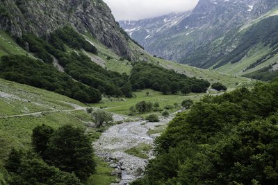
PIAN DEL RAZUR - gianluca.giordano  Geology
The Pra del Rasur
The ample meadow of the Pra del Rasur was formed towards the end of the last Ice Age, when rockslides from both sides of the valley blocked the course of the torrent. The detritus carried by the torrent itself, still quite impetuous today, gradually filled up the basin that was formed, thus creating the flat area.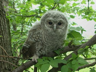
Allocco - Augusto Rivelli  Fauna
FaunaThe tawny owl
Among nocturnal birds of prey, the owl plays an important role, both from an ecological point of view and in the human imagination. It is in fact one of the most widespread species and therefore responsible for controlling the populations of rodents in wooded areas. For our part, often confused with the owl due to its shrill calls, it has a typical song that anyone recognizes: the typical mournful owl song. It can be recognized from owls and owls by the color of its eyes: the iris is completely dark.
La Palazzina Reale di Caccia di San Giacomo - Roberto Pockaj  History and historical trail
The former Royal Hunting Lodges
The two large buildings, now owned by religious groups, are said to have been built between 1865 and 1870 at the behest of Vittorio Emanuele II, to be used during his sojourns in the Royal Hunting Reserve. The one on the left, with its attractive portico decorated in horizontal stripes with the colors of the House of Savoy, was the residence of the royal entourage, while the other housed the stables.
The stables were then given to the army, which expanded the building between 1897 and 1898, transforming it into the Princess Elena barracks.
Description
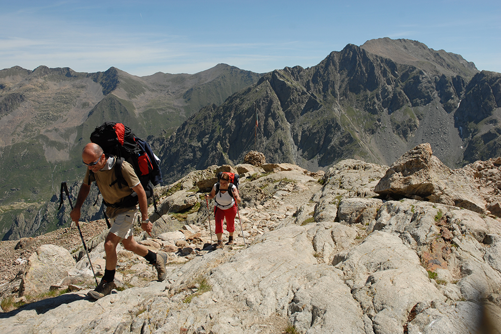
From the Rifugio Federici Marchesini al Pagarì (2627 m) follow the path that descends to the east, losing height with numerous gradually wider hairpin bends. The path bends to the north-west (left), dropping with steep traverses, among rocks and alpine meadows. Just beyond the Rio Pagarì the trail flattens out for a short distance to the Passo sottano del Muraion, where it resumes with a long series of hairpin bends.
When the slope decreases you reach Rio Pantacreus (which, in high water, can be crossed on the wooden footbridge just above the path); a little further on by a large rock, ignore the path to the Moncalieri Bivouac hut on the left. Now on a comfortable mule track, with a long traverse descend to Gias Colombo, turn right to cross the stream on a long footbridge and then continue north to the remains of Gias sottano del Vej del Bouc (1437 m, 2.30 hours from the Federici Marchesini Refuge).
Follow the dirt road that leads down the valley from the gias, across the entire plains of Pra del Rasur, and climb briefly to over the ridge where you pass Gias del Rasur. From this point you continue to follow the road downhill, ignoring various shortcuts, until you arrive at the back of the former Royal Hunting Lodges, these are now used as summer camps by religious orders (fountain).
Here you a tarmac road continues the descent to the bridge over the Torrente Gesso della Barra and then to San Giacomo di Entracque (1209 m, 1:00 hour from Gias sottano del Vej del Bouc.
- Departure : Federici Marchesini al Pagarì Refuge (2627 m)
- Arrival : San Giacomo di Entracque (1209 m)
- Towns crossed : Entracque
Altimetric profile
Recommandations
Transport
SNCF line TER Provence Alpes-Côte d'Azur For travel in the PACA region and towards Cuneo www.ter-sncf.com/pac
Trenitalia for travel in the Piedmont region https://www.trenitalia.com/it.html
Access and parking
Parking :
Report a problem or an error
If you have found an error on this page or if you have noticed any problems during your hike, please report them to us here:
Close by3
- Mountain Hut
Mountain Hut
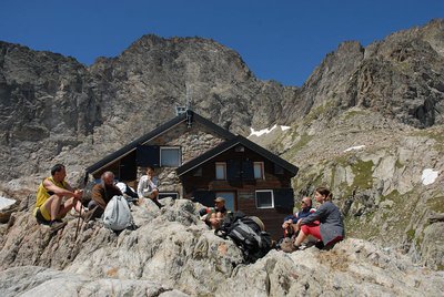
Rifugio Pagarì
It stands on a small rocky promontory, with a large dry stone wall on the north side to increase the flat space.
The construction is dominated to the west by the imposing wall of the Maledia peak. To the N the slope, made up of rocks sometimes covered with grassy vegetation of the nival type, descends to the underlying stream (Rio Pagarì), while on the horizon the view extends over the entire Alpine range: from Monviso (N - NW) to Gran Paradiso (N). - Mountain Hut
Mountain Hut
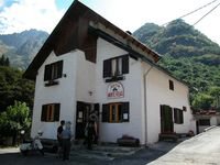
Rifugio escursionistico S. Giacomo e Baita Monte Gelas
Structure open only in the summer season.
The Baita Monte Gelas was born in 1953 thanks to Giovanni Gerbino and Caterina Mellano. Since then our family has been offering hospitality and refreshments to visitors to the upper Gesso Valley.