2. GTM - Stage 02 : Estenc - Saint-Dalmas-le-Selvage
9 points of interest
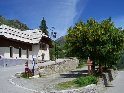
Refuge de la Cantonnière - Refuge de la Cantonnière  Refuge
La Cantonnière refuge
The history of the refuge is closely linked with the Route des Grandes Alpes connecting Lac Léman with the Mediterranean. It was built in the early 20th century by the French Touring Club with the very rudimentary means of the period by Italian workers, for whom the imposing Cantionnière house was built.
Accessible in summer 1913 to the few automobiles which were around at the time, the road was to be inaugurated by President Poincaré in August 1914. But the declaration of war deprived the people of Entraunes of this visit.
The building today serves as a refuge and has been fully renovated by Mercantour National Park.
Capacity: 36 in dormitories of 2, 4, 5 and 18.
Prices and opening periods: http://lacantonniere.wixsite.com/refugelacantonniere
Tel: 04.93.05.51.36
E-Mail: lacantonniere@gmail.com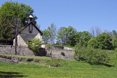
Chapelle Notre-Dame des Grâces à Estenc. - Marion BENSA  Small heritage
Estenc
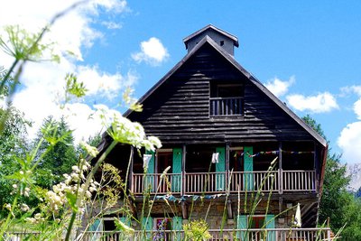
In the 1930s, 15 families lived in Estenc, mainly as sheep and arable farmers (barley, rye). Life, virtually cut off from the rest of the world, was marked by poverty and rough. All the resources nature provided were made use of, but balance was maintained and a certain harmony existed between the people and the natural world. Currently, with rural desertification, the forest and fallow land are taking over; just a single farming family today remains in Estenc.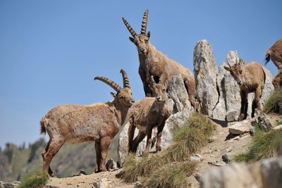
Bouquetin des Alpes, (Capra Ibex). Groupe de bouquetins. - Philippe PIERINI  Fauna
FaunaAlpine ibex (Capra ibex)
A symbol of the high mountains and their giddying peaks, this ungulate disappeared from this region more than 150 years ago.
Since 1987, reintroduction operations have been jointly undertaken by the Mercantour National Park and the Parco naturale Alpi Marittime.
A group of fifty or so have settled at Roche Grande.
To allow them to be identified, the animals are given coloured ear tags. The park staff regularly monitor the development of the species.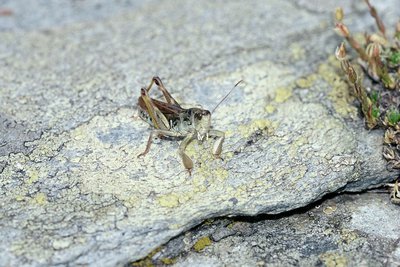
Gomphocère des alpages ou criquet de Sibérie, sur un rocher, (Gomphocerus sibiricus). - MALAFOSSE Jean-Pierre FaunaSiberian cricket (Aeropus sibericus)
During the great glacial periods, this orthoptera lived on the plains. As the climate has warmed back up, it has moved to the high mountains, above 2000m. The male can be recognised thanks to the its bulging back legs, hence its surname of “Popeye”. This herbivore, whose predators include birds, marmots and foxes, is part of the food chain in high-altitude pastures.
Zone humide dans le vallon de l'Estrop. - COSSA Jean-Louis  Pastoralism
Pastoralism
This grassy valley called Estrop (stropia: flock) a been used for pastoral purposes for many a long year: 1500 sheep graze it from August to September. The hut serves as a shelter for the shepherd. The flock rests on the knoll as the abundance of nettles and wild spinach attest. The Alpine grass is a fragile environment where the National Park helps ensure that a biological balance is maintained, while trying to improve the working conditions of shepherds.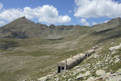
Blockhaus sous le col de Gialorgues dans le vallon de l'Estrop à Entraunes. - Marion BENSA  History and historical trail
Military remains
Just before the Second World War, the French army decided to build fortifications (bunkers) on Col de Gialorgues with a few to stopping a possible Italian invasion. Military authorities aimed to open a sufficiently wide track to allow all-terrain vehicles to reach Col de Gialorgues. Materials were transported by mules from the camp which was set up at the foot of the Estenc woods, but the soldiers had to rapidly give up due to the stony nature of the ground.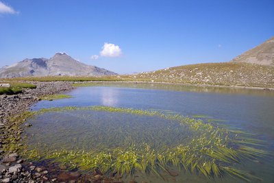
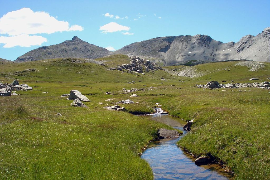
Le lac de l'Estrop un jour d'été, commune d'Entraunes. - Marion BENSA  Lake
LakeThe Estrop lakes
Around 10000 years ago, the glacier occupied the whole valley before it gradually shrank as the climate warmed up, leaving a body of water behind each glacial rock bar. Slowly, erosion overcame this stock of water. Ad you head up the valley, you are also heading back in time: grasses towards the bottom, peat bogs in the middle, lakes towards the top. Around the wetland areas, Arcto-Alpine species flourish such as the cane and Zweifarbige Seggen which are protected at both a national and a European level.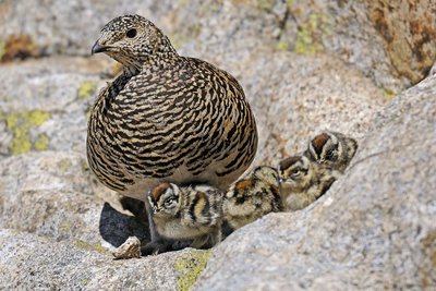
Lagopède alpin, (Lagopus mutus). En été, une femelle lagopède dans les rochers avec ses quatre poussins. - Jacques BLANC FaunaWhite-tailed ptarmigan (Lagopus mutus)
Also known as the snow quail (or “jalabre” in the local dialect), this bird of the Tetraoninae family is a familiar sight in the high mountains. It is perfectly adapted to the cold and lives all year round at 2500 - 3000m. Three to four times per year, it changes its feathers according to its surrounding environment. In the autumn, the ptarmigans can join together in groups of 20 to 25 individuals. Their main predators are stoats and golden eagles.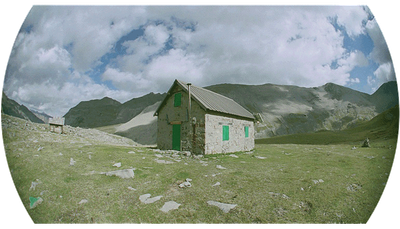
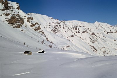
Le refuge de Gialorgues - PNM/DR RefugeGialorgues refuge
Capacity: 12 in refuge
Warden: No
Opening period: All year
Obligatory reservation
Pick up and drop off point for keys:
Hôtel Regalivou
04.93.02.49.00
St Etienne de Tinée
M. FERRAN 04.93.05.54.22
Estenc
In case of problems:
contact Nice CAF
michelle@cafnice.org
04 93 62 59 99
Useful numbers:
Park House: 04 93 02 42 27
St-Etienne de Tinée Tourism Office: 04 93 02 41 96
St-Dalmas Lodge: 04 93 02 44 61
Description
From the upper carpark (m.284), at the entrance to the Mercantour National Park, take the path on the right and then, lower down, you will go over a footbridge which crosses the Sanguinière mountain stream (m.281).
Follow the flat path (former canal) and you will reach the Estrop valley without any particular difficulties via markers 282 and 283. At marker 283, turn left and you will soon cross the Estrop valley and climb up the other side via a long hairpin bend (m.275) over the rock bar of the Estrop valley.
At around 2100m, you will reach an initial flatter section under the bars of Roche-Grande (south) before entering into the curious cirque of L’Entonnoir, a depression into which the Estrop waterfall plunges.
A short, sharp climb leads to the long and gradual Estrop climb, where an alpine pasture hut sits at the foot of La Pointe du Génépi. From time to time, imposing cairns show the direction to head in, and progress is easy until Col de Gialorgues (2519m - m.279), a characterful passage between the Var and the Tinée with its series of abandoned military pillboxes located on your left, which can be used as shelters.
From the col, you can look out over the opposite slopes and a vast panoramic view over La Haute Tinée with the distant focal point of the southern face of Mont Viso (3841m). Closer at hand, the sizeable Gialorgues valley displays its alpine pastures between the rocky peak of Bollofré on the right (east) and Fort Carra on the left.
Head down into the Gialorgues valley, where a path through the pastures leads pleasantly to a wide flatter section where the CAF refuge of Gialorgues (unstaffed) (2280m - m.73a) as well as the pastoral hut can be found.
Continue northwards and the route passes close to Les Sagnes de Gialorgues, where a stream bordered by cotton grass flows. You will reach the first areas of larch forest and then, when the path has zigzagged upwards, you will reach a dirt track (Valloar carpark) (1950m - m.73).
Turn left and ford the Valloar mountain stream and then follow the path to the right as it heads down the left bank of the Gialorgues mountain stream (approximately 6km). Via markers 72 and 66, you will reach the village of Saint-Dalmas-le-Selvage (1500m - m.67).
- Departure : Estenc
- Arrival : Saint-Dalmas-le-Selvage
- Towns crossed : Entraunes and Saint-Dalmas-le-Selvage
Altimetric profile
Recommandations
Report a problem or an error
If you have found an error on this page or if you have noticed any problems during your hike, please report them to us here:
Close by2
- Mountain Hut