13. GTM - Stage 13 : Refuge de la Madone de Fenestre - Refuge de Nice
3 points of interest
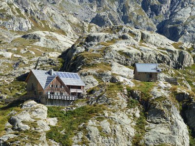
Refuge de la Madone de Fenestre - CAF / DR  Refuge
La Madone de Fenestre refuge
Club Alpin Français
Capacity: 62 Possibility of eating and having a shower
Warden: Mid-June to late-September + school holidays and weekends in winter
Tel. 04 93 02 83 19
Out of season upon reservation: Patrick Miraillet: 04 93 03 91 02
Online reservations: http://chaletmadonedefenestre.ffcam.fr/
Useful numbers:
St-Martin-Vésubie Tourism Office: 04 93 03 21 28
Park House: 04 93 03 23 15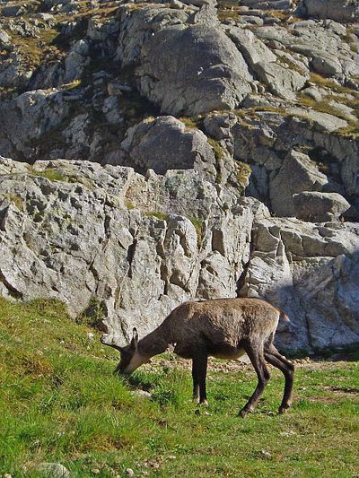
Chamois (Rupicapra rupicapra) près du refuge de Nice en Gordolasque à la fin de l'été - MALTHIEUX Laurent  Fauna
FaunaChamois (Rupicapra rupicapra)
A mammal of the Bovidae family and the subfamily of the Caprinae, the chamois (Rupicapra rupicapra) is a mountain dweller par excellence. It can climb 1000m upwards in 15 minutes (a hiker would take 3 hours). It can be recognised thanks to its horns, which are straight and then curved backwards, and quite small compared to those of the ibex.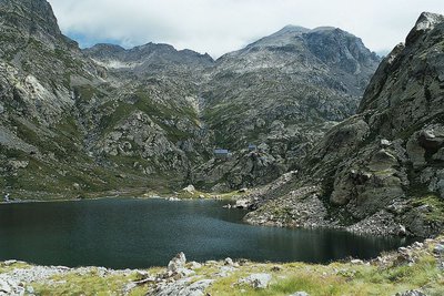
En Gordolasque, le lac de la Fous et le refuge de Nice - LE BOUTEILLER Eric  History and historical trail
The Salt Road
The track which leads to the Nice refuge is one of the secondary passages of the Salt Road via the “Pas de Pagari”. Frequented since ancient time, this Pas gets its name from Paganino dal Pozzo,an Italian entrepreneur who, in 1453, was appointed as salt tax adjudicator by the Duke of Savoie.
Paganino was responsible for the construction of a new route via the “Pas de Pagari” to transport salt from Provence to Cuneo in Piedmont.
Description
From the sanctuary, head down along GR52 (m357) towards the cow barns, cross the mountain stream and then head back up the left bank at cut across the mountain stream (m359), then head up the left bank and cut across the Ponset valley (m367).
Continue through the prairie where several small springs cut across the path; head across the different rocky projections.
After the last trees, take the fork to the right following the GR markers towards Les Caïres de la Madone; further down to the left is the herbaceous plateau of Jas Cabret. Continue as you climb across the screes until you reach the outlet of the Mont Colomb valley, which you should then climb through along grassy areas to reach the small lake of the same name. Head up the left bank (according to the season, a large patch of snow may still cover the path) and you will soon reach Pas du Colomb (m400 - 2548m).
Once you have gone over it, descend towards the east via a steep and narrow corridor, which is one of the most technically difficult parts of the itinerary, then cross the screes to finish the descent via a series of hairpin bends on a fairly steep grassy slope (m416).
Go up the Gordolasque valley at the place called Barme, continue along the right bank, heading around the lake of La Fous (EDF water intake) and finish along a steep slope which is well-landscaped to reach the Nice refuge 2232m.- Departure : Madone de la Fenestre refuge
- Arrival : Nice refuge
- Towns crossed : Saint-Martin-Vésubie and Belvédère
Altimetric profile
Recommandations
Report a problem or an error
If you have found an error on this page or if you have noticed any problems during your hike, please report them to us here: