2. The finest Ligurian villages - Hike from Airole to Dolceaqua - Stage 2
Description
Leave the village along the main road which comes from and follow it for around 750m until you get to the oratory which denotes the beginning of your itinerary. Turn left and cross the bridge. Follow the track until you reach a fork at the foot of a green telephone pylon. Take the wide concrete track on your right (despite the sign saying “Interdit, Propriété privée” and the chain which you can safely ignore).
The climb is steep. You will quickly find red and white markers and on the third hairpin bend, take the path which heads to the right; it is relatively unobtrusive and not signposted.
The path heads uphill on a regular gradient through the forest and reaches an altitude of 430m in a large space which overlooks the sea, with tall pine trees. Follow the sign for “Isolabona, Morgi”. The path heads uphill on your left and the forest makes way for less airy Mediterranean vegetation: cistus, arbutus, heather…. You will now be more or less on a ridge but still surrounded by foliage. Only a single wide gap allows you a magnificent view over the Camporosso plain and the sea. At an altitude of 600m, you will see a ruin on your right. Continue along the path until you reach a scree, which you will need to cross, and then head alongside it on the right before reaching the forest again.
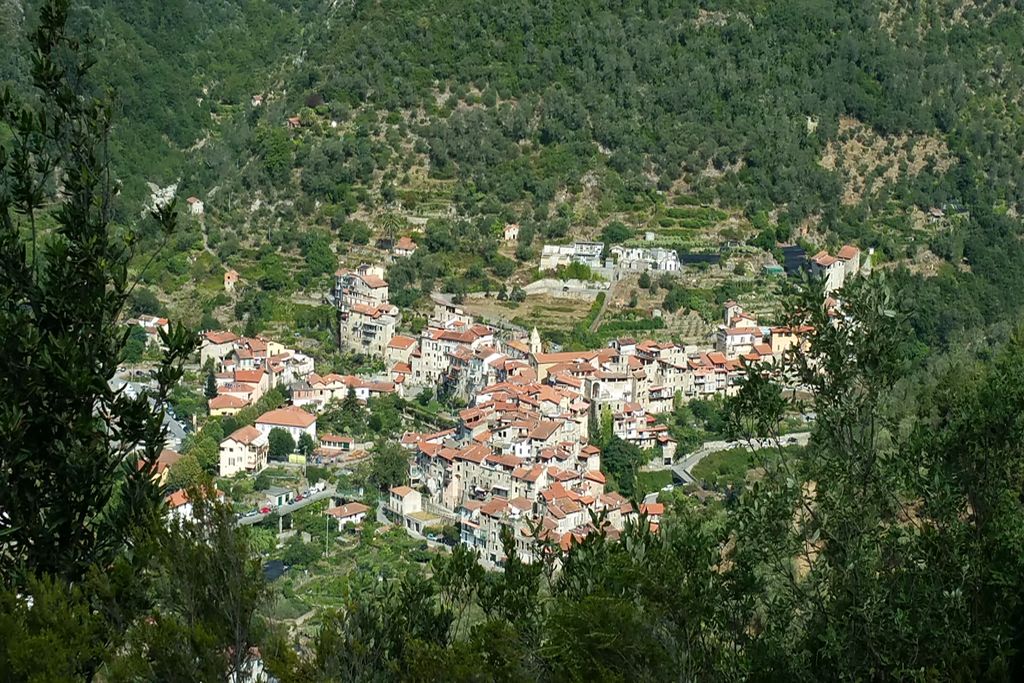
You will find a sign for “Morgi/Isolabona” at 690m altitude in a clearer area. Turn left and, at the next sign, (30m higher), turn right and head alongside a renovated house. Follow a wide dirt track until you reach the col, a large space which signals the descent towards Isolabona. You will soon be able to enjoy the view over Apricale, Perinaldo and even more discreetly over Baiardo. Mont Bignone can be seen facing you and the sea is on the right, above San Remo. On the other side, there is a magnificent view over Mont Torrage (altitude 1970m).
Stay on this track to Isolabona. At times, you can go along the path which provides a shortcut avoiding the track’s hairpin bends. You will first go past the Marra chapel and then the Marra cross.
The fairly steep path goes straight down to the village and comes to an end at the road (Via Roma).
Cross this road, turn right for a few metres and enter the village via the alley on the left, in a pedestrian area. Head up this main walkway and go past the church.
At the western edge of the village, cross the road (pedestrian crossing as you leave the tunnel). The path has white and red markers at the entrance to a property. Follow this to Apricale. The path rises gradually parallel to the road. As you get close to the village, you will head along a tarmacked surface for a few metres and then take the path on the right which heads down into the valley and then up the other side. Head to the centre of Apricale avoiding the road.- Departure : Rocchetta Nervina
- Arrival : Apricale
- Towns crossed : Rocchetta Nervina, Dolceacqua, and Apricale
Altimetric profile
Report a problem or an error
If you have found an error on this page or if you have noticed any problems during your hike, please report them to us here: