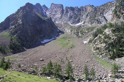
Grand Tour of Argentera and Vallée des Merveilles
7 steps
25 points of interest
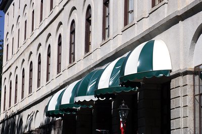
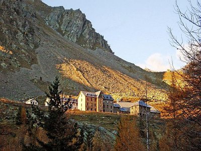
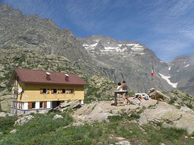
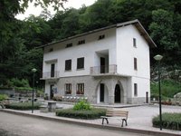
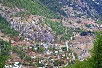
L'Hotel Royal a Terme di Valdieri - Roberto Pockaj  Architecture
The Valdieri Royal Hot Springs
First cited in the mid sixteenth century. When King Carlo Emanuele III decided to valorize the Valdieri hot springs, in 1755, a building and other appurtenances were quickly built in order to create a spa around the sulfurous waters. Cavour called Valdieri "the richest in health-preserving waters in all the nation, and perhaps in all of Europe as well". Vittorio Emanuele II, who first visited Val Gesso in 1855, became a frequent guest at the spa, and it was at his behest that, on 10 July 1857, the first stone was laid for the structure that was to become the Hotel Royal.
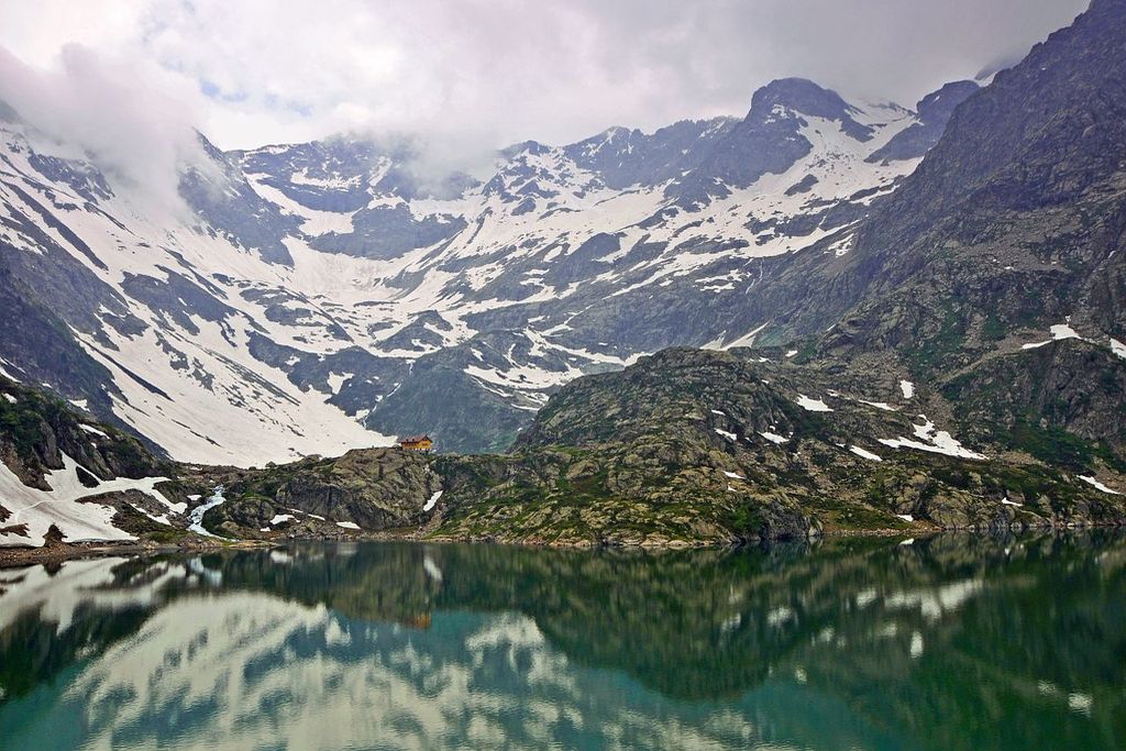
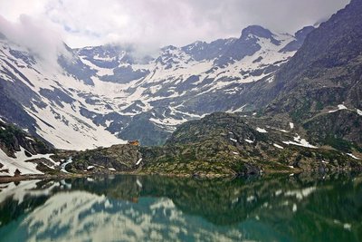
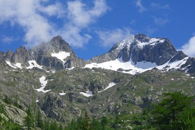
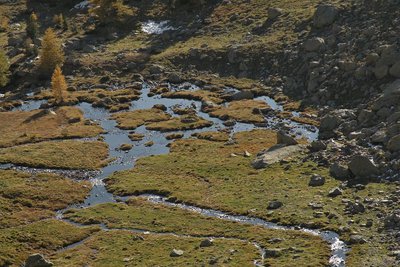
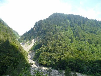
Panorama dai pressi del Lagarot di Lourousa; sullo sfondo al centro il Canalone di Lourousa e, a destra, il Corno Stella - Roberto Pockaj  Lake
LakeThe Lagarot di Lourousa
Springwater, welling up among meadows and larches, forms numerous limpid pools and streams; the water is at times turquoise, at times milky and at others perfectly transparent, making this a particularly striking location, perfect for a contemplative rest. The Canalone di Lourousa, bordered by Monte Stella and the Corno Stella and scoured by the Gelas di Lourousa, lies beyond the plateau of the same name, and a look over one's shoulder yields a view of the imposing outline of Monte Matto.

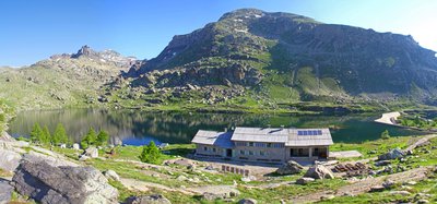
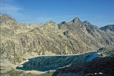
La diga del Chiotas - Roberto Pockaj LakeThe Chiotas Reservoir, the Della Piastra dam and the Lake della Rovina
The Chiotas Reservoir is closed off by two dams: the Chiotas dam and the Colle di Laura dam. The Chiotas dam, an arch-gravity structure, is 130 meters high and stretches for a length of 230 meters. Its thickness varies from 37.5 meters at its base to 5 meters at the top. The mass gravity Colle di Laura dam is smaller, rectilinear and only 30 meters at its maximum height. Its length is 70 meters. The Chiotas Reservoir has a carrying capacity of 27.3 million cubic meters of water.
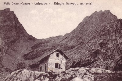
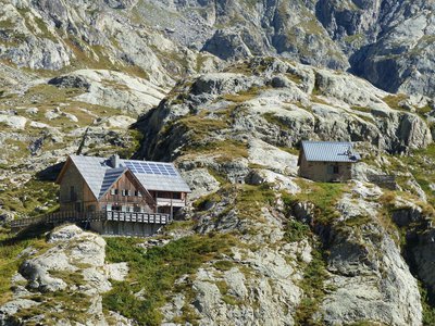
Il vecchio Rifugio Genova - Archivio EAM ArchitectureThe Genova Figari Refuge
To valorize the hiking trails along the Argentera Massif, in the last years of the nineteenth century the Liguria chapter of CAI decided to build a refuge near the upper Gias del Monighet, in the Vallone della Rovina. The Genova Refuge, as it was named, was inaugurated on 15 August 1898.
But the fate of the first refuge in the Maritime Alps was definitively sealed in 1968: the reservoir of the new Chiotas dam would submerge it permanently. ENEL assumed the task of building another refuge, which was inaugurated in 1981.
The refuge is named for Bartolomeo Figari, who as Secretary General of CAI saw both the successful conquest of K2 and the birth of the National Alpine Rescue Corps, to which he bequeathed all his worldly goods.
Praterie di alta quota - Cati Caballo  Flora
FloraThe cleared meadows
At the highest altitudes there are cleared meadows, the typical alpine pastures; they are composed of herbaceous species capable of covering soils normally closed to woody species, which, due to the very short vegetative period, cannot find suitable conditions for their development. Grazing by wild ungulates and, sometimes, by domestic sheep affects their composition, even if the most severe factor for species selection is represented by the climate.
Giovani stambecchi al Colle di Fenestrelle - Roberto Pockaj  FaunaColle di Fenestrelle, as well as the surrounding area, is very popular with the ibex.
The Alpine ibex (Capra ibex), frequents alpine meadows and rock faces even above 3000 m, reaching the valley floor (provided it is not wooded) only in early spring, to be able to refresh itself after the long winter. Both sexes have annual growth horns, but much larger in males. The coat, light beige in summer, darkens to dark brown in winter.
Sedentary, grazing, it essentially feeds on grass, integrated with mosses, lichens and leaves of mountain shrubs, especially in winter.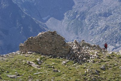
Il Ricovero Fenestrelle - Roberto Pockaj  History and historical trail
The Fenestrelle shelter
The ruins near the pass mark the site of the Fenestrelle shelter, named for Lieutenant Angelo Bertolotti. Built in 1888 and in use until the Second World War, it could house a garrison of 10 on straw pallets. In their guidebook, entitled "La Valle Gesso", the Boggias indicate the shelter as being instead dedicated "to the memory of Angelo Bortolo, of the 1∞ Reg. of the Alpine Corps, who was killed on the Ortigara during the First World War".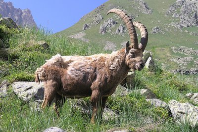
Stambecco maschio adulto, durante la muta primaverile del mantello - Roberto Pockaj FaunaThe Ibex of the Alps
Colle di Fenestrelle, as well as the surrounding area, is very popular with the ibex.
The Alpine ibex (Capra ibex), frequents alpine meadows and rock faces even above 3000 m, reaching the valley floor (provided it is not wooded) only in early spring, to be able to refresh itself after the long winter. Both sexes have annual growth horns, but much larger in males. The coat, light beige in summer, darkens to dark brown in winter.
Sedentary, grazing, it essentially feeds on grass, integrated with mosses, lichens and leaves of mountain shrubs, especially in winter. History and historical trail
The Military Barracks at Colle delle Finestre and the other works of the Vallo Alpino
The barracks is a large building in stone and cement, still in decent condition, which was built to garrison the contingent tasked with defending the pass; its 16 rooms could house 50 men.
In addition to the barracks, other fortifications also defended the pass during the Second World War. On what is now the French side the remains of a nineteenth century shelter named for Lieutenant Mario Amedo are clearly visible, as are two bunkers of the Vallo Alpino defensive fortifications; 126 to the left of the pass and 127 to the right.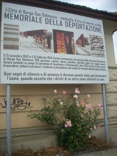
Pannello al memoriale della deportazione di Borgo S.D. - Archivio EAM History and historical trailTrails of Freedom
Between the 8th and 13th of September, 1943, just days after Italy's surrender, about twelve hundred Jewish civilians of all ages and walks of life, originating from Saint-Martin VÈsubie, crossed the Alps together with the Italian troops of the IV Army Corps. On foot, following two different routes, over the Colle di Finestra and the Colle di Ciriegia, the refugees arrived, respectively, in Entracque and Valdieri, where they were housed in the barracks and wherever else possible. A plaque affixed to the wall of the barracks at Colle di Ciriegia commemorates these events.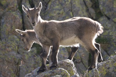
Giovani stambecchi al Colle di Finestra - Roberto Pockaj FaunaThe Alpine Ibex
Alpine ibex are a common sight at Colle di Fenestrelle and in the surrounding area. The Alpine ibex Capra ibex), a mountain goat, lives in Alpine meadows and rocky terrain, even over 3,000 meters, descending to the valley floors (if they are not wooded) only in the early spring, when the long winter's hardships make the new sprouts irresistible. Both sexes have horns that grow each year, but the males' horns are decidedly bigger. Their coats, a light beige in the summer, turn dark brown in the winter months.
A permanent resident, this grazing mountain goat subsists mostly on grass, in addition to some mosses, lichens and leaves of mountain shrubs, especially during the winter.
Colle di Finestra, panorama sul versante italiano - Roberto Pockaj  Cross-border
Il Colle di Finestra
The pass is a direct link between Valle Gesso and Vésubie, and has been crossed since time immemorial - and immortalized in legend and historical annals - by saints, emperors and invading armies. Before the Savoys gained direct access to the sea, the Colle di Finestra pass was also an important supply route for the salt trade.
Its name, which first appears in the written records in 1041, has remained unchanged up to the present day: Colle di Finestra or, as written on the military maps of the early 1900s, Colle delle Finestre. The first version is the right one, though, because it refers to a single natural window (Finestra) that splits the northwest crest of the Cayre de la Madone.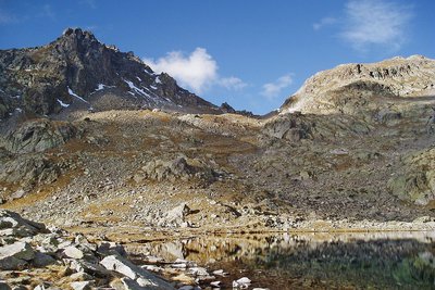
Lac, col et cîme ouest de Fenestre en automne, éclairage automnal. - Guigo Franck  Peak
PeakCol de Fenestre
A communication route within the House of Savoy, the col became part of Italian territory in 1860 and a border col in 1947, the date at which the border was moved to the watershed. When the weather is clear, the view extends beyond the plain of Pô to 200km to the north: Cervin (4478m) and Mont Rose (4634m) are visible in these conditions.
Vieille souche et portion de tronc de mélèze dans le torrent de la Madone de Fenestre face au Cayre de la Madone. - RICHAUD Philippe History and historical trailTerre de cour
The black rock marks one of the borders of the Terre de Cour, formerly a domain of the Count of Provence, before it was returned to the House of Savoy in the 14th century. Two inscriptions on the black rock provide a reminder of the past: “B” for Belvédère, “SM” for Saint-Martin-Vésubie. Terre de Cour was located exclusively in these two communes but they have to share the ancient rights to pasture and wood with Lantosque and Roquebillière.
Dans l'ombre à droite le pas du mont Colomb, (2548 m). - GUIGO Franck  Geology
The scars of erosion
When they converge, runoff streams of water leave the ground bare, breaking a fragile equilibrium. In addition, footfall due to tourism damages the ground and raises the question of preservation of natural environments. Plant cover has to be maintained as it protects the ground from erosion and guarantees its stability. Restoration work has been carried out to guide and direct the hundreds of hikers who love these wild areas.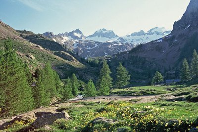
Le Gélas encore bien enneigé en fin de printemps, depuis le vallon de la Madone de Fenestre - LOMBART Guy History and historical trailCol de Fenestre mule track
This track has been used for a thousand years and was regularly maintained to allow mules transporting salt to pass with ease. The technique used to make and maintain these tracks involved self-locking stones. Identically sized slabs were arranged vertically in close lines. Fine materials were then used to hold it all in place. Gutters provided a run-off area for rainwater.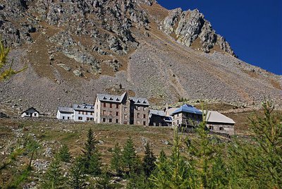
Depuis le vallon, le sanctuaire de la Madone de Fenestre en début d'automne - LEBOUTEILLER Eric History and historical trailLa Madone de Fenestre sanctuary
In the 8th century, a modest refuge already, providing accommodation for travellers. This sanctuary with its imposing forms was built by the Benedictines of Borgo San Dalmasso and destroyed by the Saracens in the 10th century. The Templars restored it in the 13th century shortly after the Virgin Mary appeared at the Grand Caire window. Subsequently, the sanctuary was devastated by fire several times and then rebuilt. Today it belongs to the diocese of Nice.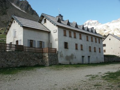
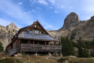
Refuge de la Madone de Fenestre - CAF / DR  Refuge
La Madone de Fenestre refuge
Club Alpin Français
Capacity: 62 Possibility of eating and having a shower
Warden: Mid-June to late-September + school holidays and weekends in winter
Tel. 04 93 02 83 19
Out of season upon reservation: Patrick Miraillet: 04 93 03 91 02
Online reservations: http://chaletmadonedefenestre.ffcam.fr/
Useful numbers:
St-Martin-Vésubie Tourism Office: 04 93 03 21 28
Park House: 04 93 03 23 15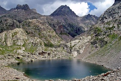
Le lac Niré, (2353 m), et la cime de Chamineye, (2921 m), le 29 septembre 2006, - GUIGO Franck GeologyThe eclogite of Lac Niré
Just above Lac Niré, on the right bank of the mountain stream, among the migmatite, can be found very dark rocks which take the shape of huge lentils (geologists call them “black puddings”).
When you look closely at these one of these lentil, you can see very different minerals to the ones you find in migmatite. The rusty red coloured ones are garnet and the darker ones are amphibole.
This very distinctive rock with characteristic fine and very dense crystals is eclogite; it is quite rare and a remainder from oceans which have disappeared. It is a metamorphic rock which springs from the transformation of basalts, ancient lava from the oceanic crust.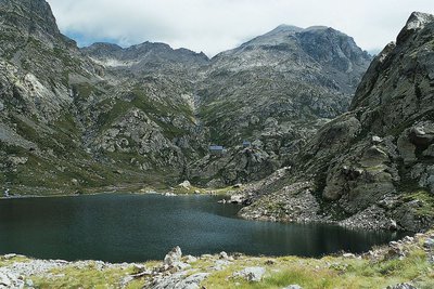
En Gordolasque, le lac de la Fous et le refuge de Nice - LE BOUTEILLER Eric History and historical trailThe Salt Road
The track which leads to the Nice refuge is one of the secondary passages of the Salt Road via the “Pas de Pagari”. Frequented since ancient time, this Pas gets its name from Paganino dal Pozzo,an Italian entrepreneur who, in 1453, was appointed as salt tax adjudicator by the Duke of Savoie.
Paganino was responsible for the construction of a new route via the “Pas de Pagari” to transport salt from Provence to Cuneo in Piedmont.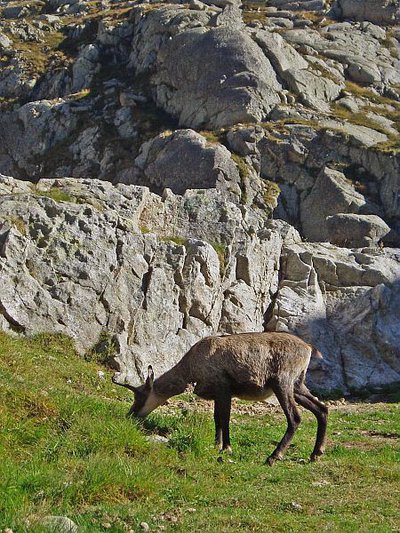
Chamois (Rupicapra rupicapra) près du refuge de Nice en Gordolasque à la fin de l'été - MALTHIEUX Laurent FaunaChamois (Rupicapra rupicapra)
A mammal of the Bovidae family and the subfamily of the Caprinae, the chamois (Rupicapra rupicapra) is a mountain dweller par excellence. It can climb 1000m upwards in 15 minutes (a hiker would take 3 hours). It can be recognised thanks to its horns, which are straight and then curved backwards, and quite small compared to those of the ibex.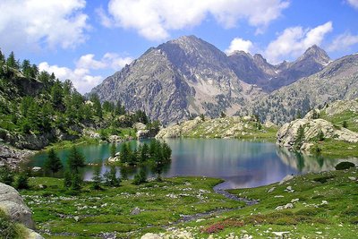
Le lac de Trécolpas en été, (2150 m) - GUIGO Franck  Know-how
Mountain climbing in the Mercantour
At the start of the 20th century, for the first mountain climbers, the Mercantour was a taste of adventure. Little by little, the summits of the chain were conquered, initially via the normal routes and then, with the arrival of modern mountain climbing, along the most difficult routes. From Victor de Cessole to Patrick Bérhault, the greatest names have been involved in climbing in the Mercantour. Today, whether they are snowy, icy or rocky, the reputation of certain routes is well established.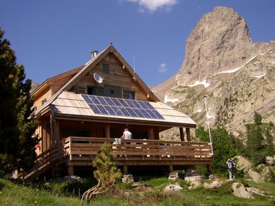
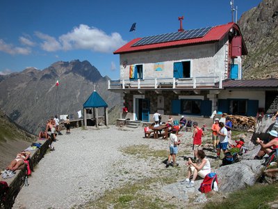
Refuge de la Cougourde - CAF / DR RefugeLa Cougourde refuge
Club Alpin Français
Warden: June – September: Manuel Putelat
September – June: Charly Barcelo: 06 18 54 02 43
Reservations by telephone or e-mail: refugelacougourde@ffcam.fr
Refuge landline: 09 78 23 31 59
Website: http://refugelacougourde.ffcam.fr/
Useful numbers:
St-Martin-Vésubie Tourism Office: 04 93 03 21 28
Park House: 04 93 03 23 15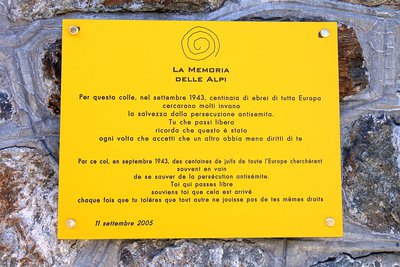
La targa commemorativa posta sulla Casermetta al COlle di Ciriegia in occasione del 25° anniversario del Parco - Roberto Pockaj History and historical trailTrails of Freedom
Betwee the 8th and 13th of September, 1943, just days after Italy's surrender, about twelve hundred Jewish civilians of all ages and walks of life, originating from Saint-Martin Vésubie, crossed the Alps together with the Italian troops of the IV Army Corps. On foot, following two different routes, over the Colle di Finestra and the Colle di Ciriegia, the refugees arrived, respectively, in Entracque and Valdieri, where they were housed in the barracks and wherever else possible. A plaque affixed to the wall of the barracks at Colle di Ciriegia commemorates these events.
L'abetina di abete bianco - Cati Caballo FloraThe silver fir fir
The white fir covers entire slopes in purity, since, like the beech, it takes advantage of the climatic conditions of this strip of the Alps so close to the sea. The current diffusion of this conifer, particularly within the beech woods, is in any case reduced compared to its potential, because in the past it was disadvantaged by human action to the benefit of the beech, producer of a more requested type of fuel.
Altimetric profile
Recommandations
This itinerary takes place along high-valley Alpine paths. The accommodation sites listed are the only ones which are available along this route. Before heading off on a hike, ensure that you have studied the safety advice. If you are setting off on this hike in the early part of the season, you will need to take particular care as patches of snow can still be present in higher areas.
Specific regulations apply when you cross Vallée des Merveilles. Signs on site.
· Do not leave the marked paths
· Do not touch or damage the rock carvings
· Do not use hiking poles without placing rubber tips on the ends.Access and parking
Parking :
Report a problem or an error
If you have found an error on this page or if you have noticed any problems during your hike, please report them to us here:
Close by9
- Mountain Hut
Mountain Hut
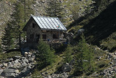
Rifugio Morelli - Buzzi 2351 m
The Morelli-Buzzi Mountain Hut was built by the CAI (Italian Alpine Club) of Cuneo in 1931, expanded in 2000, and completely renovated in three phases between 2010 and 2012.
It is located in the enchanting Lourousa Valley, in the heart of the Maritime Alps Regional Nature Park, at the foot of the north face of Monte Stella. - Mountain Hut