Alto Tanaro Tour
9 steps
7 points of interest
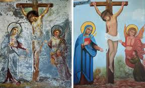
Dipinto restaurato del pittore Arduino - Archivio EAM  History and historical trail
Eugenio Arduino
Among the various artists who decorated churches, houses and shrines, Eugenio Arduino is certainly worth remembering. He left numerous testimonies in the late 19th and early 20th centuries and is credited with having painted, among other things, San Martino on the facade of the Parish Church in Ormea.
Also the art work of the Pilone delle Caranche, dated 1902 but still fairly well conserved, bears his signature.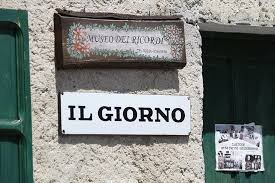
Insegna del Museo - Archivio EAM  Small heritage
The Museum of Memories
A small ethnographic museum has been set up near the church a few years ago, the Museo dei Ricordi, where hundreds of everyday objects from the past decades are on display: tools, furniture, clothes and many other small pieces of memorabilia.

 Fauna
FaunaThe short toed eagle
The short-toed eagle, Circaetus gallicus (from the Greek "kirkos" = falcon and "aëtos" = eagle, the adjective "gallicus" refers to that area of France called Gaul), is a very special eagle. In fact, it nourishes only of reptiles and in particular of serpents, which it searches for on the sunny slopes of the Mediterranean regions and of the Alpine valleys. His hunting technique is also particular for an eagle, because it consists in hovering motionless in mid-air, in the so-called "holy spirit" flight. Long-range migrant, it is a species native to Africa.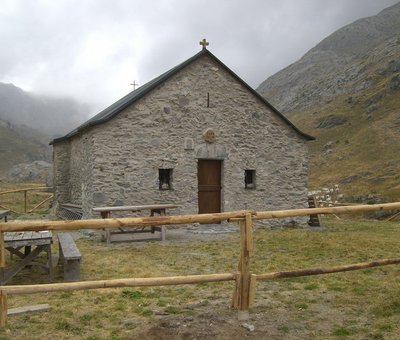
La Cappella-Rifugio di Sant'Erim - Archivio EAM  Architecture
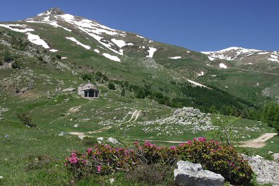
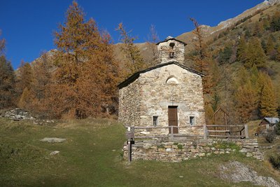
The Chapel of Sant'Erim and the Selle Refuge in Carnino
The Chapel of Sant'Erim (Chapel of Sant'Elmo) was built following the saint's apparitions here to groups of shepherds. Tradition has it that a mass was celebrated here every year on the day the cattle went up to the mountain pastures.
The Rifugio Selle di Carnino was built from a shepherds hut by the Ligurian Section of the CAI . It was used until the Second World War when it was seriously
damaged and definitively abandoned.
[A. Parodi, R. Pockaj, A. Costa - Nel cuore delle Alpi Liguri, collana Sentieri e Rifugi, Andrea Parodi Editore, 2012, p.42]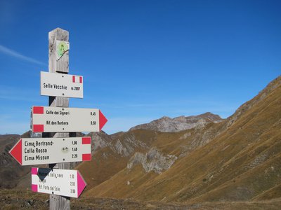
Palina segnaletica al Colle delle Selle Vecchie - Archivio EAM  Cross-border
The Colle delle Selle Vecchie
This was an important pass in past ages, probably on one of the salt routes, it was widely used by the shepherds from Briga in their transhumance towards the pastures at the foot of the Marguareis Massif.
The place name refers to the "selle", or "cellars" for the preservation of cheeses, once evidently present in the surrounding area. The cellars are generally stone buildings, with a barrel vault, covered and insulated with grass clods to ensure constant temperature and humidity inside.
[A. Parodi, R. Pockaj, A. Costa - Nel cuore delle Alpi Liguri, collana Sentieri e Rifugi, Andrea Parodi Editore, 2012, p.34]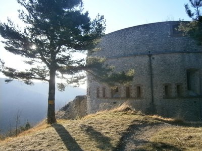
Forte Pozzanghi - Archivio EAM  History and historical trail
The Colle di Nava blockade
The Colle di Nava blockade was built between 1880 and 1888, to prevent transit on the easy pass that connects the Valle Tanaro with the Valle Arroscia. The square had five forts: the Central Fort and the Bellarasco Fort near the pass, the Richermo Fort on the left, the Pozzanghi Fort and the Montescio Fort on the right (at a considerable distance from the other works), as well as a series of semi-permanent field batteries. The armament was small and medium calibre in all the forts.
[Le Fortificazioni delle Alpi del Mare, pp.49-50]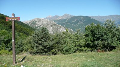
Bocchino di Semola - Archivio EAM  Mountain pass
Migration over the Bocchino di Semola
Migratory birds make long journeys between nesting sites and wintering sites. Many migratories reach Europe from Africa in March, some using the position of the sun and the mountain ranges as a reference (diurnal migration), and some the moon and stars (nocturnal migration). The return journey takes place in the months of September and October. The Bocchino di Semola is an important passage in the migratory routes that cross the border between Liguria and Piedmont.
[On-site information panel, text by Fabiano Sartirana]
Description
Precisely because of the variation in height it is difficult to indicate an ideal season, probably between September and October after checking that the stopover accommodation is open. If hot weather doesn't bother you, apart from years with a lot of snow you can do the route from late spring onwards, when Rifugio Don Barbera opens, and even earlier for the lower stages. The stopovers are often in managed refuges and at times in hotel accommodation in the villages in the valley.
- Departure : Garessio, Fraz. Barchi, Case Breo (670 m)
- Arrival : Garessio, Fraz. Barchi, Case Breo (670 m)
- Towns crossed : Ormea, Briga Alta, La Brigue, Tende, Cosio di Arroscia, and Garessio
Altimetric profile
Recommandations
Transport
Riviera Trasporti Piemonte S.r.l.
Viale Piaggio 38 - 12078 Ormea (Cn)
Telephone Switchboard: 0183.7001
Email contacts http://www.rtpiemonte.it/index.php/contatti-azienda
Timetables http://www.rtpiemonte.it/Upload/Orari/202.pdf
To reach Barchi you need to book a taxi:
https://www.virgilio.it/italia/ormea/cat/TAXI.html
Access and parking
Parking :
Report a problem or an error
If you have found an error on this page or if you have noticed any problems during your hike, please report them to us here:
Close by6
- Mountain Hut
Mountain Hut
Rifugio Chionea
The refuge is located in the village of Chionea, the largest in the municipality of Ormea, in Alta Val Tanaro.
The landscape is dominated by Pizzo d'Ormea (2476 m), one of the first peaks of the Ligurian Alps, which offers many opportunities to appreciate the unspoiled nature that surrounds us, both in winter and in summer.
From the top, on clear days, the view reaches the sea. - Mountain Hut
Mountain Hut
Rifugio Don Barbera
The current structure, in stone and wood, is the result of a complete renovation recently carried out. It is a comfortable refuge, suitable for hikers as well as for groups and schools.
The refuge is located a few meters from the Colle dei Signori, immersed in the austere and uncontaminated nature of the upper Pesio and Tanaro valley natural park. - Mountain Hut
Mountain Hut
Rifugio La porta del Sole
The building has been completely renovated maintaining the original architectural features. Note the completely slate roof, the stone exterior and the wooden interior. A few meters from the refuge is the Saradin campsite, jointly managed with the refuge.
The refuge is located in the characteristic village of Upega, immersed in the uncontaminated environment of the upper Tanaro valley, at the foot of the Marguareis massif. - Mountain Hut
Mountain Hut
Rifugio Mongioie
Located on the large plateau (Pian Rosso) above the town of Viozene, the Mongioie refuge is the ideal starting point for excursions at high altitude.
The Mongioie massif (2630m) slopes down towards the refuge with spectacular limestone formations up to 350m high where you can climb beautiful rock.
In addition, there are many activities related to the mountain accompanied by typical and seasonal cuisine. - Mountain Hut
Mountain Hut
Rifugio Pian dell’Arma
From its 1350 m above sea level, the Refuge offers a breathtaking view of the Ligurian Sea and the cliffs of Rocca dell'Arma. From here, with short walks, the Monte is added
Armetta and the Madonna della Guardia, from which the view embraces the Marguareis Natural Park, the splendid beginning of the western Alpine arc. - Mountain Hut
Mountain Hut
Rifugio Quarzina
The Quarzina refuge is located in the heart of the Ligurian Alps, at the foot of Pizzo di Ormea.
Located in the village of the same name that can be reached by car all year round, it enjoys a breathtaking view of the Val Tanaro, Colle di Nava, as far as the Ligurian Sea and sometimes Corsica

