5. Alta Via dei Re, stage 5: from Refuge Genova Figari to Refuge Soria-Ellena
5 points of interest
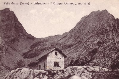
Il vecchio Rifugio Genova - Archivio EAM  Architecture
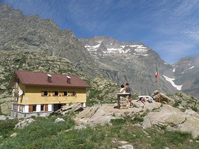
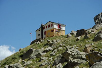
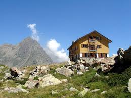
The Genova Figari Refuge
To valorize the hiking trails along the Argentera Massif, in the last years of the nineteenth century the Liguria chapter of CAI decided to build a refuge near the upper Gias del Monighet, in the Vallone della Rovina. The Genova Refuge, as it was named, was inaugurated on 15 August 1898.
But the fate of the first refuge in the Maritime Alps was definitively sealed in 1968: the reservoir of the new Chiotas dam would submerge it permanently. ENEL assumed the task of building another refuge, which was inaugurated in 1981.
The refuge is named for Bartolomeo Figari, who as Secretary General of CAI saw both the successful conquest of K2 and the birth of the National Alpine Rescue Corps, to which he bequeathed all his worldly goods.
Praterie di alta quota - Cati Caballo  Flora
FloraThe cleared meadows
At the highest altitudes there are cleared meadows, the typical alpine pastures; they are composed of herbaceous species capable of covering soils normally closed to woody species, which, due to the very short vegetative period, cannot find suitable conditions for their development. Grazing by wild ungulates and, sometimes, by domestic sheep affects their composition, even if the most severe factor for species selection is represented by the climate.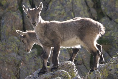
Giovani stambecchi al Colle di Fenestrelle - Roberto Pockaj  FaunaColle di Fenestrelle, as well as the surrounding area, is very popular with the ibex.
The Alpine ibex (Capra ibex), frequents alpine meadows and rock faces even above 3000 m, reaching the valley floor (provided it is not wooded) only in early spring, to be able to refresh itself after the long winter. Both sexes have annual growth horns, but much larger in males. The coat, light beige in summer, darkens to dark brown in winter.
Sedentary, grazing, it essentially feeds on grass, integrated with mosses, lichens and leaves of mountain shrubs, especially in winter.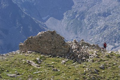
Il Ricovero Fenestrelle - Roberto Pockaj  History and historical trail
The Fenestrelle shelter
The ruins near the pass mark the site of the Fenestrelle shelter, named for Lieutenant Angelo Bertolotti. Built in 1888 and in use until the Second World War, it could house a garrison of 10 on straw pallets. In their guidebook, entitled "La Valle Gesso", the Boggias indicate the shelter as being instead dedicated "to the memory of Angelo Bortolo, of the 1∞ Reg. of the Alpine Corps, who was killed on the Ortigara during the First World War".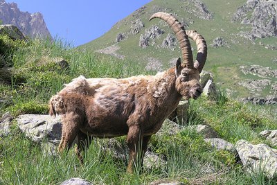
Stambecco maschio adulto, durante la muta primaverile del mantello - Roberto Pockaj  Fauna
FaunaThe Ibex of the Alps
Colle di Fenestrelle, as well as the surrounding area, is very popular with the ibex.
The Alpine ibex (Capra ibex), frequents alpine meadows and rock faces even above 3000 m, reaching the valley floor (provided it is not wooded) only in early spring, to be able to refresh itself after the long winter. Both sexes have annual growth horns, but much larger in males. The coat, light beige in summer, darkens to dark brown in winter.
Sedentary, grazing, it essentially feeds on grass, integrated with mosses, lichens and leaves of mountain shrubs, especially in winter.
Description
Continuing with other hairpin bends, the mule track rises on small grassy plots and stony ground, then turns right again, halfway down the slope, on the steep slopes of Rocce di Laura.
After crossing the many valleys that cut the slopes of Ciamberline and Fenestrelle points, the mule track curves south across the centre of the valley; then, with a final series of hairpin bends, it climbs up to the scree that leads to Colle Fenestrelle (2463 m - 1h30 from the refuge).
There is a fantastic view to the southeast over the Gelàs and to the northwest over the Argentera.
The route descends towards the Gesso della Barra valley, brushing the modest but very suggestive Fenestrelle lake (at the end of the normally dry season). With a beautiful route, the path runs along the slope that ends at Punta delle Lobbie and leaves it at about 2300 meters. After having abandoned the path that leads to the Gias Confurri or Confucci (2281 m), the path ends with numerous turns to the Gias Balmetta (2156 m) in the center of the valley of Fenestrelle.
The mule track regularly loses altitude and passes near the Gias Alvé (1840 m) from where one reaches the track which, from San Giacomo di Entracque, climbs the Gesso della Barra valley to the refuge. From Gias del Praiet it is possible to shorten the long loop that the track makes by following straight on the path that climbs the escarpment at the foot of the refuge.
- Departure : Refuge Genova Figari (2009 m)
- Arrival : Refuge Soria-Ellena (1840 m)
- Towns crossed : Entracque
Altimetric profile
Recommandations
Report a problem or an error
If you have found an error on this page or if you have noticed any problems during your hike, please report them to us here:
Close by2
- Mountain Hut
Mountain Hut
Rifugio Genova - Figari
The Genova-Figari refuge stands between two lakes: the Brocan, a natural alpine lake, and the artificial reservoir of Chiotàs, one of the largest in Europe. Easy to access, surrounded by meadows and the two lakes, it overlooks the walls of the peaks dell'Argentera, which with its 3300 m. it is the highest peak of the massif, and offers the opportunity to admire the numerous species of animals: ibexes, chamois, marmots, stoats, eagles, together with rare botanical species such as saxifrage florulenta, etc.

