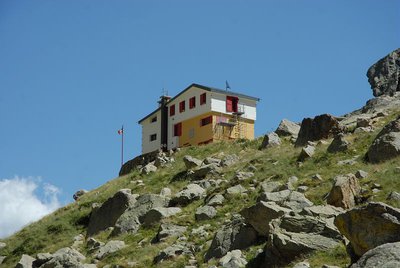
The Soria Ellena Refuge
The Vallone della Barra, up which the trail climbs after a cool initial tract through beech woods, opens onto broad, sunny pastures. This valley was chosen by Park management as the site for releases of bearded vultures in the international reintroduction program.
2 points of interest
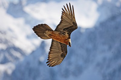
Un gipeto in volo - Michelangelo Giordano  Fauna
FaunaThe bearded vulture
The bearded vulture (Gypaetus barbatus), also known as the lamb vulture, has a wingspan that can reach 285cm and can weigh more than 6 kilos. An accomplished glider, it can exploit even the mildest ascending thermals. It is a carrion eater, feeding exclusively on carcasses of dead animals, ungulates for the most part, both wild and domestic. It consumes bones, cartilage and ligaments, and is known to drop bones from great heights in order to break them into manageable pieces. Monogamous and long-lived, the bearded vulture nests on rocky cliff faces at altitudes beween 1,000 and 3,000 meters.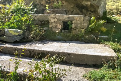
I resti di una cucina da campo nei pressi del Piazzale dei Cannoni - Roberto Pockaj  History and historical trail
The Piazzale dei Cannoni
The name Piazzale dei Cannoni, or better still, Piana dei Cannoni, is due to the presence there of the 181st Artillery Battery, armed with 210/8 mortars, during the Second World War. The mortar emplacements are just south of the dirt road, along the slope, but they are not easy to spot. On the opposite side of the valley, across the torrent, there are the remains of probable logistical outposts and even an open-air kitchen.
Description
After San Giacomo di Entracque (1226 m), shortly beyond the park hiking refuge, the road becomes unpaved and, with a few switchbacks, rises up into the Vallone della Barra.
The beech woods rapidly thin out and give way to lush meadows interspersed by occasional patches of brush. The trail continues to climb at a mild gradient, near the valley floor; passing to the right of the Gias Isterpis, recently restructured, the trail continues on a long traverse until it reaches Piazzale dei Cannoni, where it passes by a mule track on the left leading to the Gias della Siula.
The road climbs with two switchbacks (shortcut possible here), then proceeds, alternating traverses and occasional switchbacks: at about 1650 m, next to a switchback heading right and at the foot of a rocky outcropping, there is another small path leading off to the left, easy to see but a bit difficult, that shortens the route.
After passing the narrow bottleneck known as the Passaggio di Peirastretta, the steepest part of the trail is finished: passing by the trail for Colle di Fenestrelle on the right, the dirt road fords the Gesso della Barra torrent at the mouth of the Piano del Praiet plateau.
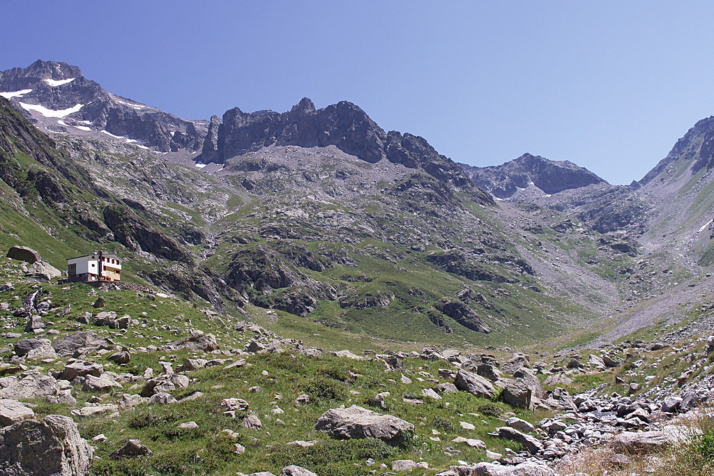
Hikers should cross the torrent on the wooden footbridge, a few meters to the left of the ford. Just over the footbridge, there is a fork: the route continues on the left fork and, on a trail half-hidden by weeds, leads to the Praiet shelter. Here the trail turns right and climbs up a steep ramp over a rocky ridge, atop which stands the Soria Ellena Refuge (1840 m, 2 hours and 10 minutes - 2 hours and 20 minutes from San Giacomo di Entracque).
If you prefer to avoid this tract of trail as well, after crossing the footbridge, follow the dirt track leading southward into the broad pastures of the Piano del Praiet until it meets another branch of the torrent, just at the turnoff on the right for Colle di Finestra and the Pera de Fener.
The track fords this stream as well and, turning sharply northward, climbs up the hillside to the Soria Ellena Refuge.
- Departure : San Giacomo di Entracque (1226 m)
- Arrival : Soria Ellena Refuge (1840 m)
- Towns crossed : Entracque
Altimetric profile
Recommandations
Transport
SNCF line TER Provence Alpes-Côte d'Azur For travel in the PACA region and towards Cuneo www.ter-sncf.com/pac
Trenitalia for travel in the Piedmont region https://www.trenitalia.com/it.html
Access and parking
From Borgo San Dalmazzo go up the Valle Gesso. After Valdieri, turn left for Entracque. Before the village, turn right for San Giacomo and then right again for San Giacomo. Always follow the signs for San Giacomo. Paid parking in the summer season.
Parking :
Report a problem or an error
If you have found an error on this page or if you have noticed any problems during your hike, please report them to us here:
Close by3
- Mountain Hut
Mountain Hut
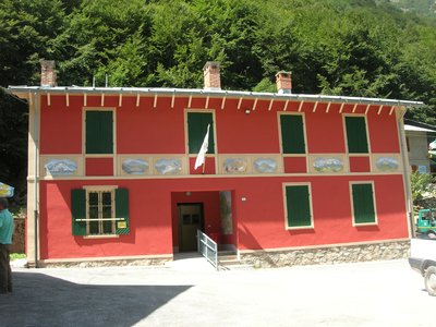
Rifugio escursionistico S. Giacomo e Baita Monte Gelas 1226 m
The Monte Gelas Mountain Hut was founded in 1953 by Giovanni Gerbino and Caterina Mellano. Since then, the Gerbino family has been offering hospitality and refreshments to visitors to the upper Gesso Valley, while also managing the adjacent San Giacomo Hiking Hut.