La Fracha
4 points of interest
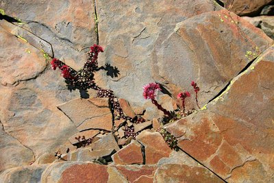
Grès du Lauzanier en gros plan - GOURON Claude  Geology
Sandstone
Made up of grains of sand held together by silica, which is very slightly soluble in water, sandstone is a sedimentary rock. It is formed at the bottom of the oceans with the accumulation of sand coming from the erosion of old mountain ranges. It can now be found at altitude, since the Alps rose up.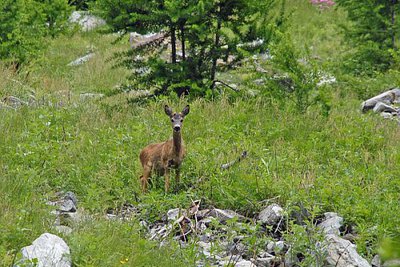
Chevreuil, (Capreolus capreolus), au début de l'été. - GUIGO Franck  Fauna
FaunaDeer
In the undergrowth, there are plenty of clues as to the presence of deer, (hoofmarks, signs that they have rubbed against trees, droppings), rubbing their antlers to mark their territory or to remove the velvet from new antler growth. Their diet mainly consists of tree shoots and brambles, but also herbaceous plants and acorns.
These animals live in family groups (mother and offspring) for much of the year and they join together in herds of ten to fifteen individuals in the winter.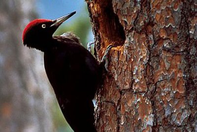
Pic noir accroché à un tronc d emélèze, (Dryocopus martius), famille des Picidés, ordre des piciformes. - DELUERMOZ Gilles  Fauna
FaunaBlack woodpecker
This is the biggest woodpecker in Europe. Almost entirely black with a red cap, it eats ants and other insects and larvae which it finds under the bark of trees. The black woodpecker marks its territory with the characteristic noise produced as it drills into dry tree trunks. To rise its chicks, it digs a cavity into a tree. Drilling these “lodgings” requires both the male and the female to work for two or three weeks.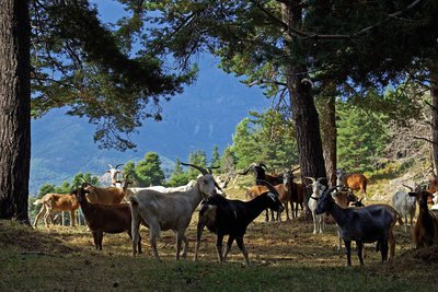
Elevage caprin à Peira-Cava à la fin de l'été. En bordure de pinède. - CEVASCO Jean-Marie  Flora
FloraFir and beech forests
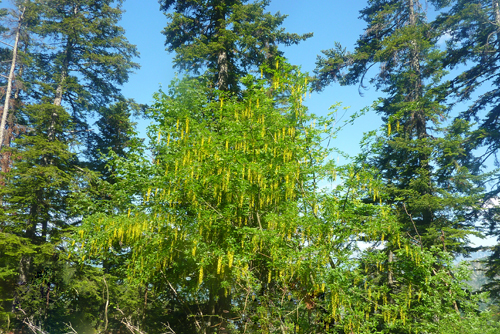
The forest you walk through on this hike mainly consists of fir trees, although there are a few smaller deciduous trees, such as rowans, willows, elders and boxwood. The tracks through the mountains are directly linked to the wood industry.
Beech trees, which can reach up to 30 to 40 metres in height, is almost entirely absent from Vésubie. There is nevertheless a beautiful such forest at Peïra-Cava. The two trees which can be seen on the ridge towards Col de Turini are perhaps a sign that this wood is expanding its territory.
Beech nuts are edible and can also be turned into oil. Note the smooth bark that beech trees have, even very old ones.
Description
Head off from Col de Turini, from markers 184 then 195, on GR52a, with red and white markers. Follow the forest track down its gentle slope (approximately one hour). At the first crossroads, turn right. At the following intersection, go straight on.
At marker 196, continue straight on until you reach marker 191. Here you should leave the track and the GR, turning left onto a path which climbs up over the bank towards Cime de Suorcas (yellow markers).
After climbing for a few minutes, the path heads downwards for a short while and then climbs gently until you reach La baisse de Suorcas (balise 192).
You will come out on the southern slopes, where you can admire the view over Peïra-Cava and Rocassiera.
Continue via the ridge towards La Croisette. At La Tête de Fracha, the path widens. Carry on until you reach the forest house of La Croisette, and then until the tarmacked road, which you will cross at marker 193 towards Col de Turini (“climb over” the supporting wall, marker 194).
Continue along the ridge. On the path, turn right. Continue for 100 metres until marker 182, then get back onto GR52a. At marker 183: a delightful view over the Bévéra valley to the southeast. Go under the ski lift and head down towards the ski slope. Before Col de Turini, you can make a stop at the little pond to look at the tadpoles.
- Departure : Col de Turini
- Arrival : Col de Turini
- Towns crossed : Moulinet, La Bollène-Vésubie, and Lantosque
Altimetric profile
Recommandations
Information desks
Office de Tourisme Menton, Riviera & Merveilles - Bureau de Sospel
1 place St Pierre, 06380 Sospel
Horaires
Toute l'année. Tous les jours
Ouverture le lundi de 9h à 12h30 et de 13h30 à 17h. Le mardi, mercredi, jeudi, vendredi et samedi de 9h30 à 12h30 et de 13h à 17h.
Fermé le dimanche.
Fermetures exceptionnelles les 1er janvier, Lundi de Pâques, Jeudi de l'Ascension, 1er mai, 8 mai, 1er novembre, 11 novembre et 25 décembre.
Report a problem or an error
If you have found an error on this page or if you have noticed any problems during your hike, please report them to us here:
