The Colle di Finestra
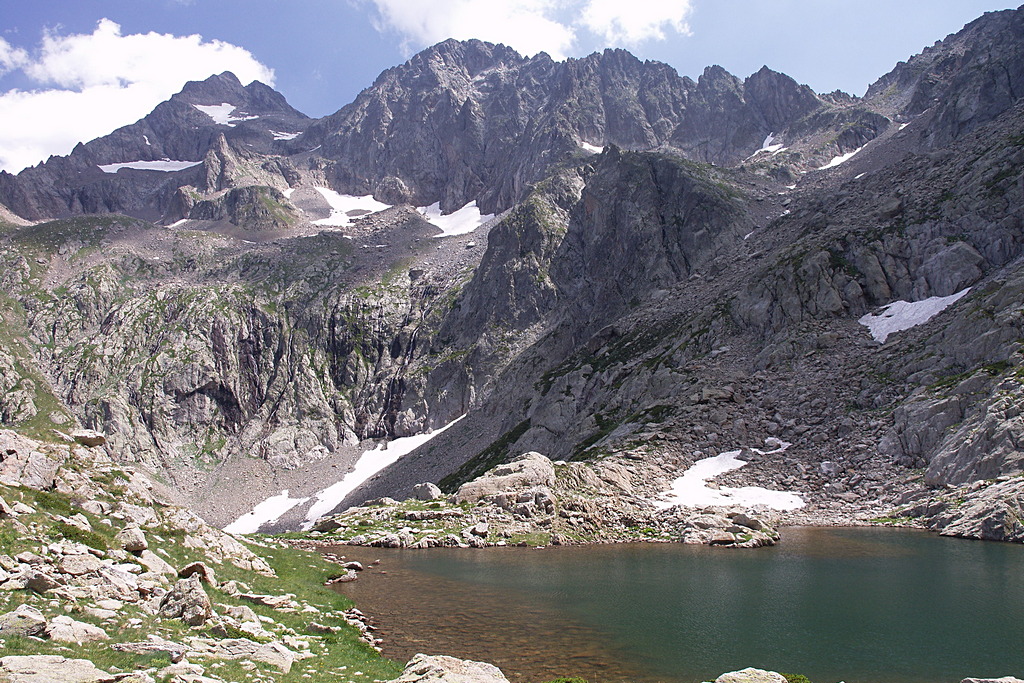
Beyod the pastures of Piano del Praiet, the habitat becomes markedly detritic, with a little gem: the often overlooked but very charming Lake Praiet, just a few minutes off the main trail. The route passes by the ruins of numerous military structures of various ages.
6 points of interest
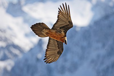
Un gipeto in volo - Michelangelo Giordano  Fauna
FaunaThe bearded vulture
The bearded vulture (Gypaetus barbatus), also known as the lamb vulture, has a wingspan that can reach 285cm and can weigh more than 6 kilos. An accomplished glider, it can exploit even the mildest ascending thermals. It is a carrion eater, feeding exclusively on carcasses of dead animals, ungulates for the most part, both wild and domestic. It consumes bones, cartilage and ligaments, and is known to drop bones from great heights in order to break them into manageable pieces. Monogamous and long-lived, the bearded vulture nests on rocky cliff faces at altitudes beween 1,000 and 3,000 meters.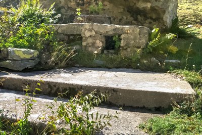
I resti di una cucina da campo nei pressi del Piazzale dei Cannoni - Roberto Pockaj  History and historical trail
The Piazzale dei Cannoni
The name Piazzale dei Cannoni, or better still, Piana dei Cannoni, is due to the presence there of the 181st Artillery Battery, armed with 210/8 mortars, during the Second World War. The mortar emplacements are just south of the dirt road, along the slope, but they are not easy to spot. On the opposite side of the valley, across the torrent, there are the remains of probable logistical outposts and even an open-air kitchen. History and historical trail
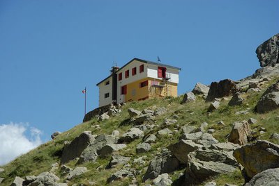
The Military Barracks at Colle delle Finestre and the other works of the Vallo Alpino
The barracks is a large building in stone and cement, still in decent condition, which was built to garrison the contingent tasked with defending the pass; its 16 rooms could house 50 men.
In addition to the barracks, other fortifications also defended the pass during the Second World War. On what is now the French side the remains of a nineteenth century shelter named for Lieutenant Mario Amedo are clearly visible, as are two bunkers of the Vallo Alpino defensive fortifications; 126 to the left of the pass and 127 to the right.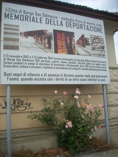
Pannello al memoriale della deportazione di Borgo S.D. - Archivio EAM History and historical trailTrails of Freedom
Between the 8th and 13th of September, 1943, just days after Italy's surrender, about twelve hundred Jewish civilians of all ages and walks of life, originating from Saint-Martin VÈsubie, crossed the Alps together with the Italian troops of the IV Army Corps. On foot, following two different routes, over the Colle di Finestra and the Colle di Ciriegia, the refugees arrived, respectively, in Entracque and Valdieri, where they were housed in the barracks and wherever else possible. A plaque affixed to the wall of the barracks at Colle di Ciriegia commemorates these events.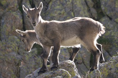
Giovani stambecchi al Colle di Finestra - Roberto Pockaj FaunaThe Alpine Ibex
Alpine ibex are a common sight at Colle di Fenestrelle and in the surrounding area. The Alpine ibex Capra ibex), a mountain goat, lives in Alpine meadows and rocky terrain, even over 3,000 meters, descending to the valley floors (if they are not wooded) only in the early spring, when the long winter's hardships make the new sprouts irresistible. Both sexes have horns that grow each year, but the males' horns are decidedly bigger. Their coats, a light beige in the summer, turn dark brown in the winter months.
A permanent resident, this grazing mountain goat subsists mostly on grass, in addition to some mosses, lichens and leaves of mountain shrubs, especially during the winter.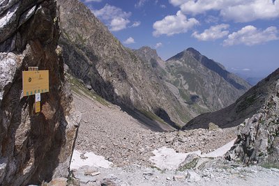
Colle di Finestra, panorama sul versante italiano - Roberto Pockaj  Cross-border
Il Colle di Finestra
The pass is a direct link between Valle Gesso and Vésubie, and has been crossed since time immemorial - and immortalized in legend and historical annals - by saints, emperors and invading armies. Before the Savoys gained direct access to the sea, the Colle di Finestra pass was also an important supply route for the salt trade.
Its name, which first appears in the written records in 1041, has remained unchanged up to the present day: Colle di Finestra or, as written on the military maps of the early 1900s, Colle delle Finestre. The first version is the right one, though, because it refers to a single natural window (Finestra) that splits the northwest crest of the Cayre de la Madone.
Description
From San Giacomo di Entracque (1226 m), just beyond the Park's trekking refuge, the road become unpaved and, with some switchbacks, climbs up the Vallone della Barra. The beech woods thin out rapidly and lush pastures interspersed with a few bushes dominate the landscape. The route continues at a moderate incline, near the valley floor; after passing by the Gias Isterpis, recently restructured, it proceeds on a long traverse until it reaches the Piazzale dei Cannoni, where it passes by a mule track on the left leading to the Gias della Siula.
The road climbs with two switchbacks (shortcut possible here), then proceeds, alternating traverses and occasional switchbacks: at about 1650 m, next to a switchback heading right and at the foot of a rocky outcropping, there is another small path leading off to the left, easy to see but a bit challenging, that shortens the route.
After passing the narrow bottleneck known as the Passaggio di Peirastretta, the steepest part of the trail is finished: passing by the trail for Colle di Fenestrelle on the right, the dirt road fords the Gesso della Barra torrent at the mouth of the Piano del Praiet plateau.
Hikers should cross the torrent on the wooden footbridge, a few meters to the left of the ford. Just over the footbridge, there is a fork: the route continues on the right, returning to the dirt track that heads southward through the broad pasture of Piano del Praiet (1812 m, 2 hours and 10 minutes - 2 hours and 20 minutes from San Giacomo).
When the dirt road leading up to the Soria Ellena Refuge comes to another branch of the torrent, the trail turns off to the left, on the old mule track (washed away by the floodwaters of the torrent in some tracts) up to the Colle di Finestra.
The mule track crosses the plain and climbs up the orographic right slope of the valley in broad, easy switchbacks, passing by the fork for Pera de Fener and Lake Maura on the left at the very start of the uphill tract.
When the valley narrows, the route proceeds past the trail on the left (unmarked) leading to the ruins of the former barracks known as the Testata Gesso della Barra shelter (which appears in many maps and guidebooks by other names), and crosses over to the orographic left, where it continues to climb in a series of switchbacks and mid-slope traverses, ignoring another turnoff to the left on the mule track to the Testata Gesso della Barra shelter. The trail proceeds, alternating switchbacks and traverses, past a rocky bastion on the right before meeting up, at about 2260 meters, with the turnoff on the left for little Lake Praiet.
We strongly recommend the detour to Lake Praiet (2285 m, 10 minutes). The trail begins near an enormous flat boulder, and is signaled by little stone markers. There is a short uphill climb through grass and rocky ground to the shores of the lake.
At an altitude of about 2310 m, the route passes a turnoff on the left that leads to a disused hunting blind, and after going past a very short stretch that has been obstructed by a rockslide, the deep, narrow cut known as the Colle di Finestra comes into view.
After a last long traverse, now over detrictic rubble, the mule track reaches the ruins of the large military barracks of Colle delle Finestre. From the barracks, a few switchbacks lead up to the pass of Colle di Finestra (2474 m, 2 hours and 5 minutes from Piano del Praiet).
- Departure : San Giacomo di Entracque (1226 m)
- Arrival : Col de Fenestre (2474 m)
- Towns crossed : Entracque and Saint-Martin-Vésubie
Altimetric profile
Recommandations
Transport
SNCF TER Provence Alpes-Côte d'Azur line - For traveling in the PACA region and towards Cuneo - www.ter-sncf.com/pac
Trenitalia for travel in the Piedmont region https://www.trenitalia.com/it.html
Access and parking
From Borgo San Dalmazzo drive up the Valle Gesso. After passing Valdieri, turn left for Entracque. Before entering the town, turn right for San Giacomo and then right again for San Giacomo. There is a parking fee in the summer season.
Parking :
Report a problem or an error
If you have found an error on this page or if you have noticed any problems during your hike, please report them to us here:
Close by3
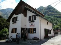
- Mountain Hut
Mountain Hut
Rifugio escursionistico S. Giacomo e Baita Monte Gelas
Structure open only in the summer season.
The Baita Monte Gelas was born in 1953 thanks to Giovanni Gerbino and Caterina Mellano. Since then our family has been offering hospitality and refreshments to visitors to the upper Gesso Valley.