The Colle dell'Arpione
From the ancient terraced fields, now partly reclaimed by the woods, the route continues through broad meadows on calcareous ground, in which numerous sinkholes have appeared. The return leg passes through a lovely tract of beech forest.
3 points of interest

Frassineto d'invasione - Cati Caballo  Flora
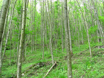
FloraThe invasive ash woods
Invasive ash woods are woods composed mostly of common ash and mountain maple, which in recent times have settled on plots that were once cultivated and then abandoned and for this reason they are called newly formed woods. These are generally luxuriant populations because they have established themselves on fresh and deep soils; they are also unstable because they are destined to give way to oak, beech or fir woods.
Foto d'archivio alla cava di marmo di Desertetto - Archivio EAM  Geology
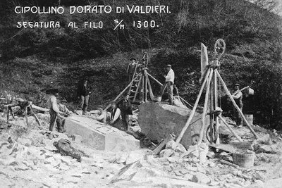
The marble quarry
On the orographic left of the valley, the scrap and detritus dumped from the quarry can still be seen. Walking along the trail, if one observes carefully, there are blocks of marble that have fallen from the quarry above, although time and the elements have combined to coat them with a grayish film that conceals their bright white interior.

Doline lungo il sentiero per il Colle dell'Arpione - Enzo Piacenza  Geology
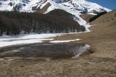
The sinkholes
The basin, located on calcareous ground, due to erosive phenomena of the water, has some characteristic sinkholes in the ground, some quite large. These typical karst emergencies, originating by dissolution or collapse, convey water underground and are called sinkholes or sinkholes.
Description
From the hamlet of San Bernardo di Desertetto (1085 m) follow the paved road that crosses the town and turns into a dirt road. You ignore various side branches until, in the locality of Borghignon, the road forks: on the right the cart track (closed by a bar) leads to the old marble quarry, while on the left you head towards Colle dell'Arpione.
The dirt road rears up sharply and ends and after a stony stretch it meets a newly built track on the left, which you ignore, continuing straight on, in the shade of the trees, up to the edge of the beech forest, near a small grassy clearing. Here you ignore the dirt track to Gias del Colle dell'Arpione across the meadow and take the path to Colle dell'Arpione on the right (signs).
Heading north, with a steep traverse at times in the woods, the path reaches a large pasture valley in which there are some evident sinkholes.
Turning left, a well-trodden track among the meadows follows the bottom of the valley up to the base of the steep slope that leads to the hill. Go up the slope up to a crossroads: head right then, having reached the ridge, ignore the new track on the left for Gias del Colle dell'Arpione and, beyond a small fir grove, you come out on Colle dell' Arpione (2:10 hours from Desertetto).
To return, from the pass you return to the penultimate crossroads encountered, then take the track which, among the rhododendrons, points towards the nearby beech forest.
As soon as you enter the wood, an excellent path appears, which further on becomes an easy mule track and then a sheep track, then meets the forest track which, descending at first with moderate slopes, then more accentuated, returns to the dirt road traveled on the outward journey right at the point where it ends, and from here to Desertetto (1:30 hours from Colle dell'Arpione).
- Departure : Desertetto (1085 m)
- Arrival : Colle dell'Arpione (1721 m)
- Towns crossed : Valdieri and Demonte
Altimetric profile
Recommandations
Transport
up to Desertetto, it is necessary to continue on foot
SNCF TER Provence Alpes-Côte d'Azur line - For traveling in the PACA region and towards Cuneo - www.ter-sncf.com/pac
Trenitalia for weddings in the Piedmont region- https://www.trenitalia.com/it.html
Access and parking
From Borgo San Dalmazzo, drive up the Valle Gesso. After passing through Valdieri, continue on towards Terme, turning right for Desertetto. Continue on to the hamlet of San Bernardo.
Parking :
Report a problem or an error
If you have found an error on this page or if you have noticed any problems during your hike, please report them to us here:
