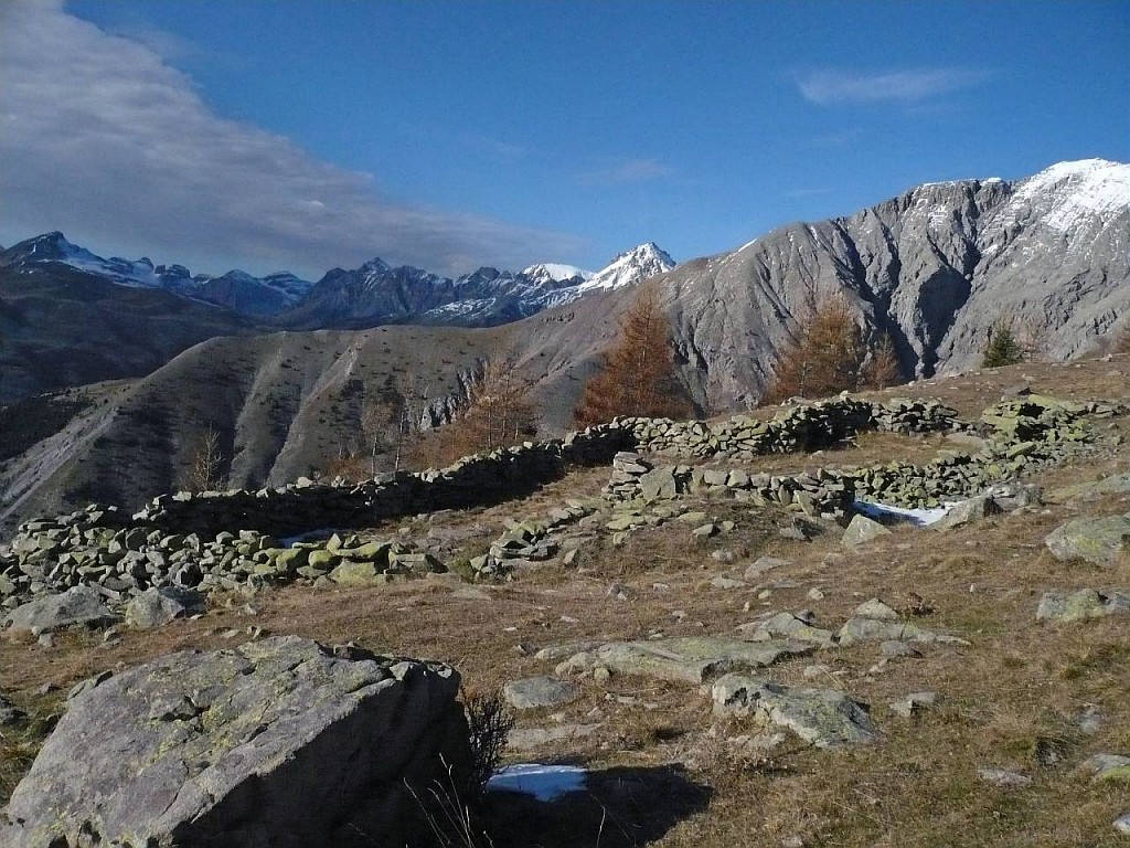
Le Bois de Rougnous
1 point of interest
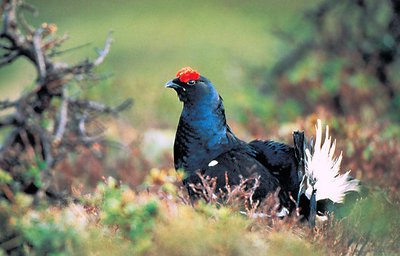
Tétras-lyre mâle en gros plan, (Tetrao tetrix ou lyrurus tetrix) - VINAJ Jean-Charles  Fauna
FaunaBlack grouse (Tetrao tetrix)
Also known as the blackcock, this sedentary galliforme is the symbol of the European Alps and can often be found on the edge of forests and in light woods. It is closely linked to the larch forest in the Mercantour.
The male’s plumage is of a bluish-black colour with white bar on its wing and under its tail which is the shape of a lyre. This is very different to the female’s plumage. She is light brown with dark brown stripes and she is also much smaller. Above the male’s eye is a red caruncle which can be of varying size – in the spring it is very prominent – and the male also has a short beak.
Its courting rituals are legendary. The males engage in a lek and confront each other in vocal contests.
Description
From marker 105, take the path with yellow markers which heads up to La Baisse de la Vallette (marker 107). Along the way, you will be able to explore the different types of forest which correspond to different levels of altitude: Scotch pines, larch on the peak and then Mountain pines.
At La Baisse de la Valette (marker 107), the view opens up, allowing you to admire the summits of the High Var Valley to the west and of the Massif du Mounier to the East.
Head back down into the Bois de Rougnous. When the woods thin out, marker 106 indicates the direction of Aliège on the left, and this is the way you should go. The walk continues to bypass the Réal valley, which you will now be able to look over: the hoodoos and the exposed ochre rocks show how much erosive activity there is here. Cross the valley via a path which is renewed every time the mountain stream bursts its banks.
Having crossed the valley, continue along a path to reach the hamlet of Aliège. You will then come across the road which will lead you back to the starting point in the matter of a few steps.- Departure : Aliège, hamlet of Péone (marker105)
- Arrival : Aliège, hamlet of Péone
- Towns crossed : Péone and Guillaumes
Altimetric profile
Recommandations
Information desks
Maison du Parc national du mercantour - La maison Valberganne
Rue Saint Jean, 06470 Valberg
La Maison du Parc du Mercantour propose de nombreuses activités de sensibilisation sur la nature et l'environnement pour les enfants, ainsi que des projections, jeux nature et vente de publications.
Horaires
Toute l'année de 9h à 18h.
Ouverture du 9h à 12h puis de 14h à 18h. Fermé le mercredi.
Access and parking
At Guillaumes, take the road which heads towards Péone (RD29). As you come into the village, turn left and then immediately right on the road to Le Chardonnier and Aliège.
Continue along this road (keep following these directions until you reach Aliège, marker 105).Accessibility
- Emergency number :
- 114
Report a problem or an error
If you have found an error on this page or if you have noticed any problems during your hike, please report them to us here: