Canal de l'Adroit
2 points of interest
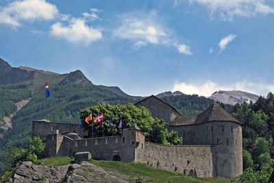
Le Fort de Savoie à Colmars-les-Alpes. - LE BOUTEILLER Eric  History and historical trail
Colmars
As a former border town between the Duchy of Savoie and the Kingdom of France, Colmars has a lively and often dramatic history.
A prosperous city until the 14th century, Colmars built its first ramparts under the menace of invasions from the north in 1391 and they were reinforced in 1527: the Place de Guerre then received the royal coat of arms from King Francis I of France. Sculpted onto the Porte de France, the salamander and fleur-de-lis were ransacked during the Revolution.
In the late 17th century, the Duchy of Savoie declared war. Colmars resisted and built the fortifications which bestowed the city with the elegant appearance it conserves to this day.
In 1923, the city and the forts, Fort de France and Fort de Savoie, were classified as historic monuments.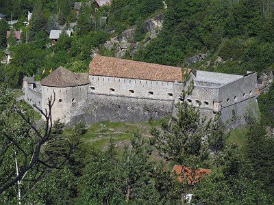
Le fort de Savoie à Colmars-les-Alpes - LEBOUTEILLER Eric History and historical trailFort de Savoie
At the end of the 17th century, Colmars built the set of fortifications which define its appearance today. In 1690, the War of the League of Augsbourg forced Louis XIV to reinforce all of the borders of his kingdom. From 1693 to 1695, the Calvaire fort to the south (now called Fort de France) and that of St-Martin to the north (Fort de Savoie) were thus built.
Fort de Savoie is better preserved than Fort de France with its 2.5m-thick walls, many rooms, sentry walk with a turret, a tower with 32 arrow slits and a water tank filled by a spring which never freezes...
Description
Having gone through the village and across the Verdon, the track climbs up a south-facing slope, allowing you to enjoy the view over the walled city and the valley. Cross the fields which were previously used for agricultural purposes and enter a forest consisting of Scotch pines which soon make way for larches.
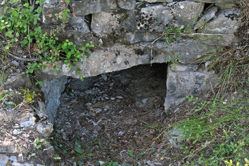
The itinerary then passes alongside the canal and crosses other abandoned fields which are marked with stone walls and hutches. They used to make up a very fertile stretch of land given over to dryland and irrigated land agriculture.
You will then continue through a variety of groves before reaching a forest of Austrian pines, which is the fruit of mountain terrain restoration work.
Make the return journey along the road.
- Departure : Colmars-les-alpes
- Arrival : Colmars-les-alpes
- Towns crossed : Colmars
Altimetric profile
Information desks
Verdon Tourisme - Bureau d'information touristique de Colmars-Les-Alpes
Ancienne auberge fleurie, 04370 Colmars les Alpes
Horaires
Du 02/01 au 31/12.
Fermetures exceptionnelles les 1er mai, 1er novembre, 11 novembre et 25 décembre.
En avril et octobre
Du lundi au samedi de 9h à 12h et de 14h à 18h
Jours fériés de 9h30 à 12h30
Fermé le dimanche
En mai, juin et septembre
Du lundi au samedi de 9h à 12h et de 14h à 18h
Dimanche de 9h30 à 12h30
Jours fériés de 9h30 à 12h30
En juillet et août
Tous les jours de 9h à 12h30 et de 14h à 18h30
De novembre à mars
Lundi, mercredi au samedi de 10h à 12h et de 14h à 17h
Fermé le mardi, dimanche (sauf vacances zone B) et les jours fériés.
Access and parking
From Nice
Take the Route des Alpes, the Route des Grandes Alpes and then the D908 towards Sainte Anne. It is also possible to take the legendary Route Napoléon.
More information
Report a problem or an error
If you have found an error on this page or if you have noticed any problems during your hike, please report them to us here: