The Wolf Trail - Argentera & Mercantour
6 steps

28 points of interest
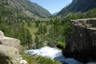
Prateria fiorita di fondovalle - Cati Caballo  Flora
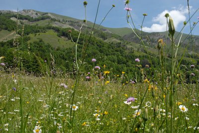
FloraThe grasslands of the valley floor
Despite what one might think, the grasslands that occupy the valley floor are not very stable environments. Their presence and appearance strictly depend on the intensity of the cultivation treatments carried out: grazing and mowing, irrigation and fertilization interventions clearly influence their floristic composition. Mowing in particular has the function of counteracting the return of the forest, which advances, slowly but inexorably, whenever human intervention is lacking.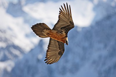
Un gipeto in volo - Michelangelo Giordano  Fauna
FaunaThe bearded vulture
The bearded vulture (Gypaetus barbatus), also known as the lamb vulture, has a wingspan that can reach 285cm and can weigh more than 6 kilos. An accomplished glider, it can exploit even the mildest ascending thermals. It is a carrion eater, feeding exclusively on carcasses of dead animals, ungulates for the most part, both wild and domestic. It consumes bones, cartilage and ligaments, and is known to drop bones from great heights in order to break them into manageable pieces. Monogamous and long-lived, the bearded vulture nests on rocky cliff faces at altitudes beween 1,000 and 3,000 meters.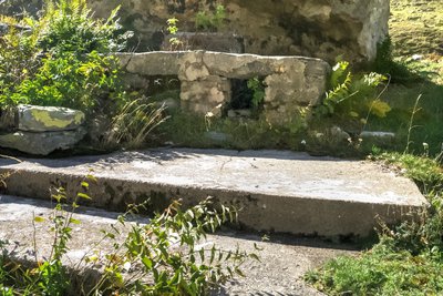
I resti di una cucina da campo nei pressi del Piazzale dei Cannoni - Roberto Pockaj  History and historical trail
The Piazzale dei Cannoni
The name Piazzale dei Cannoni, or better still, Piana dei Cannoni, is due to the presence there of the 181st Artillery Battery, armed with 210/8 mortars, during the Second World War. The mortar emplacements are just south of the dirt road, along the slope, but they are not easy to spot. On the opposite side of the valley, across the torrent, there are the remains of probable logistical outposts and even an open-air kitchen. History and historical trail
The Military Barracks at Colle delle Finestre and the other works of the Vallo Alpino
The barracks is a large building in stone and cement, still in decent condition, which was built to garrison the contingent tasked with defending the pass; its 16 rooms could house 50 men.
In addition to the barracks, other fortifications also defended the pass during the Second World War. On what is now the French side the remains of a nineteenth century shelter named for Lieutenant Mario Amedo are clearly visible, as are two bunkers of the Vallo Alpino defensive fortifications; 126 to the left of the pass and 127 to the right.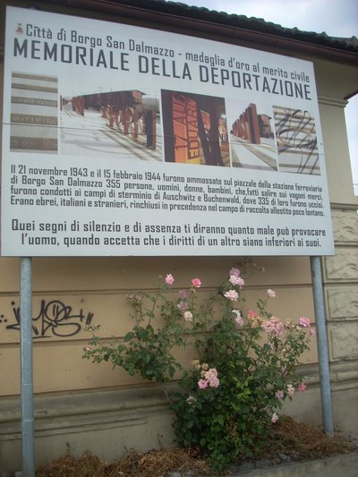
Pannello al memoriale della deportazione di Borgo S.D. - Archivio EAM History and historical trailTrails of Freedom
Between the 8th and 13th of September, 1943, just days after Italy's surrender, about twelve hundred Jewish civilians of all ages and walks of life, originating from Saint-Martin VÈsubie, crossed the Alps together with the Italian troops of the IV Army Corps. On foot, following two different routes, over the Colle di Finestra and the Colle di Ciriegia, the refugees arrived, respectively, in Entracque and Valdieri, where they were housed in the barracks and wherever else possible. A plaque affixed to the wall of the barracks at Colle di Ciriegia commemorates these events.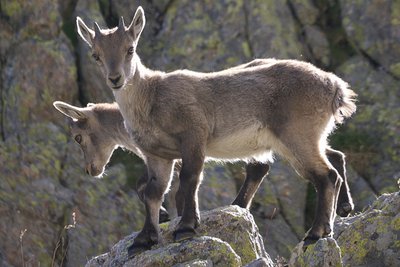
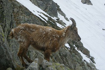
Giovani stambecchi al Colle di Finestra - Roberto Pockaj FaunaThe Alpine Ibex
Alpine ibex are a common sight at Colle di Fenestrelle and in the surrounding area. The Alpine ibex Capra ibex), a mountain goat, lives in Alpine meadows and rocky terrain, even over 3,000 meters, descending to the valley floors (if they are not wooded) only in the early spring, when the long winter's hardships make the new sprouts irresistible. Both sexes have horns that grow each year, but the males' horns are decidedly bigger. Their coats, a light beige in the summer, turn dark brown in the winter months.
A permanent resident, this grazing mountain goat subsists mostly on grass, in addition to some mosses, lichens and leaves of mountain shrubs, especially during the winter.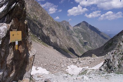
Colle di Finestra, panorama sul versante italiano - Roberto Pockaj  Cross-border
Il Colle di Finestra
The pass is a direct link between Valle Gesso and Vésubie, and has been crossed since time immemorial - and immortalized in legend and historical annals - by saints, emperors and invading armies. Before the Savoys gained direct access to the sea, the Colle di Finestra pass was also an important supply route for the salt trade.
Its name, which first appears in the written records in 1041, has remained unchanged up to the present day: Colle di Finestra or, as written on the military maps of the early 1900s, Colle delle Finestre. The first version is the right one, though, because it refers to a single natural window (Finestra) that splits the northwest crest of the Cayre de la Madone.
Lac, col et cîme ouest de Fenestre en automne, éclairage automnal. - Guigo Franck  Peak
PeakCol de Fenestre
A communication route within the House of Savoy, the col became part of Italian territory in 1860 and a border col in 1947, the date at which the border was moved to the watershed. When the weather is clear, the view extends beyond the plain of Pô to 200km to the north: Cervin (4478m) and Mont Rose (4634m) are visible in these conditions.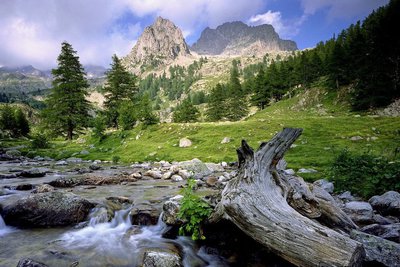
Vieille souche et portion de tronc de mélèze dans le torrent de la Madone de Fenestre face au Cayre de la Madone. - RICHAUD Philippe History and historical trailTerre de cour
The black rock marks one of the borders of the Terre de Cour, formerly a domain of the Count of Provence, before it was returned to the House of Savoy in the 14th century. Two inscriptions on the black rock provide a reminder of the past: “B” for Belvédère, “SM” for Saint-Martin-Vésubie. Terre de Cour was located exclusively in these two communes but they have to share the ancient rights to pasture and wood with Lantosque and Roquebillière.
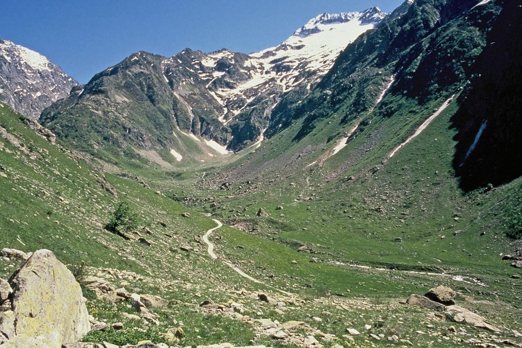
Dans l'ombre à droite le pas du mont Colomb, (2548 m). - GUIGO Franck  Geology
The scars of erosion
When they converge, runoff streams of water leave the ground bare, breaking a fragile equilibrium. In addition, footfall due to tourism damages the ground and raises the question of preservation of natural environments. Plant cover has to be maintained as it protects the ground from erosion and guarantees its stability. Restoration work has been carried out to guide and direct the hundreds of hikers who love these wild areas.
Le Gélas encore bien enneigé en fin de printemps, depuis le vallon de la Madone de Fenestre - LOMBART Guy History and historical trailCol de Fenestre mule track
This track has been used for a thousand years and was regularly maintained to allow mules transporting salt to pass with ease. The technique used to make and maintain these tracks involved self-locking stones. Identically sized slabs were arranged vertically in close lines. Fine materials were then used to hold it all in place. Gutters provided a run-off area for rainwater.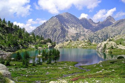
Le lac de Trécolpas en été, (2150 m) - GUIGO Franck  Know-how
Mountain climbing in the Mercantour
At the start of the 20th century, for the first mountain climbers, the Mercantour was a taste of adventure. Little by little, the summits of the chain were conquered, initially via the normal routes and then, with the arrival of modern mountain climbing, along the most difficult routes. From Victor de Cessole to Patrick Bérhault, the greatest names have been involved in climbing in the Mercantour. Today, whether they are snowy, icy or rocky, the reputation of certain routes is well established.
Deux gardes moniteurs de la Vésubie sur le toit de la vacherie de Salèse sous la neige, entourée de forêts. - RIFFLET François  Small heritage
Cow barns
This element of the community system allowed the inhabitants of the valley to place their cows into the charge of a guardian who would be responsible for them as they enjoyed the high-altitude pastures in summer. Mountain dwellers were thereby free to participate in the hay cutting and other agricultural activities close to the villages.
The cow barns which you can see on the Erps and Le Cavalet circuit were temporarily used during the summer, which explains why they are small. Today, only two farmers still work on the site of Boréon, owning or hosting thirty or so cows each.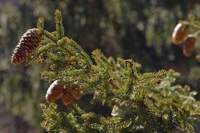
Les cônes d'un épicéa - F. Guigo FloraConifers
These resinous trees, with leaves shaped like needles or scales, produce conical fruits, hence the name given to this group. The larch is the only conifer which loses its needles in the winter. They are grouped together in clumps of 15 to 20. This species is only present in the Alps. It can also be found at the upper limit of the forest as it needs light to develop.
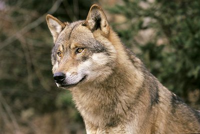
Portrait de loup d'Europe, (Canis lupus lupus). - JOULOT Christian FaunaWolf (Canis lupus)
In 1992, wolves came back into this area of their own accord, crossing the border from Italy, but they remain very secretive in the park.
They live in packs of 4 to 6 individuals, each pack having a territory which covers some 200 to 300 km².
Its diet is highly varied, mainly eating wild ungulates (mouflons, chamois, wild boar, deer) in addition to domestic ones (sheep), but it also eats small rodents, birds, insects and vegetal matter (wild berries, mushrooms,...).
Its role as a regulator of wild fauna needs to be underlines. This species is protected by national and international regulations and it has a natural place in the food chain and the ecosystem.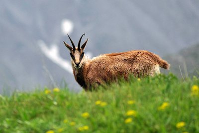
Un chamois - P. Pierini FaunaChamois (Rupicapra rupicapra)
A mountain dweller par excellence, the chamois can climb 1000m upwards in 15 minutes (a hiker would take 3 hours). It is easy to spot. The population of chamois is high and it roams along the mountains, from the forests and grasslands to the peaks.
It can be recognised thanks to its horns, which are straight and then curved backwards, and quite small compared to those of the ibex. Its forehead and cheeks are white, separated by two black bands from its ears to its muzzle.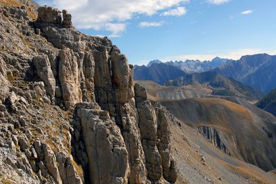
Panorama sur la chaine transfrontalière Argentera-Mercantour depuis les barres du Mont Mounier, (sommet à 2817 mètres). - PIERINI Philippe GeologyArgentera granite
If you look closely at this grey rock, you will see that it is made of different minerals. Quartz (grey) and feldspar (white) sometimes big with a few sparkling areas here and there on the rock. This is black mica and more specifically biotite.
You have discovered blocks of granite. All the minerals it is made up of are contiguous and visible with the naked eye. The texture is igneous, characteristic of plutonic rocks which crystallised deep in the earth.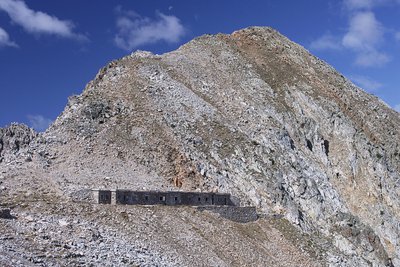
La Casermetta difensiva Colle Fremamorta e la Cima di Fremamorta - Roberto Pockaj History and historical trailThe Cima di Fremamorta barracks
The barracks building is an imposing structure and is still in relatively good condition: The camouflage paint on the doors is still visible, and there are a good number of windows and doors left, outside and inside. Outside, there are traces of the open-air kitchen, used by the troops during the warm months. The barracks could house a garrison of 60.
Along the last stretch of uphill trail, as well as in the nearby Val Morta, there remain a few telephone poles in larch, on which were strung the wires for communications between defensive outposts.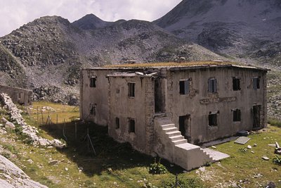
Il ricovero Umberto I - Roberto Pockaj History and historical trailThe Umberto I shelter
This is in fact a large barracks, designed to house 130 soldiers and 4 officers. Built in 1894, it was readapted on three separate occasions, the last of which in 1934, when another section was added on one side of the main building to house the kitchen, and a freestanding structure was also erected. The ruins of an old storage barn and stables can be seen just above the barracks.
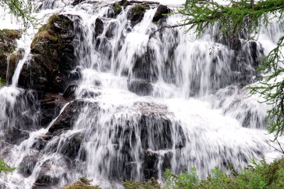
La cascata all'imbocco del Pian del Valasco - Roberto Pockaj GeologyThe Pian del Valasco waterfall
The mass of rocks over which the water falls is a typical example of a glacial rock step. During the glaciations it formed the lower limit of the lake at the foot of the glacier. A tongue of the glacier extended beyond the step.
Il Lariceto - Cati Caballo FloraThe larch
This type of forest is rather localized in the Maritime Alps, which notoriously represent the realm of the beech forest. It covers the slopes at the heads of the valleys with sparse and luminous populations, sometimes grazed by the herds that have climbed the mountain pastures. Most of the time their purity is not natural, but induced by man: in fact, over the centuries, man has favored this tree species to the detriment of others, such as the stone pine, for example, because they are less favorable for exercising the grazing due to the increased shading of the soil.
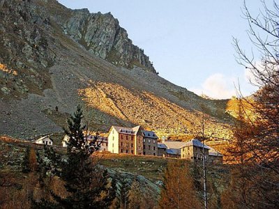
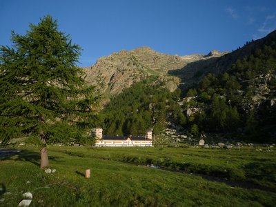
L'Hotel Royal a Terme di Valdieri - Roberto Pockaj  Architecture
The Valdieri Royal Hot Springs
First cited in the mid sixteenth century. When King Carlo Emanuele III decided to valorize the Valdieri hot springs, in 1755, a building and other appurtenances were quickly built in order to create a spa around the sulfurous waters. Cavour called Valdieri "the richest in health-preserving waters in all the nation, and perhaps in all of Europe as well". Vittorio Emanuele II, who first visited Val Gesso in 1855, became a frequent guest at the spa, and it was at his behest that, on 10 July 1857, the first stone was laid for the structure that was to become the Hotel Royal.
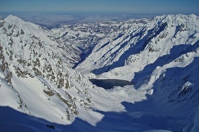
Panorama dai pressi del Lagarot di Lourousa; sullo sfondo al centro il Canalone di Lourousa e, a destra, il Corno Stella - Roberto Pockaj  Lake
LakeThe Lagarot di Lourousa
Springwater, welling up among meadows and larches, forms numerous limpid pools and streams; the water is at times turquoise, at times milky and at others perfectly transparent, making this a particularly striking location, perfect for a contemplative rest. The Canalone di Lourousa, bordered by Monte Stella and the Corno Stella and scoured by the Gelas di Lourousa, lies beyond the plateau of the same name, and a look over one's shoulder yields a view of the imposing outline of Monte Matto.

La diga del Chiotas - Roberto Pockaj LakeThe Chiotas Reservoir, the Della Piastra dam and the Lake della Rovina
The Chiotas Reservoir is closed off by two dams: the Chiotas dam and the Colle di Laura dam. The Chiotas dam, an arch-gravity structure, is 130 meters high and stretches for a length of 230 meters. Its thickness varies from 37.5 meters at its base to 5 meters at the top. The mass gravity Colle di Laura dam is smaller, rectilinear and only 30 meters at its maximum height. Its length is 70 meters. The Chiotas Reservoir has a carrying capacity of 27.3 million cubic meters of water.

Praterie di alta quota - Cati Caballo FloraThe cleared meadows
At the highest altitudes there are cleared meadows, the typical alpine pastures; they are composed of herbaceous species capable of covering soils normally closed to woody species, which, due to the very short vegetative period, cannot find suitable conditions for their development. Grazing by wild ungulates and, sometimes, by domestic sheep affects their composition, even if the most severe factor for species selection is represented by the climate.
Giovani stambecchi al Colle di Fenestrelle - Roberto Pockaj FaunaColle di Fenestrelle, as well as the surrounding area, is very popular with the ibex.
The Alpine ibex (Capra ibex), frequents alpine meadows and rock faces even above 3000 m, reaching the valley floor (provided it is not wooded) only in early spring, to be able to refresh itself after the long winter. Both sexes have annual growth horns, but much larger in males. The coat, light beige in summer, darkens to dark brown in winter.
Sedentary, grazing, it essentially feeds on grass, integrated with mosses, lichens and leaves of mountain shrubs, especially in winter.
Il Ricovero Fenestrelle - Roberto Pockaj History and historical trailThe Fenestrelle shelter
The ruins near the pass mark the site of the Fenestrelle shelter, named for Lieutenant Angelo Bertolotti. Built in 1888 and in use until the Second World War, it could house a garrison of 10 on straw pallets. In their guidebook, entitled "La Valle Gesso", the Boggias indicate the shelter as being instead dedicated "to the memory of Angelo Bortolo, of the 1∞ Reg. of the Alpine Corps, who was killed on the Ortigara during the First World War".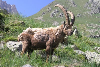
Stambecco maschio adulto, durante la muta primaverile del mantello - Roberto Pockaj FaunaThe Ibex of the Alps
Colle di Fenestrelle, as well as the surrounding area, is very popular with the ibex.
The Alpine ibex (Capra ibex), frequents alpine meadows and rock faces even above 3000 m, reaching the valley floor (provided it is not wooded) only in early spring, to be able to refresh itself after the long winter. Both sexes have annual growth horns, but much larger in males. The coat, light beige in summer, darkens to dark brown in winter.
Sedentary, grazing, it essentially feeds on grass, integrated with mosses, lichens and leaves of mountain shrubs, especially in winter.
Altimetric profile
Recommandations
This itinerary takes place along high-valley Alpine paths.
The accommodation sites listed are the only ones which are available along this route.
Before heading off on a hike, ensure that you have studied the safety advice. If you are setting off on this hike in the early part of the season, you will need to take particular care as patches of snow can still be present in higher areas.Access and parking
Report a problem or an error
If you have found an error on this page or if you have noticed any problems during your hike, please report them to us here:
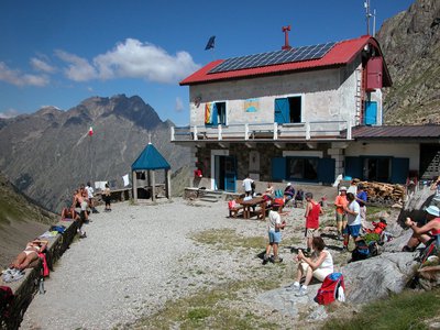
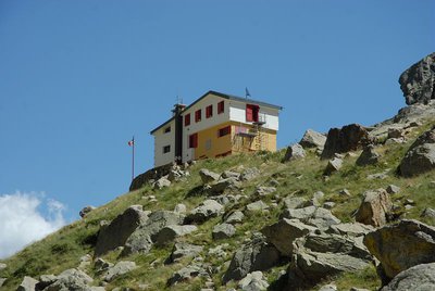
Close by8
- Mountain Hut
Mountain Hut
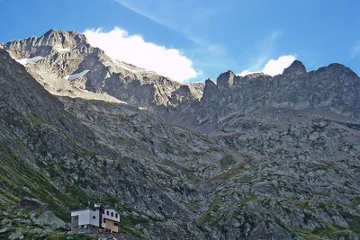
Rifugio Morelli Buzzi
The Morelli-Buzzi refuge is a structure built by the Cai of Cuneo in 1931, enlarged in 2000 and completely modernized in three phases between 2010 and 2012.
It is located in the enchanting Vallone di Lourousa at 2351m above sea level, in the heart of the Maritime Alps Park, at the foot of the north face of Monte Stella, the highest in the Maritime Alps. - Mountain Hut
Mountain Hut
Rifugio Valasco
At the center of the Valasco plateau stands the beautiful Palazzina Reale di Caccia, commissioned by Vittorio Emanuele II for his chamois hunting and for some years now it has become an accommodation facility.
The Valasco Refuge, in the heart of the Alpi Marittime Park, stands at 1764 m in Valle Gesso, Terme di Valdieri (CN). - Mountain Hut
Mountain Hut
Rifugio escursionistico S. Giacomo e Baita Monte Gelas
Structure open only in the summer season.
The Baita Monte Gelas was born in 1953 thanks to Giovanni Gerbino and Caterina Mellano. Since then our family has been offering hospitality and refreshments to visitors to the upper Gesso Valley. - Mountain Hut
Mountain Hut
Rifugio posto tappa Gta "Savoia"
The Casa Savoia refuge (GTA stopover) is located in Terme di Valdieri, in the heart of the spa area, at 1,368 meters above sea level. It is located along the itinerary of the Great Crossing of the Alps and is the starting point of numerous excursion itineraries.