6. The Wolf Trail - Argentera & Mercantour - Stage 6
8 points of interest
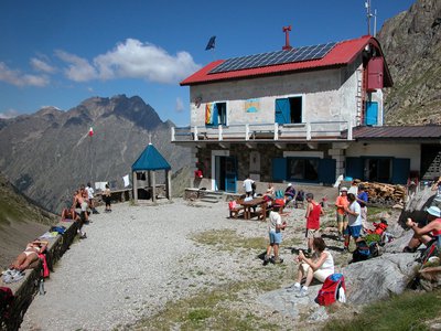
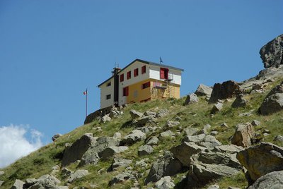
Il Rifugio Morelli - Roberto Pockaj  Architecture
The Morelli Buzzi Refuge
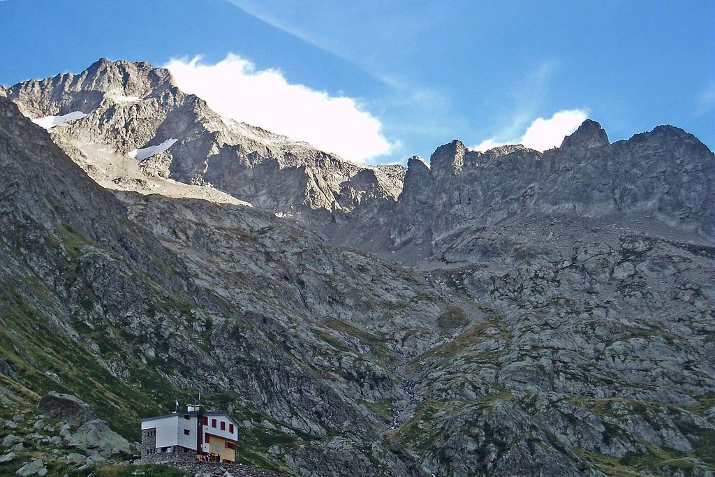
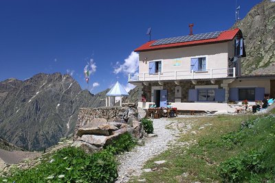
The oldest refuge in the Cuneo chapter of CAI, it was built in 1931, restored for the first ime in 1968 and then again in 2000. It is dedicated to Giuseppe Costanzo Morelli, who lost his life on 6 January 1928 on the Monviso, during a violent blizzard, trying with all his might until the last to assist his partner, Guido Raballo, who also died of exposure. Later, Morelli's name was joined by that of Alvaro Buzzi, commander of the military airport of Torino Caselle and promoter of the restructuring of the Refuge, who died prematurely and was unable to see its inauguration.

La diga del Chiotas - Roberto Pockaj  Lake
LakeThe Chiotas Reservoir, the Della Piastra dam and the Lake della Rovina
The Chiotas Reservoir is closed off by two dams: the Chiotas dam and the Colle di Laura dam. The Chiotas dam, an arch-gravity structure, is 130 meters high and stretches for a length of 230 meters. Its thickness varies from 37.5 meters at its base to 5 meters at the top. The mass gravity Colle di Laura dam is smaller, rectilinear and only 30 meters at its maximum height. Its length is 70 meters. The Chiotas Reservoir has a carrying capacity of 27.3 million cubic meters of water.

Praterie di alta quota - Cati Caballo  Flora
FloraThe cleared meadows
At the highest altitudes there are cleared meadows, the typical alpine pastures; they are composed of herbaceous species capable of covering soils normally closed to woody species, which, due to the very short vegetative period, cannot find suitable conditions for their development. Grazing by wild ungulates and, sometimes, by domestic sheep affects their composition, even if the most severe factor for species selection is represented by the climate.
Giovani stambecchi al Colle di Fenestrelle - Roberto Pockaj  FaunaColle di Fenestrelle, as well as the surrounding area, is very popular with the ibex.
The Alpine ibex (Capra ibex), frequents alpine meadows and rock faces even above 3000 m, reaching the valley floor (provided it is not wooded) only in early spring, to be able to refresh itself after the long winter. Both sexes have annual growth horns, but much larger in males. The coat, light beige in summer, darkens to dark brown in winter.
Sedentary, grazing, it essentially feeds on grass, integrated with mosses, lichens and leaves of mountain shrubs, especially in winter.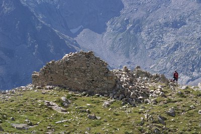
Il Ricovero Fenestrelle - Roberto Pockaj  History and historical trail
The Fenestrelle shelter
The ruins near the pass mark the site of the Fenestrelle shelter, named for Lieutenant Angelo Bertolotti. Built in 1888 and in use until the Second World War, it could house a garrison of 10 on straw pallets. In their guidebook, entitled "La Valle Gesso", the Boggias indicate the shelter as being instead dedicated "to the memory of Angelo Bortolo, of the 1∞ Reg. of the Alpine Corps, who was killed on the Ortigara during the First World War".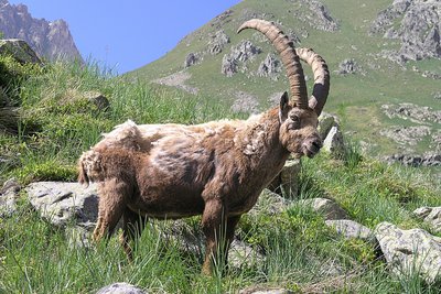
Stambecco maschio adulto, durante la muta primaverile del mantello - Roberto Pockaj FaunaThe Ibex of the Alps
Colle di Fenestrelle, as well as the surrounding area, is very popular with the ibex.
The Alpine ibex (Capra ibex), frequents alpine meadows and rock faces even above 3000 m, reaching the valley floor (provided it is not wooded) only in early spring, to be able to refresh itself after the long winter. Both sexes have annual growth horns, but much larger in males. The coat, light beige in summer, darkens to dark brown in winter.
Sedentary, grazing, it essentially feeds on grass, integrated with mosses, lichens and leaves of mountain shrubs, especially in winter.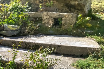
I resti di una cucina da campo nei pressi del Piazzale dei Cannoni - Roberto Pockaj History and historical trailThe Piazzale dei Cannoni
The name Piazzale dei Cannoni, or better still, Piana dei Cannoni, is due to the presence there of the 181st Artillery Battery, armed with 210/8 mortars, during the Second World War. The mortar emplacements are just south of the dirt road, along the slope, but they are not easy to spot. On the opposite side of the valley, across the torrent, there are the remains of probable logistical outposts and even an open-air kitchen.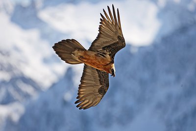
Un gipeto in volo - Michelangelo Giordano FaunaThe bearded vulture
The bearded vulture (Gypaetus barbatus), also known as the lamb vulture, has a wingspan that can reach 285cm and can weigh more than 6 kilos. An accomplished glider, it can exploit even the mildest ascending thermals. It is a carrion eater, feeding exclusively on carcasses of dead animals, ungulates for the most part, both wild and domestic. It consumes bones, cartilage and ligaments, and is known to drop bones from great heights in order to break them into manageable pieces. Monogamous and long-lived, the bearded vulture nests on rocky cliff faces at altitudes beween 1,000 and 3,000 meters.
Description
At 2342 metres altitude, close to the refuge, bear right following the N8 path with white and red markers, which are then complemented by orange markers as you rise, reaching 2526 metres altitude at Colle Chiapous. From there, following the indication on the marker, turn right onto the M9 path. At 2497 metres, do not take the path heading towards Passo del Porco, but bear left and continue the descent via a series of comfortable hairpin bends (white and red markers). Close to the shores of the lake, head towards the dam. Turn left after the dam and go down the tarmacked road. You will go through a short tunnel and then go up to the right along a track which can be used by vehicles, following the markers. Go around the north-eastern and south-eastern shores of the lake and you will quickly reach the Genova refuge.
From the Genova refuge, turn left onto the track which runs alongside the shores of Bacino del Chiotas. Having crossed a mountain stream, turn right onto the path which begins with a few staircases following the white and red GTA Colle di Fenestrelle markers. Head up a series of fine hairpin bends heading through grassy slopes until you reach a promontory at 2300 metres, which is where the path heads downhill for a few metres (white and red markers supplemented by orange ones). After a valley where snow can remain on the ground late into the season (proceed with caution), turn right on a flatter section. Go across two large permanent pools on the left then on the right before reaching Colle Fenestrelle at 2463 metres. Continue along the M11 path with white and red markers and you will first reach some ruins below the col and then a flatter grassy section at 2412 metres. Continue the descent along this pleasant path until you reach the bottom of the Gias Alve valley, below the Ellena Soria refuge at 1783 metres altitude. Turn left onto the track which can be used by vehicles following the M11 GTA red and white markers. At an altitude of 1738 metres, you can turn right onto an unmarked path to take a shortcut across a few of the hairpin bends on the track. Go past the foot of the high-altitude waterfall at 1409 metres altitude then head alongside the cow barn. Continue along the track to reach the hamlet of San Giacomo at an altitude of 1202 metres.
- Departure : Morelli refuge
- Arrival : San Giacomo d'Entracque
- Towns crossed : Valdieri and Entracque
Altimetric profile
Report a problem or an error
If you have found an error on this page or if you have noticed any problems during your hike, please report them to us here:
Close by4
- Mountain Hut
Mountain Hut
Rifugio Morelli Buzzi
The Morelli-Buzzi refuge is a structure built by the Cai of Cuneo in 1931, enlarged in 2000 and completely modernized in three phases between 2010 and 2012.
It is located in the enchanting Vallone di Lourousa at 2351m above sea level, in the heart of the Maritime Alps Park, at the foot of the north face of Monte Stella, the highest in the Maritime Alps. - Mountain Hut
Mountain Hut
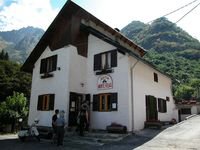
Rifugio escursionistico S. Giacomo e Baita Monte Gelas
Structure open only in the summer season.
The Baita Monte Gelas was born in 1953 thanks to Giovanni Gerbino and Caterina Mellano. Since then our family has been offering hospitality and refreshments to visitors to the upper Gesso Valley.