9. Alto Tanaro Tour, stage 9: from Garessio to Barchi
Description
From Piazza Vittorio Veneto in Garessio (584 m) take Via Marro, then Via Rovere. After the railway underpass, turn right past the San Bernardo water bottling plant and continue on a narrow surfaced road following signs for Sparvaira.
Dopo poco si prende a sinistra il sentiero che s'innalza deciso nel bosco. Il sentiero incrocia la strada tre volte; alla quarta, la tocca appena presso un tornante di quest'ultima. Ignoring the turnings, you pass the chapel of Santa Maria Maddalena, then a first hamlet and a second one, Sparvaira. After the houses go down to the right and cross the Tanaro River on a road bridge. You cross the railway again and arrive on the main road SS28 at Trappa (614 m, 1:00 hour from Garessio).
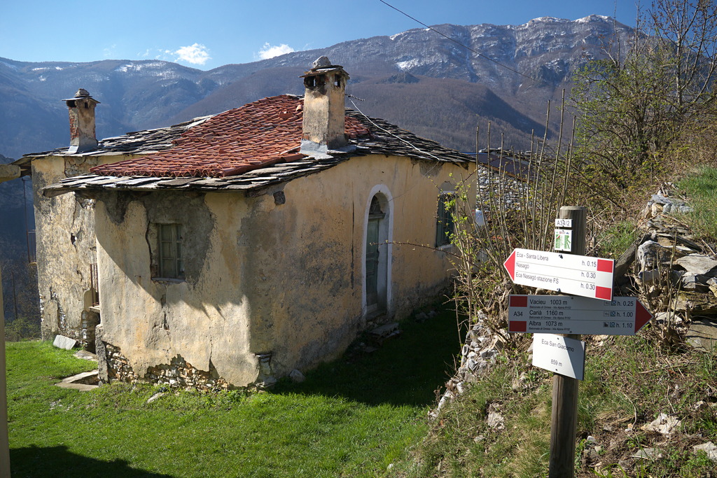
Continue left and take Via Pianbernardo on the right. The asphalt road continues between the houses: when the road forks you cross the Rio Parone on a bridge. A little further on, take the path on the left that rises steeply into the woods, crossing the road three times, the fourth time it just touches it in a bend. Here an old mule track reappears road that meets the road for the last time, with the houses of Pian Bernardo (940 m, 1:00 hour from Trappa) now in sight. Between the houses and immediately beyond there are a number of junctions in quick succession so take care to follow the white and red paint marks: above the houses continue on a rough dirt track and, when it bends to the right, go straight on following an old mule track. It rises for a long time in the beech forest. Leaving the dense woods, follow the uphill trail on broad meadow slopes to Prati sopra Le Balze. Here it bends to the left bringing you to Colletto Prati sopra Le Balze (1457 m, 1:45 hours from Pian Bernardo). Beyond the ridge the trail cuts across arid slopes, re-enters the forest and meets the ruins of Case Lurdera (1328 m, 0:20 mins from Colletto Prati sopra Le Balze). After the ruins go down the mule track, turn left and go down with a few turns and long traverses. You ignore a fork on the right to Vacieu, and turn to right at the next crossroads, arriving at Giorrea soprana (1016 m, 0:30 mins from Case Lurdera). Drop down to an unsurfaced road below and go right. The road comes in sight of the houses of Vacieu: without reaching them, take the mule track to the left. The mule track, with a moderate descent, leads to San Giacomo di Eca (859 m, 0:35 mins from Giorrea soprana). Turn right at the church and go down to the hamlet of Santa Libera (about 780 m). When you reach the asphalt, go to the right: a hundred metres after the first hairpin bend on the left you take the trail to the right (not well signed). Traverse down through the wood to the main road SS28 at Nasagò. Cross the road, pass under the railway and cross the Tanaro River on the roadbridge to the parking area at Case Breo di Barchi (670 m, 0:30 mins from San Giacomo di Eca).
- Departure : Garessio, Borgo Ponte (584 m)
- Arrival : Barchi, Case Breo (670 m)
- Towns crossed : Garessio and Ormea
Altimetric profile
Transport
Per raggiungere Barchi è necessario prenotare un taxi:
https://www.virgilio.it/italia/ormea/cat/TAXI.html
Access and parking
Parking :
Report a problem or an error
If you have found an error on this page or if you have noticed any problems during your hike, please report them to us here:
