1. Malinvern Lake Tour - Isola 2000 - Malinvern refuge - Col Lombarde - Stage 1
2 points of interest
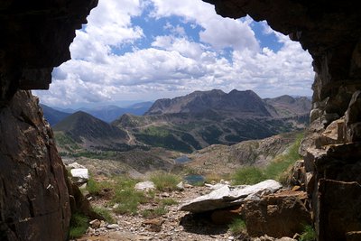
La visuale da una delle gallerie che ospitavano la Batteria del Druos - Roberto Pockaj  History and historical trail
The Druos Artillery Battery
Near the Bassa del Druos there are the ruins of a shelter and the Druos Battery, a defensive military gun emplacement in a cave of the Vallo Alpino. The artillery battery, realized with minimum investment in the mid-thirties, consisted of 4 100/17 howitzers captured from the Austrians in WWI. The guns were positioned in the cave without any shielding whatsoever: there wasn't even a command room inside. Two of the 4 galleries where the cannons were placed can still be seen clearly, but the entrances to the other two have been obstructed by landslides.
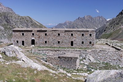
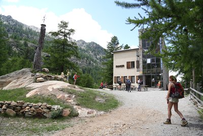
La caserma del Druos ai Laghi superiori di Valscura - Roberto Pockaj History and historical trailThe Massimo Longà Barracks
The barracks are named for Massimo Longà, Captain of the Alpine Corps, who died on Monte Ortigara on 10 June 1917 (to be precise, on an Army Corps of Engineers map, the Rifugio's name is indicated as Massimo Mongà, differently from the inscription on the plaque over the main entrance). The barracks building is an imposing structure, built, according to documents of the Engineering Corps, in 1903. Other sources give the date of its construction as between 1916 and 1917, thanks to the forced labor of Austrian prisoners captured on the Eastern front, but if the Engineering Corps documents can be believed, it is more probable that the barracks were only restructured during the WWI years.
Description
From the top of the Isola 2000 ski station, head along the access road for Hôtel Diva (2070m - m90); go past the hotel and continue along the road as it heads slightly uphill to the left and you will come, at the end of the carpark and on the left again, to the Terre Rouge path (m90a) with rectangular yellow markers.
Follow this path which rises in hairpin bends through the forest on the southern slopes of the ski station. Cross the Alpine ski slope to reach marker 91 and take the right fork (east). The itinerary initially heads through a chaotic rocky zone before crossing the river in the Terre Rouge valley (which you will need to ford) and then, after a steeper section, at marker 92, goes along the military track coming from Coll Mercière. From marker 91, the path has GR markers (white, red).
Continue due north on this path which reaches the glacial rock bar (m93) and allows you to see the small lakes (2417m, 2425m) and the large lake of Terre Rouge (2452m).
A turn and several hairpin bends lead to Baisse de Druos (2628m - m94) from where you can see the Italian rocky cirque Valscura and the top of the Malinvern mountain ridge (2938m).
From La Baisse, the path begins the descent on the other slope down the mountainside towards the upper Valscura lakes and the former military barracks (2466m), which can be seen from Baisse de Druos. This is an excellent reference point for following the path, which still has white and red markers. After a series of hairpin bends alongside a rocky bastion, you will reach the lower Valscura lake (2265m). Head alongside it and you will find the turning on the left, with a signpost on the boulder (the back of the signpost is facing you) before the intersection between paths, signposted towards Colletto di Valscura 50 minutes. The climb takes place along a well-defined path which rises through hairpin bends and which become steeper as you reach the top of the col. The path which heads downhill towards the refuge is initially stony, and you will first reach Malinvern lake which you can also see all the way down this descent. At the lake, there is an uphill section which only lasts for a few metres and a final descent to reach the Malinvern refuge 1835m.
To reach your accommodation located on the other slope, at the altitude of the refuge take the first path which heads away to the left and which reaches the book and heads up the other side.- Departure : Isola 2000
- Arrival : Malinvern refuge
- Towns crossed : Isola, Valdieri, and Vinadio
Altimetric profile
Report a problem or an error
If you have found an error on this page or if you have noticed any problems during your hike, please report them to us here: