Il Colle Vaccarile
Description
In Limone Piemonte, an unsurfaced road leads off from via Almellina (1067 m) towards Capanna Chiara. This track passes Casali Barat (1091 m) immediately on the right and climbs quite steeply. Ignore the various paths leading off to either side until you reach a turning in the road to the left to Tetti Almellina (used on way back). The route carries straight on passing the ruins of Casali Braia (1282 m, 0:45 mins from Casali Barat), then bends to the right and after some wide turns it climbs to the abandoned Maire Gavel (1408 m, fountain). Staying on the road you come into an open plain where you come to a junction by a ski lift. To the right it is not far to Capanna Chiara (1448 m, 0:35 mins from Casali Braia), to the left a track carries on towards Monte Jurin.
Turning to the left the track climbs through the fields, to the right a grassy mule track breaks off (unmarked) to Colletto Sud del Cros and ends shortly after. Continue to the right on the path for Colle Vaccarile.
The panoramic path makes a long traverse through pasture and rocks rising to cross a ridge, from here the path veers east north-east and continues traversing, turning to the east to enter a grassy valley at the top of Valle Gorgiassa.
After crossing an animal pen, the path climbs abruptly, on reaching a fork in the path leave the more direct (and shorter) route to Colle Vaccarile to the left and keep to the right on an evident track that climbs beside the water course.
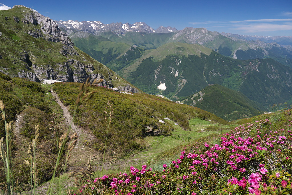
After a number of tight bends you come to a grassy depression where the path turns left. On reaching the watershed with the Pesio, follow the marker posts through the pleasant pastures with clumps of rhododendron, as the path gets fainter follow your nose to reach a clear track along the wide ridge. Follow to the left keeping slightly on the Vermenagna side of the ridge this pleasant undulating path follows the watershed, passing to the west of Punta Melasso to reach Colle Vaccarile (2046 m, 2:15 hrs from Capanna Chiara). At the pass leave the path to Gias Vaccarile soprano to the right, and tending gradually west you come to Colletto Mirauda (2028 m).
At the pass leave the track to the right for Bric Costa Rossa and drop down to the left on a vague track. A little lower down the path becomes more evident again dropping quickly through grassy banks with narrow turns. Arriving at the ridge that closes off Valle Almellina to the north, you pass by Gias Ghigiet, then a long stretch along the sunny crest often through overgrown grasses. At a height of around1730 m the path veers south-west into the woods, where the long descent continues to the ruins of Tetti Almellina (1362 m, 1:15 hrs from Colletto Mirauda).
Giunti sul crinale che chiude a nord la Valle Almellina, si tocca il Gias Ghigiet, poi si segue a lungo in discesa l'assolata displuviale, spesso tra vegetazione erbacea invadente. Intorno a quota 1730 il sentiero piega a sud-ovest ed entra nel bosco, dove la discesa prosegue a lungo fino ai ruderi dei Tetti Almellina (1362 m, 1:15 ore dal Colletto Mirauda).
As you come into the hamlet turn left through the houses on an old mule track. It loses height quickly to the river which it follows on the right. After crossing the bridge over the river turn right to meet the track used for the ascent, just below Casali Braia.
Follow the unsurfaced road back to the starting point (1067 m, 0:30 mins from Tetti Almellina).
- Departure : Casali Barat (1067 m)
- Arrival : Casali Barat (1067 m)
- Towns crossed : Limone Piemonte
Altimetric profile
Access and parking
Report a problem or an error
If you have found an error on this page or if you have noticed any problems during your hike, please report them to us here: