The caves of Aisone
The route initially passes through small hamlets, some of whose buildings are still roofed over with rye hay, then skirts several natural caves inhabited by humans in neolithic times. Its excellent exposure to sunlight makes it a perfect excursion in spring and fall.
3 points of interest
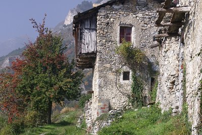
Case Piron - Roberto Pockaj  History and historical trail
The toponyms Piron and Ciancamentes
The small chapel at Case Piron is said to have been built atop a pre-existing votive pillar, known as "lou piloun"; the word was changed to Piroun and then Piron, the actual name of the hamlet. The Italianization of the place name has led to its further alteration to Pirone, now much in use.
The abandoned cluster of houses known as Ciancamentes has a different origin: it is thought that it was originally derived from "giam entes" in the language of Oc, which means "ask me where it is", in reference to the hamlet's particularly hidden location.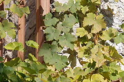
Le vigne di Aisone - Roberto P.  Know-how
Grapevine cultivation
The careful observer will note the sporadic presence of grapevines: along with the place names of the hamlets, they are evidence of cultivations that, favored by a warmer and more humid climate than the current one, in addition to excellent exposure to sunlight, were once fairly common even at these altitudes until a few decades ago.
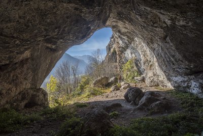
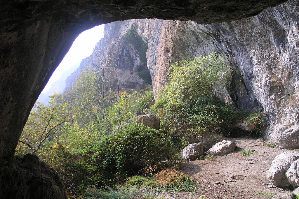
Una delle grotte di Aisone - Nanni Villani  Archeology
The Caves of Aisone
The calcareous rock formations have favored the creation of the numerous caves found along this route. Many relics that were found during archeological digs and are now on display at the Cuneo Municipal Museum (Museo Civico) prove that the caves, whose mouths at the bottoms of cliff faces enjoy excellent exposure to the sun, were already frequented in the Neolithic Era, between 4,800 and 3,500 B.C., by people of the square-mouthed vase culture. More recently, they were used as shelters by local shepherds.
Description
From SS 21, uphill from the houses of Aisone (840 m), turn off on the road leading up to Case Piron. Pass the trail leading down to the Aisone caves (which you will follow back up to the road on the return leg) and continue on the road until you reach Case Piron (1031 m, 35 minutes from Aisone).
The route proceeds midslope, following an old mule track in the Valletta del Rio Borbone. Shortly before reaching the ridge marking the watershed, the trail dips downward to the left towards Castellar delle Vigne.
A flat stretch of trail cuts across the slope to the hamlet of Baile (1040 m, 25 minutes from Case Piron).
{From Baile it is a short walk to Castellar delle Vigne (1035 m), where a marked path leds down to La Comba.}
In Baile, walk south among the houses until you reach the last one. An unmarked path heads east and winds down through the woods until it reaches a small clearing in La Comba (900 m, 15 minutes from Baile).
Here there are still some buildings with straw roofs at the foot of the characteristic rock outcroppings.
For a brief tract, the route follows an unpaved road leading downvalley, but leaves it for a path to the left, near an electrical pylon. The path runs along a sun-drenched slope, following the undulating foot of the limestone cliffs, along which open the mouths of several natural caves, some easily accessible, known as the Aisone caves (884 m, 20 minutes from La Comba to the farthest cave).
The last portion of the route rejoins the unpaved road seen at the start to return to Case Piron.
- Departure : Aisone (840 m)
- Arrival : Aisone (840 m)
- Towns crossed : Aisone and Vinadio
Altimetric profile
Access and parking
From Borgo San Dalmazzo, up Valle Stura to Aisone. The excursion begins just past the last houses, at the fork (marked with road signs) for Piron.
Report a problem or an error
If you have found an error on this page or if you have noticed any problems during your hike, please report them to us here: