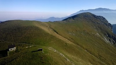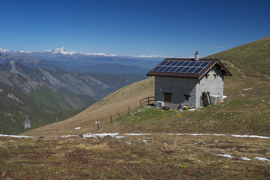
The Balur Refuge
Beautiful beech woods and broad Alpine pastures are the attractions in this excursion to a little frequented part of the Valle Gesso. There is a spectacular view from the heights around the Balur Refuge. Be sure not to miss seeing the Dragonera spring near the start of the excursion.
3 points of interest
La Grotta Dragonera - Roberto Pockaj  Geology
Dragonera Cave
The cave from which the Dragonera Spring springs is 130 meters long, and the first explorations date back to 1962. However, it was on May 15, 1968 that tragedy struck. Three cave divers dive down to the small room at an altitude of -15m, however abandoning the safety rope which was blocked. A cloud of mud numbed the waters, effectively eliminating visibility. Of the three, only one managed, fortunately, to gain access and raise the alarm. The two companions, on the other hand, took the wrong route, finding themselves in a siphon pool of a few meters. The two decided to stop waiting for help, which, after unsuccessful attempts, however, gave up. After almost 14 hours, with the water clear again, the two trapped cave divers decided to give it their all and look for a way out on their own: moving slowly so as not to raise mud, the two came across a rope left by the rescuers and they managed to return to the light of the sun.
[Information panel on site]
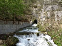
La Sorgente Dragonera - Roberto Pockaj  History and historical trail
The Dragonera Spring
From the source, once known only as the öy, water gushes out in considerable quantity and of excellent quality: analyzes, now from 2009, classify it as "microbiologically pure oligomineral water, with a fair amount of calcium and magnesium, low in sodium, with very few nitrates."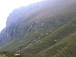
Il monte Balour - Cati Caballo GeologyThe monte Balour
In the Maritime Alps, the place names in which the root "bal" appears are very numerous. Precisely because in these parts such names are erroneously interpreted as indicators of sites suitable for hosting the "balls" of masche and other demonic beings, moreover very present in the Occitan culture, it is better to underline that the root of the denomination has little to do with the dancing parties organized by that type of creature, but rather indicates the presence of elevations or rocks in the area.
Description
On the outskirts of the village of Roaschia (803 m), a small paved road begins to the right of the provincial road, leading up to the nearby Dragonera spring. The route follows the road until the first switchback to the left, where the footpath for the Dragonera spring
begins(829 m, a detour of just a few minutes and strongly recommended). Not much further on, the little road ends in a small clearing, to the right of which there is the start of a dirt road. This rises steeply, alternating paved tracts and dirt: it crosses over the stream that flows down the Vallone della Freida four times on cement bridges sturdy enough for vehicular traffic. After the fourth bridge there is a fork: the route abandons the road (paved in this tract), which leads to the left for Tetti Virutra, and instead follows the dirt track to the right.
The track immediately climbs steeply uphill, then forks: the left fork again leads to Tetti Virutra, and the route takes the fork to the right. After a few meters, the dirt track narrows to a trail.
Climbing at a steep incline among thickets of saplings and brush, the trail enters a beech wood. The trail continues to climb in a series of switchbacks, then a very long traverse leads out of the forest.
Passing by some turnoffs to the left, the trail turns right and joins the dirt road leading to the Passo del Van pass.
The route follows the road to the left until reaching the Gias Fontana Fredda (1588 m, 2 hours and 30 minutes from Roaschia).
The route continues on a comfortable path to a small bowl above the gias, where it turns sharply to the left (east-northeast). After a long traverse through pasture fields, the trail climbs up the last, brief uphill tract and comes to the Balur Refuge (1780 m, 35 minutes from the Gias Fontana Fredda).
- Departure : Roaschia (803 m)
- Arrival : Balur Refuge (1780 m)
- Towns crossed : Roaschia
Altimetric profile
Recommandations
Transport
SNCF line TER Provence Alpes-Côte d'Azur For travel in the PACA region and towards Cuneo www.ter-sncf.com/pac
Trenitalia for travel in the Piedmont region https://www.trenitalia.com/it.html
Access and parking
From Borgo San Dalmazzo drive up the Valle Gesso to Andonno and turn left onto the bridge that crosses over the Gesso torrent at that point, then turn right for Roaschia.
Parking :
Report a problem or an error
If you have found an error on this page or if you have noticed any problems during your hike, please report them to us here: