The protected woods of Palanfrè
2 points of interest
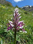
Orchidea in fiore - Cati Caballo  Flora
FloraThe orchids
Orchids are one of the most fascinating and attractive families. Also for this reason their collection is strictly prohibited. The dry and sunny grasslands represent one of the most hospitable habitats for them, but there are numerous species associated with woods and pastures. About forty species have been recorded in the protected area; the latest discovery was the so-called goat lily, typical of the Mediterranean district.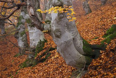
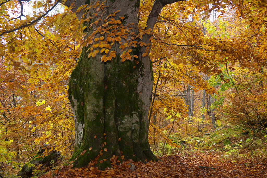
Faggi secolari nel bosco bandito di Palanfrè - Roberto Pockaj FloraThe Beech
The beech (Fagus sylvatica), a splendid tree with a gray and smooth bark and oval, intense green leaves, is often present in popular narratives as a magical tree inhabited by gnomes. It prefers shady slopes, up to 1800m above sea level, and can live over 300 years. It produces excellent wood, used for making barrels, tool handles and as fuel. The fruits, the beechnuts, are used as fodder for the pigs.
Description
On the northwest side of the parking area below Palanfrè (1352 m) there is a short unpaved road, which the route follows for a hundred meters or so, through old terraced fields and cultivations now used as pasture land. At the end of the dirt road, a bit to the right, near a watering trough, the real "Nature Trail" begins. The trail takes the first right at the fork for La Via di TÈit and Vernante, at first passing through a sparse copse of trees alongside a stream and then climbing uphill through sloping pastures.
Above and to the right, there are some curious rocky formations on the slopes of Monte Croce: these are formed by conglomerates, which are more resistant to erosion than the rocks they had been embedded in, and have thus emerged. It is also interesting to note the lush vegetation that has colonized the banks of the stream alongside which the trail climbs (hazelnut, willow, red elder, laburnum).
A steeper uphill tract crosses the stream, passing over to the orographic right, and reaches the rich pasture fields of Pianard. When the trail levels off, it veers to the left and, almost doubling back on itself, enters a stand of deciduous trees with many beeches.
The trail crosses over a stream (dry in times of little rain) and continues on through the woods at mid slope, leveling off. After passing through the small hollow of Pascoli della Valletta and a brief tract in the woods, the trail comes to a dirt track, shortly after a lookout point that offers a splendid panorama. The route crosses the track and takes the trail on the right, ignoring the one that heads off to the left at the same point. After a short climb to the edge of another, larger pasture hollow, the trail comes to the protected woods of Palanfrè (1535 m, 50 minutes from Palanfrè).
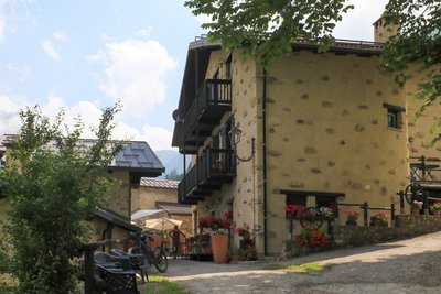
The trail now descends quite steeply to the edge of a splendid beech wood, passing next to centuries-old trees. Farther down, the trail meets up with a mule track, which it follows to the right. Not much farther, the mule track joins an unpaved road, and in this case as well, the route follows it to the right. The route passes by a mule track that goes off to the left a few meters further on, descending on the dirt road with a couple of switchbacks. At the third switchback the route passes by the turnoff on a mule track for the Frisson lakes and continues to the left on the dirt road. The unpaved road joins a small paved road that runs along the perimeter of the picturesque hamlet of Palanfrè (1370 m, 25 minutes from the protected woods) and leads back to the small village chapel at the trek's point of departure.
- Departure : Palanfrè (1352 m)
- Arrival : Palanfrè (1352 m)
- Towns crossed : Vernante
Altimetric profile
Recommandations
Access and parking
Report a problem or an error
If you have found an error on this page or if you have noticed any problems during your hike, please report them to us here: