The Viol di Tàit
Old terraced fields reclaimed by the woods, a stunning lookout point directly above Sant'Anna and the typical architecture of the outlying settlements on display at Tetti Bartola and Tetti Bariau, with roofs in rye straw, are the high points of this itinerary.
4 points of interest
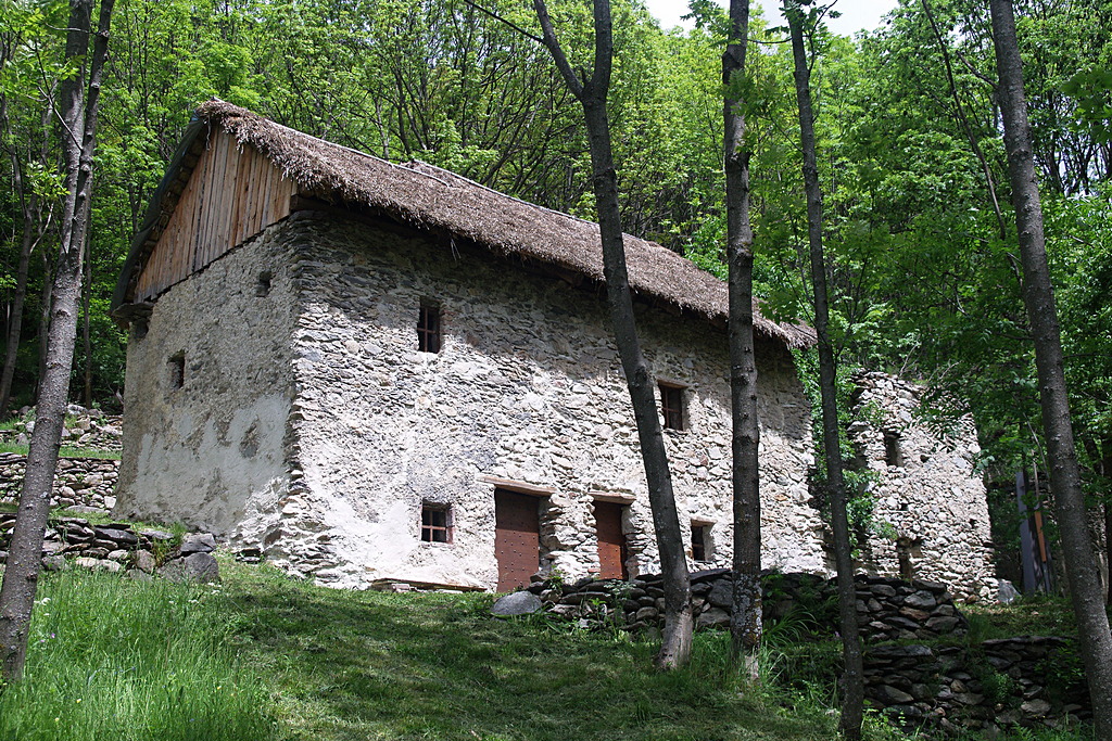
L'abitazione ristrutturata con tetto in paglia a Tetti Bariau - Roberto Pockaj  Small heritage
Tetti Bariau and Tetti Bartola
Tetti Bariau, whose inhabitants abandoned it definitively in the late '70s, had a population of some thirty souls at the start of the 1900s. The hamlet of Tetti Bartola was far more populous at the start of the last century, boasting nearly sixty inhabitants, the last of whom left in 1960.
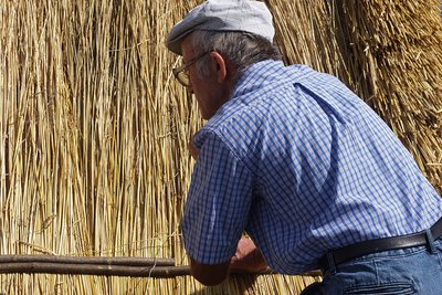
La casa a Tetti Bartola con tetto in paglia di segale - Roberto Pockaj  Know-how
Building a straw roof
A roof in rye straw was made by overlaying successive bundles of straw, generally in parallel to the line of the gutters. The initial step consisted of covering the edges with bundles affixed to the wooden frame of the roof. The subsequent bundles of straw were placed in rows, from left to right, with the tops of the stalks facing upward. Lengths of walnut - or chestnut, if available - were then laid across the rows and another layer fastened to them.
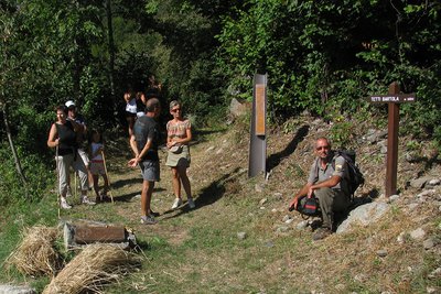
La partenza de Lo Viol di Tàit - Archivio EAM Know-howLo Viol di Tàit
The Viol di Tàit (The trail of the hamlets) is named for Mauro Rabbia, a park ranger from Sant'Anna di Valdieri who was swept away by an avalanche in 2010. To Mauro, a dedicated student and promoter of the local culture and traditions, we are also indebted for the idea of the Rye Festival.
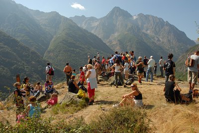
Sosta a "lo Gorgàs" durante l'escursione sul Viol di Tàit in occasione della Festa della Segale - Laura Martinelli Small heritageThe place names "Gorgas" and "Bariau"
the curious place name, "lo Gorgàs", refers to the presence of a small pool of water in a cavity of the rock. Tetti Bariau, instead, almost certainly owes its name to its position at the foot of a steep rocky slope: "bariao" means narrow passage or only passage in the language of Oc.
Description
From the Rye Museum in Sant'Anna di Valdieri (969 m), a road descends to meet, on the left, an uphill stretch that leads to the cemetery (the sign for the Viol is only visible to those coming from downvalley). Near the cemetery, on the left, there is a signpost indicating the start of the route. After a few meters there is a fork: follow the trail on the right. The path leads along a mule track in dense deciduous woods and a wooden footbridge spans a brook before continuing the climb into the Vallone della Sauma, flanked by the ruins of the old terraced fields.
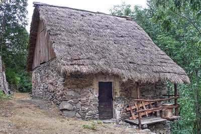
A midslope tract and a short, steep climb lead to Tetti Bartòla (Tàit Bartòla, 1103 m, 25 minutes from Sant'Anna), where there is a reconstructed house with a characteristic rye straw roof.
The trail leads above the hamlet, as far as the community oven, where it turns left. After passing a house there is a slight descent and then a wooden bridge over the torrent of the Vallone della Sauma.
There follows a midslope tract and several tight switchbacks leading up to a rocky outcropping known as "lo Gorgàs" (with a stunning view of Sant'Anna).
Another short uphill tract precedes a descent with some steep hairpin turns, down to Tetti Bariau (Tàit Bariau, 1160 m, 35 minutes from Tetti Bartòla), where there is another house reconstructed by the Parks Service. The path continues downward beyond the cluster of houses until it crosses the muleteeers' track that winds up the Vallone della Meris. The route follows the track to the left, descending with a fairly steep slope on a stony path until it reaches Sant'Anna. When the paved road forks among the houses, take the left branch, which leads to the old Post Office, just above the Museum(969 m, 25 minutes from Tetti Bariau).
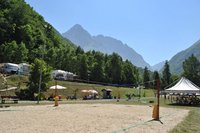
- Departure : Sant'Anna di Valdieri (969 m)
- Arrival : Sant'Anna di Valdieri (969 m)
- Towns crossed : Valdieri
Altimetric profile
Recommandations
Transport
Regular line Cuneo, Valdieri, Entracque
Tel: 00 39 (0) 171 69 29 29
www.benese.it
SNCF TER Provence Alpes-Côte d'Azur line
For your travels in the PACA region and to Cuneo
www.ter-sncf.com/pac
Trenitalia to travel in the Piedmont region
https://www.trenitalia.com/it.html
Access and parking
From Borgo San Dalmazzo, proceed up the Valle Gesso. After passing Valdieri, continue on towards Terme until you reach Sant'Anna.
Report a problem or an error
If you have found an error on this page or if you have noticed any problems during your hike, please report them to us here:
Close by2
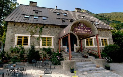
- Mountain Hut
Mountain Hut
Rifugio Balma Meris
The Balma Meris alpine inn is a refuge-hotel set in a recently renovated stone building.
The refuge is located in the center of the town of Sant'Anna, a typically mountain resort, gathered along the river at the confluence of the Meris valley, the starting point for excursions in the valley of the same name.