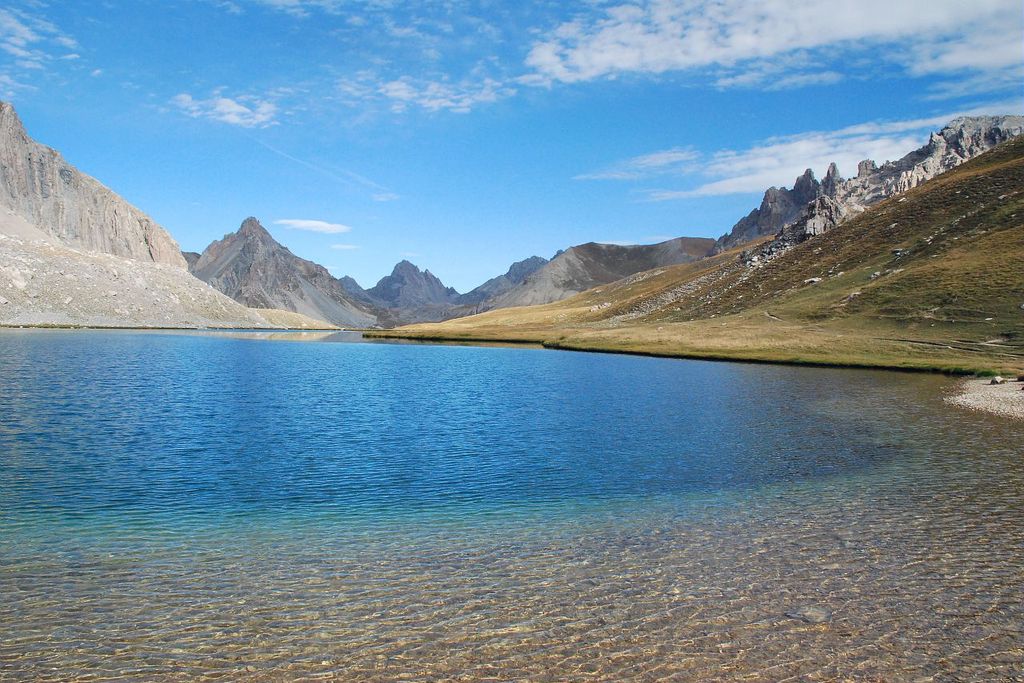
Le lac de l'Oronaye
Val-d'Oronaye
Le lac de l'Oronaye
Medium
3h30
5,1km
+562m
-8m
Round trip
Embed this item to access it offline
A hanging valley, formerly part of a glacier, which houses a turquoise lake. Close by, at the Col du Roburent, engraved stone bollards mark the former frontier with Savoie.
Description
From the car park, head into the Alpine pastures along a wide path. It starts off with a gentle upwards slope before climbing the right bank of the Orrenaye mountain stream and passing close by modern sheep folds. The path then passes over a rock cliff face.
Pass by the right turning which would take you downhill. Continue opposite and pass by a slope on the left which heads up to a pastoral hut.
At the junction between itineraries, head to the right on the upward path.
When you reach a small crossroads, continue straight on, passing by the path for the return journey which is on your right. After a small residual lake, you will reach Lac de l’Orrenaye. Keep climbing on the left of the lake and cross a brook before there is a fork in the path.
To reach the border mountain of Le Roburent (2502m) and to admire its Italian namesake, continue along the path with the gentler slope in the same direction.
Head back down via the same route. At the residual lake, take the path on the left to re-join the path taken on the outward journey in order to get back to the car park.
- Towns crossed : Val-d'Oronaye, Larche, and Argentera
Altimetric profile
Recommandations
Do not head into the valley on day when visibility is low/Keep dogs on their leads in pastoral areas/Don’t forget to bring a water bottle and binoculars.
Since summer 2015 at Lac de l'Oronaye, a programme for monitoring vegetation has been set up. Please respect the fencing and the posts which have been placed there.Information desks
Ubaye Tourisme / Office de Tourisme - Val d'Oronaye
Le Village, 06540 Val d'Oronaye
Horaires
L'Office de Tourisme de - Val d'Oronaye est ouvert la saison d'été du 15 juin au 15 septembre
TOUS LES JOURS
de 8H30 à 12H30 et de 15h30 à 18h30
Fermé le week-end en juin et en septembre
Access and parking
Col de Larche (1960m), 32km east of Barcelonnette on the D900.
1km before the montain, take a track on the left to reach the carpark, close to the former customs post, downstream of the Orrenaye mountain stream.Parking :
Track on the left close to the former customs post, downstream from the Orrenaye mountain stream, where there is a flat area.
Report a problem or an error
If you have found an error on this page or if you have noticed any problems during your hike, please report them to us here: