Cime de Pelousette
Saint-Dalmas-le-Selvage
Cime de Pelousette
Medium
4h
5,6km
+466m
-466m
Round trip
PR
Embed this item to access it offline
Setting out from the former military barracks at Camp des Fourches, follow the path until you reach the magnificent viewpoint of. The climb continues in an environment of Alpine grasses towards the summit and its view over the green bowers and the Ubaye mountains.
2 points of interest
Le Salso-Moreno et ses paysages désertiques en été, roubines et érosion. - François BRETON  View point
Viewpoint over Salso Moreno
A magnificent viewpoint over Salso Moreno and the Italian border for you here. You will also see the black areas (marl) whose colour runs off into the Tinée during powerful storms. This rocky bar is also the border between the departments of Alpes-Maritimes and Alpes de Haute-Provence. GR5 crosses these mountains and connects Ubaye (Lauzanier) with Tinée.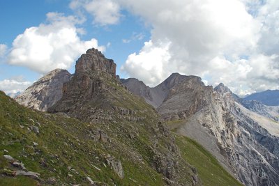
Le Bonnet Carré côtés Ubaye et Tinée en été, cumulus développés dans le ciel - François BRETON View pointCime de la Pelousette
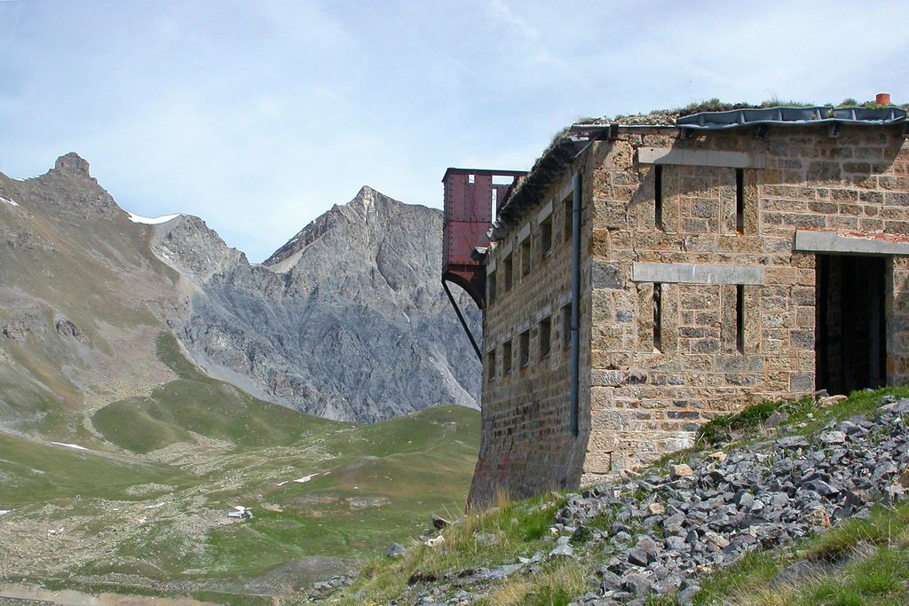
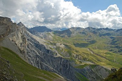
At an altitude of 2757m, with a magnificent 360° view over the Ubaye valleys, Bonnet Carré, the Bonette valley and Salso Moreno. You can also see an old military fort which dates from the beginning of the last century. This fort was part of a set of fortifications integrated into the Maginot Line in the Alps. This fort was permanently occupied until 1914. Ibex, chamois, marmots, birds of prey and snowfinches can often be found in this area.
Description
From the Camp des Fourches, head towards the Col des Fourches. After 5 minutes’ walk, take the left fork onto an old military path. Continue straight on following the yellow markers. The stony path gradually fades away, turning into a track among the Alpine grasses. Here, you may see marmots, choughs and jackdaws which live in the surrounding areas. You will subsequently begin to progressively climb towards the Cime de Pelousette. After the path zigzags a few times up the grassy slopes, you will reach the summit of the Pelousette whence there is a panoramic view over the valleys of Ubaye, La Bonette and the Salso Moreno.
- Departure : Camp des Fourches
- Arrival : Cime de Pelousette
- Towns crossed : Saint-Dalmas-le-Selvage
Altimetric profile
Recommandations
Be careful of the old military fort at the summit because its structure is unstable. You should therefore avoid going into it.
Is in the midst of the park
The national park is an unrestricted natural area but subjected to regulations which must be known by all visitors.
Information desks
Maison du Parc national du Mercantour - Saint Etienne de Tinée
Quartier de l’Ardon, 06660 Saint-Etienne de Tinée
Du 01/06 au 01/07/2022, tous les mardis, mercredis, jeudis, vendredis et samedis de 10h à 19h.
De 10h à 12h et de 14h à 19h.
Du 02/07 au 31/08/2022, tous les mardis, mercredis, jeudis, vendredis, samedis et dimanches de 10h à 19h.
De 10h à 12h et de 14h à 19h.
Du 01/09 au 30/09/2022, tous les mardis, mercredis, jeudis, vendredis et samedis de 10h à 19h.
De 10h à 12h et de 14h à 19h.
Transport
During the summer months, there is a bus to Bousiéyas.
Access and parking
Parking :
Carpark Camp des Fourches
Report a problem or an error
If you have found an error on this page or if you have noticed any problems during your hike, please report them to us here: