Rochaille path
2 points of interest
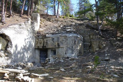
Blockhaus de Serre la Plate. Cet observatoire construit entre 1931 et 1938, et placé dans l’axe du Col de Larche. - François BRETON  History and historical trail
Serre la Plate bunker
The Serre la Plate bunker is one of the elements of the Maginot Line* in the Alps. At L’ubac de Meyronnes, you can also see the vast fort of Roche la Croix and, on the southern slope, the constructions of Saint-Ours Haut and Saint-Ours Bas, all built between 1930 and 1936.
*Line of fortifications built by France along its borders with Belgium, Luxemburg, Germany, Switzerland and Italy from 1928 to 1940.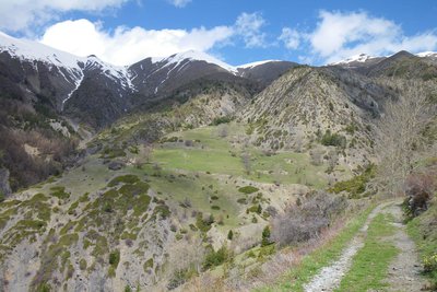
Cheminement entre la Grange de Gascon et le Plateau de Saint Ours - François BRETON  View point
Saint-Ours plateau
This is a small plateau in a bower of cultivated zones and pastures, that the large boulders of the same name underline. Now that there is less pressure on the land due to grazing, it is possible to see the dynamics of natural recolonization on the slopes around the hamlet: common and savin junipers, dog roses, Scotch pines...are gradually gaining ground.
The warmer slopes on the Rochaille path are an area for deer, whereas the Alpine pasture and the rocks above the path are home to chamois and ibex. The latter were reintroduced by the Mercantour National Park in 1999 in the Rochers de Saint-Ours.
Description
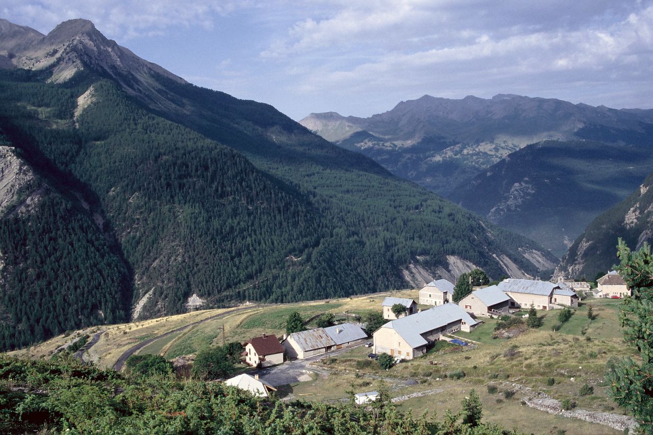
The departure point is from the village square in Meyronnes, alongside the road. Head up the village, turn left and take the little road which goes underneath the colony. The path begins off the hairpin bend on the road, where you will first have to ford a stream (to be avoided during heavy storms), then climb towards a stand of Austrian pines and larches which are the fruit of the Mountain Terrain Restoration Programme.
On the slopes of La Rochaille, 214 ha were purchased by the state in 1886 for plantation work. Today, the forest is managed by the National Forests Office (ONF). Le Belvédère du Pinas, which is located at virtually the summit of the hike provides a viewpoint over a vast unstable slope of sedimentary rocks known as Flysch; it is easy to understand why falling stones often block the road below.
The path continues at the same altitude. If you pay attention, just below the path you will see the excavations from a former slate quarry, which closed in 1884.
You will quickly come to the Serre la Plate bunker, an element of the Maginot Line in the Alps. You can also see the great fort of Rocher la Croix at Ubac de Meyronnes and, on the south-facing slopes, the works of Saint Ours Haut and Saint Ours Bas, which were all built between 1930 and 1936.
The path continues, leaving the forest and reaching the Saint Ours plateau, a little hamlet in a haven of cultivated zones and pastures, that the great Rochers which bear the same name underscore. With the pressure on pasture land having diminished, you can easily see the dynamics at work in terms of natural recolonization on the slopes around the hamlet: common and savin junipers, dog roses and Scotch pines which are gradually taking over areas.
From Saint Ours, follow the path down to Meyronnes for the return journey.- Departure : Meyronnes (Village square)
- Arrival : Same (circuit)
- Towns crossed : Meyronnes and Val-d'Oronaye
Altimetric profile
Recommandations
Access and parking
Take the D900 until the village of Meyronnes, 22km northeast of Barcelonnette.
DEPARTURE POINT: At Meyronnes, park in the carpark in the village square alongside the D900.Parking :
More information
Report a problem or an error
If you have found an error on this page or if you have noticed any problems during your hike, please report them to us here: