
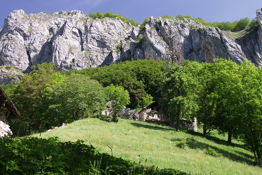
La Via di Téit
It was an excellent route for anyone interested in traditional Alpine architecture and the so-called “mountain way of life.” The trail, which passes through numerous hamlets, offered—and still partly offers—a glimpse into mountain life as it was just a few decades ago. The many recent landslides have swept away what remained of the thatched roofs, and few of the old dwellings are still standing.
3 points of interest
La Cava di Bec Moler - Roberto Pockaj  Know-how
The Bec Moler Quarry
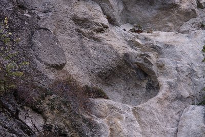
The Bec Moler quarry, used as a silica quarry for the Vernante glassworks, was cultivated until the 1960s, when it was abandoned in favor of more profitable quarries in the municipality of Robilante. The main access gallery is still passable and allows you to observe the quarry from above.
Before mining began, the millstones (or grindstones) for the mills were obtained from the Bec Moler, a fact which explains the toponym of the mountain. With a bit of attention it is still possible to observe on the rocky walls the circular carvings from which the millstones were extracted. The extraction was not always successful, as evidenced by a millstone which broke during the extraction phase and is still partly attached to the parent rock.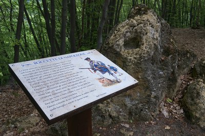
Le Roccette di Napoleone - Roberto Pockaj  History and historical trail
Le Roccette di Napoleone
The story speaks of a clash that took place on 8 August 1794 in this locality, then known as Pianot dell'Arp. The French troops, under the command of General Bonnau, descended into the valley from Colle Arpiola and from the Passo del Bec Baral, and fought with the Austro-Piedmontese troops under the command of General Audezeno. The Piedmontese retreated as far as the slopes of Monte Sapè, then, helped by the local population, repulsed the assault.
Two (perhaps three) crosses are engraved on the rocks that emerge from the ground here in memory of the fifteen soldiers who lost their lives and were buried here.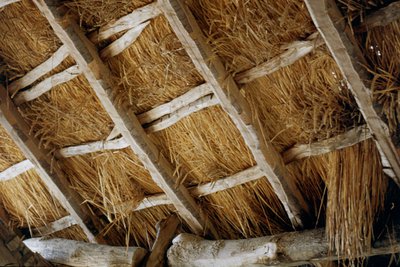
I tetti in paglia di segale - Roberto Pockaj Know-howThe rye thatched roofs
Typical of valleys lacking schistose rocks, that is easily split into slabs (lose), the roofing in rye straw was particularly widespread in all the Monregalese valleys, in Val Vermenagna and in Valle Stura. The stems were grouped in bundles and fixed to the roof framework to create fairly durable and highly insulating covers. The pitches of the roof were much more sloping than those of the roofs made of slate, since the light framework could not have supported the weight of large accumulations of snow.
Description
A dirt road branches off at the widening on the right side of the provincial road, just outside Vernante (822 m). The dirt road climbs steeply in switchbacks through the woods and reaches the entrance tunnel of a disused silica quarry.
Leaving the tunnel on your right, continue left on the dirt track that climbs to a small pass, where you turn left onto the trail leading to the Tetti Colletta.
After an uphill stretch just below the ridge, you cross over to the other side and come to the “Roccette di Napoleone.”
Continue on a gentle slope through the beech forest, then traverse slightly uphill near the ridge. When the trail forks, ignore the less obvious path that continues straight along the ridge and turn left toward the Val Grande di Palanfrè.
After a gentle climb along the hillside through a chestnut grove, you cross a ridge and come to a dirt road: following it to the right, you’ll soon reach Tetti Colletta (1226 m, 1 hour 15 minutes from Vernante).
Just before the ruins, take the trail that branches off to the left of the road and heads south-southeast along a grassy ridge. Once you enter the woods, continue on a gentle slope until you reach the Intaglio della Bercia, where you should ignore two trails on the left leading to Tetti Pedrin and the Due Ponti area, respectively.
After rounding the ridge, the trail turns west and, via a steep ascent, leads first to Tetti David, then to Tetti Bertaina (1324 m, 0:30 hours from Tetti Colletta).
Beyond the grassy ridge on which the village is perched, the trail heads northwest and reaches the watershed of the valley into which Monte Sapè flows.
After crossing the stream, the trail climbs up the right bank of the valley; it enters the next small valley and reaches its head, then continues to the watershed with the rugged Vallone di Pioccia, at the entrance to which lie the Tetti Doni (1484 m, 0:30 hours from Tetti Bertaina).
Back on sun-drenched slopes, leave the trail leading to the Maddalena pastures on your right and cut across slightly downhill to the watershed of the Vallone di Pioccia.
Cross the stream and, once on the north side, you’ll find the beech forest again; follow the trail along the hillside on level ground. After a wooden footbridge, you’ll pass through three steep ravines in succession, where snow may still be present even in spring, which should be navigated with caution.
Upon exiting the narrow valley, the trail descends briefly before beginning to climb again. Pass the fork to the left toward Due Ponti, then enter the Vallone di Franco.
Following a ridgeline, you cross the watershed of this yet another small valley, then reach a scenic pass where the Tetti Cucet stand (1501 m, 0:55 hours from Tetti Doni).
Ignore the trail that descends to the few buildings and head west: beyond the watershed of this last small valley, a fairly steep descent begins, first with tight switchbacks, then with a traverse leading to the edge of wide pastures. Here, leave the old trail on the left—which leads to the paved road—and take the newer trail that continues straight ahead toward the south. At a fork, leave a grassy track on the left and follow the trail on the right, which climbs through the meadows. You’ll soon join the more prominent trail through the Pianard pastures and follow it to the left until you reach the paved parking lot below Palanfrè. Climbing to the right along the paved road, you’ll enter the village of Palanfrè (1379 m, 0:45 hours from Tetti Cucet).
- Departure : Vernante (822 m)
- Arrival : Palanfrè (1379 m)
- Towns crossed : Vernante
Altimetric profile
Access and parking
From Borgo San Dalmazzo, drive up the Vermenagna Valley to Vernante, where you turn right toward Palanfrè. About 150 meters past a picnic area, pull over at a small clearing on the right side of the road.
Report a problem or an error
If you have found an error on this page or if you have noticed any problems during your hike, please report them to us here: