The Pagarì Refuge
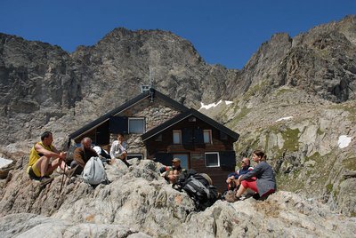
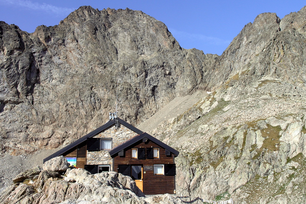
At the foot of the imposing northeast face of the Maledia, at the edge of the Pagarì Glacier (or what remains of it), with Alpine ibex nosing around the refuge: this is the typical Alpine scene that presents itself to the gaze of those who make the climb up here. The route follows the (probable) path of one of the most daring cross-Alp salt trade routes ever realized.
3 points of interest

La Palazzina Reale di Caccia di San Giacomo - Roberto Pockaj  History and historical trail
The former Royal Hunting Lodges
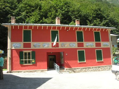
The two large buildings, now owned by religious groups, are said to have been built between 1865 and 1870 at the behest of Vittorio Emanuele II, to be used during his sojourns in the Royal Hunting Reserve. The one on the left, with its attractive portico decorated in horizontal stripes with the colors of the House of Savoy, was the residence of the royal entourage, while the other housed the stables.
The stables were then given to the army, which expanded the building between 1897 and 1898, transforming it into the Princess Elena barracks.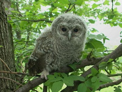
Allocco - Augusto Rivelli  Fauna
FaunaThe tawny owl
Among nocturnal birds of prey, the owl plays an important role, both from an ecological point of view and in the human imagination. It is in fact one of the most widespread species and therefore responsible for controlling the populations of rodents in wooded areas. For our part, often confused with the owl due to its shrill calls, it has a typical song that anyone recognizes: the typical mournful owl song. It can be recognized from owls and owls by the color of its eyes: the iris is completely dark.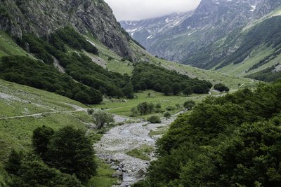
PIAN DEL RAZUR - gianluca.giordano  Geology
The Pra del Rasur
The ample meadow of the Pra del Rasur was formed towards the end of the last Ice Age, when rockslides from both sides of the valley blocked the course of the torrent. The detritus carried by the torrent itself, still quite impetuous today, gradually filled up the basin that was formed, thus creating the flat area.
Description
A few dozen meters downvalley from San Giacomo di Entracque (1209 m), the track crosses a bridge over the Gesso della Barra torrent.
Head up the Moncolomb Valley, following the same route as the "Pra del Rasur e il Gias sottano del Vei del Bouc" trail, until you reach Gias sottano del Vei del Bouc (1437 m, 1 hour and 10 minutes from San Giacomo).
At this point the dirt road ends in a fork: the route ignores the mule track on the left leading to Lake Vei del Bouc and instead takes the mule track to the right for the Pagarì Refuge.
The track crosses over the torrent on a wooden footbridge and passes by the Gias Colombo on the right, then proceeds slightly uphill on a mule track that gradually turns into a footpath.
After a long traverse, near a large boulder the track passes a turnoff on the right for the Moncalieri shelter and crosses over the Rio Pantacreus (there is a wooden walkway just uphill from the trail if the stream is too full to wade across). It then quickly passes a mule track in poor condition on the left that leads along the bottom of the Vallone di Moncolomb (this is the old trail to White Lamb Lake, almost completely erased in its upper tract). Beyond the turnoff, the track begins to climb steeply up the side of the valley in a very long stretch of switchbacks to the southwest.
The switchbacks, sometimes fairly tight and stepped, continue through thickets of brush up to the lower Muraion Pass (or Passaggio del Muraion), just beyond which the trail levels off slightly and there is a nice view of the Vallone del Muraion and the top of the valley.
The track then continues on among rocks in open ground, except for a few patches of green alders on the banks of the Rio Pagarì. Once it has crossed over the Rio Pagarì, steep traverses climb up to the turnoff on the left for the Lago Bianco dell'Agnel (White Lamb Lake), which the route passes by. At this point there is another series of long switchbacks that rise up the slope in a southwesterly direction.
The switchbacks gradually become tighter: passing by the trail for the Moncalieri shelter on the right and the one leading to the Pagarì Pass on the left, the trail is now in sight of the Federici Marchesini Refuge al Pagarì (2650 m, 3 hours and 40 minutes from the lower Gias del Vei del Bouc), commonly referred to simply as the Pagarì Refuge, just a short walk away.
- Departure : San Giacomo di Entracque (1209 m)
- Arrival : Federici Marchesini Refuge at Pagarì (2650 m)
- Towns crossed : Entracque
Altimetric profile
Recommandations
Access and parking
From Borgo San Dalmazzo, drive up the Gesso Valley. After passing Valdieri, turn left toward Entracque. Before reaching the town, turn right toward San Giacomo; then, after the dam, follow the signs to the left for San Giacomo. Parking is available for a fee during the summer season.
Report a problem or an error
If you have found an error on this page or if you have noticed any problems during your hike, please report them to us here:
Close by3
Mountain Hut
Rifugio escursionistico S. Giacomo e Baita Monte Gelas 1226 m
The Monte Gelas Mountain Hut was founded in 1953 by Giovanni Gerbino and Caterina Mellano. Since then, the Gerbino family has been offering hospitality and refreshments to visitors to the upper Gesso Valley, while also managing the adjacent San Giacomo Hiking Hut.