Lac du Lauzanier
2 points of interest

Sur le replat de Val Fourane, au niveau de la cabane Tardiez, l’Ubayette serpente tranquillement au milieu d’une zone humide. - François BRETON  Flora
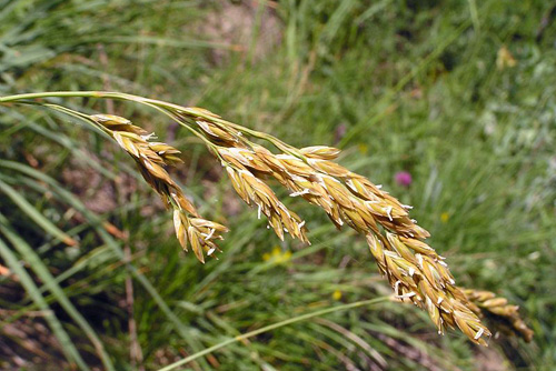
FloraThe Tardieu hut prairies
The prairies which surround the Tardieu hut are called “tall-festuca grassland”. This name comes from the dominant plant species, a tall kind of grass which grow in tall, tough clumps. The list of plants which grow alongside this tall grass and form the combination of plants constituting tall-festuca areas is long, but one of the jewels in the crown is surely Alpine sea holly or Queen of the Alps with metallic blue shades. This is currently the last area with Alpine sea holly in Ubaye, the department and the National Park.
Le lac du Lauzanier dans l'Ubayette à Larche - BRETON François  Lake
LakeThe wetland zone
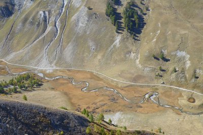
From the pastoral hut at Tardieu, the track, which is horizontal at this point, overlooks the great plateau where the winding Ubayette sparkles.
A few thousand years ago, you would not have had to go much further to find a deep lake. This great flat area with its tender green hues was covered by a lake, which was hollowed out by the Lauzanier glacier. It was not very deep and was filled in by the deposits which came off the brittle slopes.
Description
There are Mercantour National Park information signs at the carpark, follow GR5 (white and red markers) heading up the valley.
The first 500 metres are fully accessible for people in wheelchairs with no need for assistance and a multi-sensory information has been specially designed for visually impaired and hearing-impaired people (PNF/GMF sponsorship). The track heads gently upwards on the left bank of the Ubayette river which winds through a wetland area before passing close to sheepfolds at Eyssalps where you may be lucky enough to meet the shepherd and his sheep in the mountain pasture. As the track begins to rise, the waterfalls coming down from Enclausette and the Lac du Lauzanier can be seen on the left. Keep climbing until you reach the lake which reflects the summits which tower over it.
All along the path, you will easily be able to watch marmots. In the interests of their survival, please do not feed them and please respect the “quiet zones” which have been set in order to allow the marmots to live their lives in peace.
Hikers with energy to spare can continue the walk by walking around the right-hand side of the lake on path GR5-GR56, in much more mineral-based surroundings; this will lead them to the Pas de la Cavale (2671m) beneath the Trois Évêques peaks.
Follow the same route on the return journey.
We would like to remind you that because this path is entirely situated in the heart of the Mercantour National Park, no dogs are allowed, even if they are on a lead.- Departure : Pont Rouge carpark, 5 km after Larche
- Arrival : Lac du Lauzanier
- Towns crossed : Larche and Val-d'Oronaye
Altimetric profile
Recommandations
Transport
Barcelonnette, Larche.
Departmental Council Transport Service
Tel.: 33 (0)4 92 30 08 00
www.cg04.fr
Access and parking
Parking :
Accessibility
Free rental of "Joëlette" off-road wheelchairs and of the "handi-ecoguide" for the blind.
Larche Tourism Office
Tel. : +33 4 92 84 33 58
https://www.ubaye.com
Mercantour National Park at Barcelonnette
Tel. : +33 4 92 81 21 31
https://mercantour-parcnational.fr
- Emergency number :
- 114
More information
Report a problem or an error
If you have found an error on this page or if you have noticed any problems during your hike, please report them to us here:
