The waterfalls of Le Pich and Le Cimet
6 points of interest
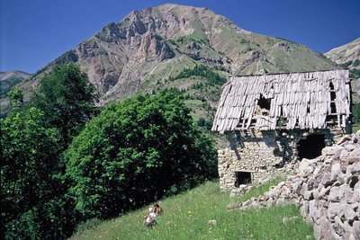
Une ruine du hameau de Bouchier - BOUVIER Martial  History and historical trail
Le clapier
This heap of stones next to the track (clapier) shows how hard people worked to remove stones from the fields. In the past, this area was cultivated, but now only the abandoned farm shows that this era ever existed.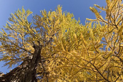
Vue partielle en contre-plongée d'un vieux mélèze, dans sa flamboyante parure automnale - Anthony TURPAUD  Flora
FloraLarch tree
The larch, archetypal tree of the southern Alps, allows grass to grow beneath it, unlike other evergreens, and it is the basis for bright wooded meadows. These zones have been used for pasture by the inhabitants of Allos and Le Bouchier for many years.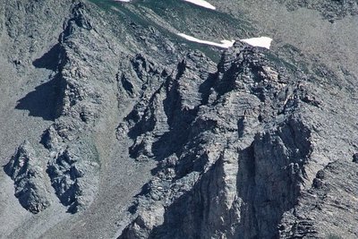
Eboulis sous les falaises de Pitch dans le haut-Verdon - ORMEA Patrick  Know-how
Screes
A cliff which is crumbling under the effects of freezing weather makes stones fall, which in itself feeds a perpetually mobile scree. When the slope of this scree is not steep enough, the ground stabilises and vegetation can establish itself. Look around you and you will see these two forms of scree, an active one and one which is stable and which has vegetation growing on it.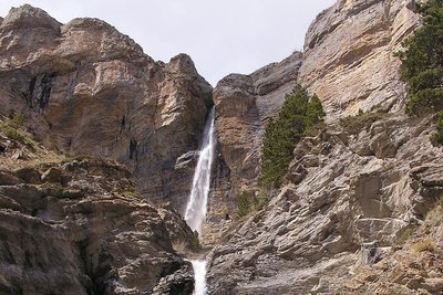
La cascade du Pich, Haut Verdon - Parc national du Mercantour  Geology
Pich waterfall
More than 140 million years ago, the sea covered this entire region. The sediment which was deposited ultimately shaped this limestone bar (Tithonian bar). The action of the glaciers revealed it and the Pich waterfall provides a remarkable spectacle thanks to it. But this spectacle will have consequences in the future: the water is cutting through the cliff which, despite its solidity, will one day be cloven in two by a craggy gorge and will be admired in turn by future generations.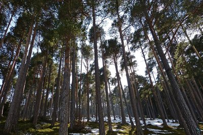
Forêt de pins sylvestres, (Pinus sylvestris), sur le plateau de la Ceva en fin d'hiver - MALTHIEUX Laurent FloraReforestation
At the start of the century, humans deforested almost all of the mountains for fuel and building materials and the consequences were catastrophic. (avalanches, disastrous flooding downstream, etc). A gigantic reforestation operation with Austrian pines, Swiss mountain pines and larch was launched, during which this hut was built for the workers undertaking this task. A nursery, irrigated by a channel was even set up and its parallel furrows still exist above the track, just before the hut. The hut is today used by shepherds.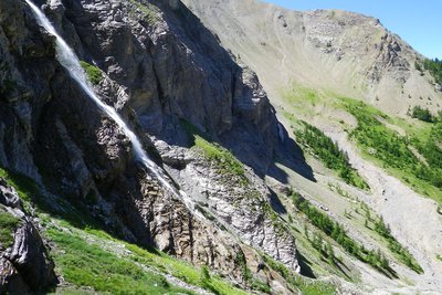
La cascade du Cimet, Haut Verdon - Parc national du Mercantour  Glacier
Cimet waterfall
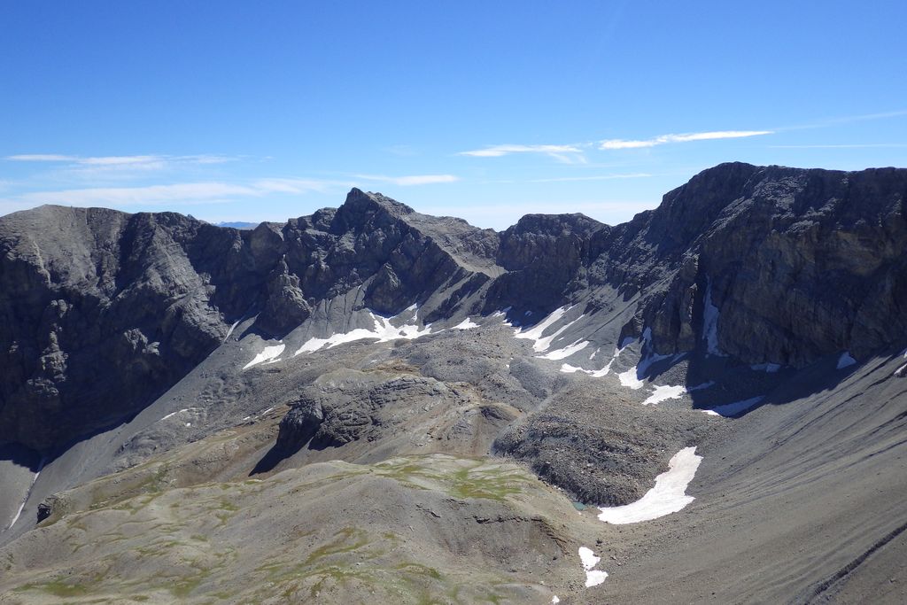
Glaciers have shaped the landscape, as this vast bowl with rounded slopes towering over the Cimet waterfall shows. Later on, erosion has occurred in various ways. The vast screes of La Gorgeasse are the result of freezing weather and then the following thaws whereas wind and water attack the more fragile rocks, shaping the sharp cliffs which tower over the footpath.
Description
Follow the forest track after the gate until it comes to an end (it widens) and continue via the path which follows (Mercantour National Park sign). This path has yellow and green markers.
Go past the farm in the woods and follow the path which initially climbs through the meadow before heading through a larch forest until you reach a forest track which you should pick up.
When this track suddenly begins to climb, take the path on the left which heads downwards. Go through the meadows at Combes and the valley begins to narrow (National Park sign).
The path heads downwards towards the valley floor and the Pich waterfall becomes visible on the opposite side. When you reach the valley floor, cross a footbridge at the bottom of the waterfall.
The path climbs up the other bank and heads over a steep hillock via two big curves. It then flattens out almost completely. The end of the path is at the huts which can be found at Talon (sign).
From here, the path is denoted with red and white markers (GR56). Continue along this path at as you leave the forest (sign), the Cimet waterfall comes into view in front of you.
Reaching the foot of the waterfall is not difficult. Those with energy to spare can go up to the top of this waterfall as long as the presence of ice doesn’t make this impossible.
Follow the same route on the return journey.
- Departure : Allos
- Arrival : The waterfalls of Le Pich and Le Cimet
- Towns crossed : Allos and Uvernet-Fours
Altimetric profile
Recommandations
The paths on this hike are good with yellow and green then red and white markers. This the atmosphere of the high mountains and the weather can change quickly. You will therefore need warm clothes, waterproofs in addition to a good pair of shoes.
The final part of the itinerary (the way up alongside the Cimet waterfall) can become extremely dangerous due to ice in spring and autumn: only go up there in good conditions.
If a sudden shower should fall, the huts at Combes and Talon can provide you with temporary shelter. In the embankment below the Talon hut, 10 metres below the level of the building, there is a spring where you can fill your drinking bottles if you need to.Information desks
Office du tourisme du Val d'Allos
Place de la coopérative, 04260 Allos
Horaires
Toute l'année.
Fermeture exceptionnelle le 1er mai.
Access and parking
Report a problem or an error
If you have found an error on this page or if you have noticed any problems during your hike, please report them to us here: