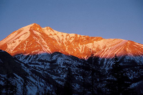
Mont Pelat
1 point of interest

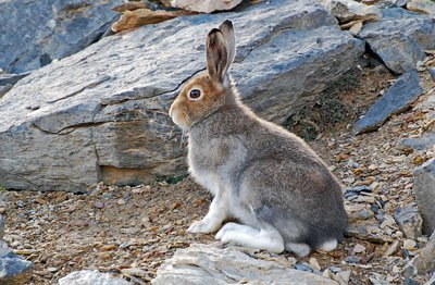
Un lièvre variable en livrée estivale, début octobre. Très discret, il est pourtant présent dans l'ensemble du Parc - BRETON François  Fauna
FaunaMountain hare (Lepus timidus)
The Mountain hare is a species which is a relic from the glacial period. It has an immigration pattern which is similar to that of the rock ptarmigan. During the glacial periods of the quaternary era, this rodent left Siberia to come and colonise Europe.
When the glaciers shrank as the climate warmed up (10000 years ago), it found refuge in the Alps and Pyrenees. Due to the slow nature of the change, the species was able to adapt. Today it can be found in the arctic zones situated above the 60th parallel and in the mountains above 2000m altitude.
Description
Take the track which leads to the lake. On the left, a path with red and white markers heads towards the Plateau de Méouilles.When you reach the far edge of the latter, again on the left, a path with yellow markers heads up to tackle Mont Pelat, one of the “3000 club" of the Mercantour range.
It climbs up gullied slopes and the screes here are an ideal habitat for certain species of bird which live on the mountain all year round.
The end at the summit, somewhat airy, provides a magnificent panoramic view over the lake and the Tours du Lac below and over the surrounding Alps.
If you feel like it, add a stone to the cairn that hikers have built on the summit.
- Departure : Plateau du Laus
- Arrival : Mont Pelat
- Towns crossed : Allos and Uvernet-Fours
Altimetric profile
Recommandations
Information desks
Office du tourisme du Val d'Allos
Place de la coopérative, 04260 Allos
Horaires
Toute l'année.
Fermeture exceptionnelle le 1er mai.
Transport
Free bus service in the Vall d'Allos (Transports Haut-Verdon Voyages): http://ete.valdallos.com/transport-ecologique.html
00 33 (0)4 92 83 95 81
Access and parking
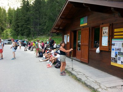
Laus carpark – Restricted access:
The road is open from 26th May to 15th October (according to a municipal bylaw) up to Laus carpark ![]() Pay and display carpark from 30th June to 26th August from 8.30am to 5.00pm (6€ per car and 2€ for motorbikes/scooter, approx. 180 parking spaces)
Pay and display carpark from 30th June to 26th August from 8.30am to 5.00pm (6€ per car and 2€ for motorbikes/scooter, approx. 180 parking spaces)![]() free access before 8.30am and after 5.00pm
free access before 8.30am and after 5.00pm
Information: 00 33 (0)4 92 83 72 68/00 33 (0)4 92 83 02 81
Parking :
Report a problem or an error
If you have found an error on this page or if you have noticed any problems during your hike, please report them to us here:

