Fenestre circuit
8 points of interest
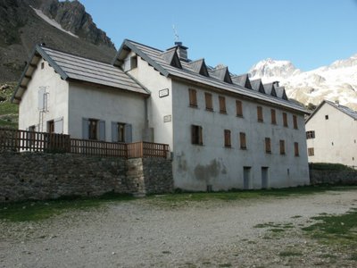
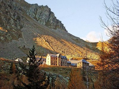
Refuge de la Madone de Fenestre - CAF / DR  Refuge
La Madone de Fenestre refuge
Club Alpin Français
Capacity: 62 Possibility of eating and having a shower
Warden: Mid-June to late-September + school holidays and weekends in winter
Tel. 04 93 02 83 19
Out of season upon reservation: Patrick Miraillet: 04 93 03 91 02
Online reservations: http://chaletmadonedefenestre.ffcam.fr/
Useful numbers:
St-Martin-Vésubie Tourism Office: 04 93 03 21 28
Park House: 04 93 03 23 15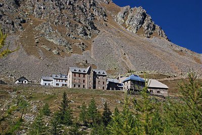
Depuis le vallon, le sanctuaire de la Madone de Fenestre en début d'automne - LEBOUTEILLER Eric  History and historical trail
La Madone de Fenestre sanctuary
In the 8th century, a modest refuge already, providing accommodation for travellers. This sanctuary with its imposing forms was built by the Benedictines of Borgo San Dalmasso and destroyed by the Saracens in the 10th century. The Templars restored it in the 13th century shortly after the Virgin Mary appeared at the Grand Caire window. Subsequently, the sanctuary was devastated by fire several times and then rebuilt. Today it belongs to the diocese of Nice.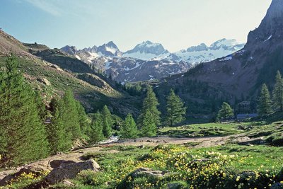
Le Gélas encore bien enneigé en fin de printemps, depuis le vallon de la Madone de Fenestre - LOMBART Guy History and historical trailCol de Fenestre mule track
This track has been used for a thousand years and was regularly maintained to allow mules transporting salt to pass with ease. The technique used to make and maintain these tracks involved self-locking stones. Identically sized slabs were arranged vertically in close lines. Fine materials were then used to hold it all in place. Gutters provided a run-off area for rainwater.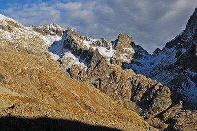
Dans l'ombre à droite le pas du mont Colomb, (2548 m). - GUIGO Franck  Geology
The scars of erosion
When they converge, runoff streams of water leave the ground bare, breaking a fragile equilibrium. In addition, footfall due to tourism damages the ground and raises the question of preservation of natural environments. Plant cover has to be maintained as it protects the ground from erosion and guarantees its stability. Restoration work has been carried out to guide and direct the hundreds of hikers who love these wild areas.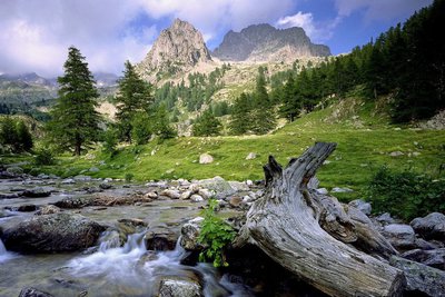
Vieille souche et portion de tronc de mélèze dans le torrent de la Madone de Fenestre face au Cayre de la Madone. - RICHAUD Philippe History and historical trailTerre de cour
The black rock marks one of the borders of the Terre de Cour, formerly a domain of the Count of Provence, before it was returned to the House of Savoy in the 14th century. Two inscriptions on the black rock provide a reminder of the past: “B” for Belvédère, “SM” for Saint-Martin-Vésubie. Terre de Cour was located exclusively in these two communes but they have to share the ancient rights to pasture and wood with Lantosque and Roquebillière.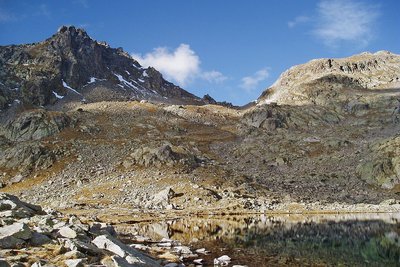
Lac, col et cîme ouest de Fenestre en automne, éclairage automnal. - Guigo Franck  Peak
PeakCol de Fenestre
A communication route within the House of Savoy, the col became part of Italian territory in 1860 and a border col in 1947, the date at which the border was moved to the watershed. When the weather is clear, the view extends beyond the plain of Pô to 200km to the north: Cervin (4478m) and Mont Rose (4634m) are visible in these conditions.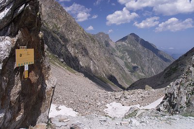
Colle di Finestra, panorama sul versante italiano - Roberto Pockaj  Cross-border
Il Colle di Finestra
The pass is a direct link between Valle Gesso and Vésubie, and has been crossed since time immemorial - and immortalized in legend and historical annals - by saints, emperors and invading armies. Before the Savoys gained direct access to the sea, the Colle di Finestra pass was also an important supply route for the salt trade.
Its name, which first appears in the written records in 1041, has remained unchanged up to the present day: Colle di Finestra or, as written on the military maps of the early 1900s, Colle delle Finestre. The first version is the right one, though, because it refers to a single natural window (Finestra) that splits the northwest crest of the Cayre de la Madone.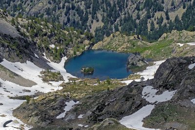
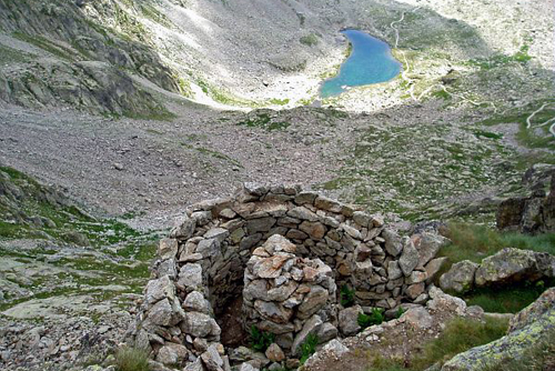
En descendant du pas des Ladres, le lac de Trecolpas, (2150 m), vallon du haut Boréon. - Franck GUIGO History and historical trailPas des Ladres
In Italian, “ladre” means thief. Indeed, the smugglers coming from Col de Fenestre came through here to reach Saint-Martin-Vésubie and avoiding the carabinieri outpost at La Madone.
From Pas des Ladres, you can Lac de Trecolpas below. Keep your eyes open, chamois often come this way.
Description
Leave from marker 357. The path zigzags upwards gently on the slope which features the sanctuary. The width and surface of the path may surprise you.
Before crossing the Magnin mountain stream (marker 368), head past the path which leads to Le Pas des Ladres a follow the direction of Le Lac de Fenestre. To the east, you can see Le Pas du Mont Colomb and on its right the northern slopes of Le Grand Caïre (2532 m) and Le Petit Caïre (2413 m).
Continue until you reach Le Lac de Fenestre, at an altitude of 2266 metres. It is 250 metres long, 75 metres and up to 4 metres in depth.
The path winds towards Le Col de Fenestre and heads between two bunkers which are sometimes frequented by ibex. You will reach the col after the intersection at marker 369. On the slopes on the Italian side, a barracks denotes the military purposes the area was used for in the past.
Return to marker 369. Turn right towards Le Pas des Ladres (marker 428), which provides an extensive view over the high Boreon valley and Lac de Trecolpas (2150 m). Continue along GR52 towards La Madone de Fenestre.- Departure : La Madone de Fenestre sanctuary, Saint Martin de Vésubie
- Arrival : La Madone de Fenestre sanctuary, Saint Martin de Vésubie
- Towns crossed : Saint-Martin-Vésubie
Altimetric profile
Recommandations
Information desks
Maison du Parc national du Mercantour - Saint-Martin-Vésubie
8, Avenue Kellermann - Villa Les Iris, 06450 Saint-Martin-Vésubie
Horaires
Ouvert tous les jours sauf le dimanche du 15 juin au 15 septembre
Office de Tourisme Métropolitain - Bureau d'information de Belvédère
Rue Victor Maurel, 06450 Belvédère
Horaires
Ouvert toute l'annéeOffice de Tourisme Métropolitain - Bureau d'information de Valdeblore - La Colmiane
La Colmiane, 06420 Valdeblore
Horaires
Toute l'année.Fermetures exceptionnelles les 1er janvier, Lundi de Pâques, Jeudi de l'Ascension, Lundi de Pentecôte, 1er mai, 8 mai, 14 juillet, 15 août, 1er novembre, 11 novembre et 25 décembre.
Transport
Information available at Saint-Martin-Vésubie Tourism Office.
Access and parking
Parking :
Report a problem or an error
If you have found an error on this page or if you have noticed any problems during your hike, please report them to us here: