Col du Sabion
3 points of interest
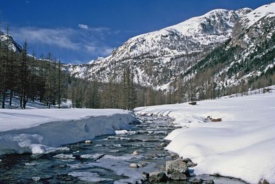
Le vallon et le torrent de Castérino en hiver. - Parc national du Mercantour  History and historical trail
Castérino valley
Long ago, Italian lumberjacks worked in the spruce and larch forests which border the entire valley all the way to St-Dalmas-de-Tende. The trunk they cut down were then taken to the bed of the mountain stream where they constituted a temporary dam behind which the water level rose. The lumberjacks then broke the dam down and the trunks were carried away by the water. The floating operating came to an end at Saint-Dalmas-de-Tende. The trunks were then loaded onto 4 wheeled carts pulled by mules and taken to the St Dalmas sawmill or the two sawmills at Tende. When the railway arrived at the start of the 20th century, they were sent to Piedmont, to the detriment of the local sawmills.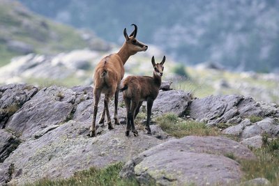
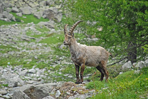
Chamois, (Rupicapra rupicapra), une femelle et son jeune cabri - ROSSI Gilbert  Fauna
FaunaChamois (Rupicapra rupicapra)
Whether it is the stocky forest chamois or the slender rock chamois, this animal is the athlete of the high slopes. Thanks to its powerful muscles, it can climb 400m upwards in 5 minutes and springs over ravines in 7 to 12m bounds. Snow patches and glaciers are its playground: its hooves adapt to the terrain and cushion it from shocks, its spurs serve as brakes and the sharp edge of its hooves are like crampons on the harder areas of snow.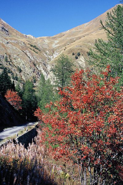
Le Col du Sabion (2268m), en automne - ROSSI Gilbert  Mountain pass
Col du Sabion
A traditional passageway, Col du Sabion towards Val d'Entraque (Italy) occupies a strategic position on the watershed.
While international tensions were growing prior to the Second World War, the col was the subject of engineering work commissioned by the Italian government: dry-stone barracks, semi-buried bunkers, telephone lines and barbed wire fences which today, with hindsight, appears to be a manifestation of hostile behaviour.
Description
The track initially goes through a wood of larches. It then reaches the Alpine pasture of Barchenzane, where you have a splendid view of the Val Castérino: a mixture of prairies, groves and scattered houses on either side of the wide watercourse.
At marker 372, head towards “Col du Sabion”: At 2236m altitude, the path passes three vaulted buildings which are covered in grass: these are former military shelters which date back to the 19th century.
Having crossed the Alpine pasture of Sabion, the path leads to the Col du Sabion, on the boundary between the two Natural Parks (Mercantour and Alpi Marittime). Down below on the Italian side, is the small Lago della Vacca, which is slowly being taken over by sediment. Chamois and ibex can often be seen.
Follow the same itinerary for the return journey.
- Departure : Baisse de Peïrefique
- Arrival : Col du Sabion
- Towns crossed : Tende
Altimetric profile
Recommandations
It is not advisable to visit the bunkers which date from the Second World War (dangerous pits and barbed wire).
Vehicle access to Baisse de Peïrefique is via an uneven and at times narrow track which is easier to pass for a vehicle with good ground clearance or a 4X4.
Information desks
Maison du Parc national du Mercantour - Tende
103 av du 16 septembre 1947, 06430 Tende
La Maison du Parc se trouve dans les locaux de l'Office de Tourisme Menton, Riviera & Merveilles - Bureau de Tende
Horaires
01/06, tous les jours de 8h30 à 17h.
Du 01/10 au 31/05.
Fermé le dimanche.
Fermetures exceptionnelles les 1er janvier, Lundi de Pâques, 1er mai, 1er novembre, 11 novembre et 25 décembre.
De 9h à 12h30 et de 14h à 17h.
Access and parking
At Saint-Dalmas de Tende, take the fork onto the RD91 until you reach the hamlet of Castérino then continue for 2km towards vallée de Valmasque.
The track is initially tarmacked then becomes a dirt track, leading to the Potamou gate which is one of the entrances to National Park. Subsequently head right on the track towards La Baisse de Peyrefique.
Having travelled 5km from Potamou, park your vehicle at the carpark next to marker 371 and follow directions to "Col du Sabion".
Parking :
Report a problem or an error
If you have found an error on this page or if you have noticed any problems during your hike, please report them to us here: