The Colle di Ciriegia
1 point of interest

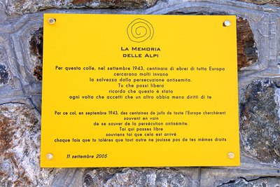
La targa commemorativa posta sulla Casermetta al COlle di Ciriegia in occasione del 25° anniversario del Parco - Roberto Pockaj  History and historical trail
Trails of Freedom
Betwee the 8th and 13th of September, 1943, just days after Italy's surrender, about twelve hundred Jewish civilians of all ages and walks of life, originating from Saint-Martin Vésubie, crossed the Alps together with the Italian troops of the IV Army Corps. On foot, following two different routes, over the Colle di Finestra and the Colle di Ciriegia, the refugees arrived, respectively, in Entracque and Valdieri, where they were housed in the barracks and wherever else possible. A plaque affixed to the wall of the barracks at Colle di Ciriegia commemorates these events.
Description
After crossing the wooden bridge over the Gesso della Valletta torrent, the route follows the mule track that crosses Pian della Casa del Re (1735 m). The mule track climbs with a few broad switchbacks up grassy detritic slopes dotted with larches until it comes to a triple fork: the route continues along the middle trail, ignoring the one on the right, which leads to the intermediate Lake Fremamorta (unmarked and reserved for expert hikers only) and the one on the left(marked) to the Regina Elena Refuge.
A bit further on, the route passes by a turnoff on the right, also for the intermediate Lake Fremamorta.
After passing through a copse of green alders, the trail circumnavigates a rockslide with a few stone steps. Arriving at the foot of a rocky outcropping, the trail surmounts it with tight switchbacks and two long traverses, passing first on the orographic right side of the valley and then returning to the left one again.
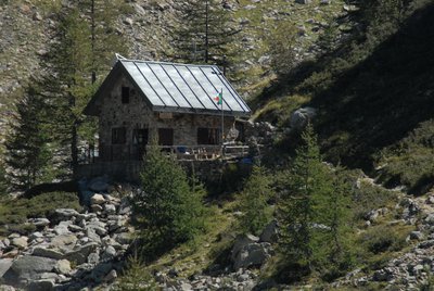
Now passing through fields of detritus, the mule track becomes a trail and passes by the remains of a small former military shelter, then winds past several large fallen boulders.
After climbing up another detritic slope, the trail proceeds through rubble until reaching a fork: the two paths come together again further on, but the one on the left is recommended.
The trail continues uphill on the orographic right; it passes by the turnoff to the left on the mule track for the Vallone di Balma GhiliË, shifts once again to the orographic left side of the valley and, in a series of long but fairly steep switchbacks, leads over the rock-strewn slope that precedes the barracks erected to house the troops defending the pass.
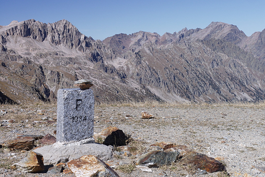
The Colle di Ciriegia pass (2543 m, 2 hours and 35 minutes from Pian della Casa del Re) is just a few meters beyond the remains of the military barracks.
- Departure : Pian della Casa del Re (1735 m)
- Arrival : Colle di Ciriegia (2543 m)
- Towns crossed : Valdieri
Altimetric profile
Recommandations
Transport
SNCF line TER Provence Alpes-Côte d'Azur For travel in the PACA region and towards Cuneo www.ter-sncf.com/pac
Trenitalia for travel in the Piedmont region https://www.trenitalia.com/it.html
Access and parking
Parking :
Report a problem or an error
If you have found an error on this page or if you have noticed any problems during your hike, please report them to us here:
Close by1
- Mountain Hut
Mountain Hut
Rifugio Regina Elena
The Regina Elena Refuge, located in the Alpi Marittime Natural Park at 1,850 meters above sea level, equipped with 14 beds with use of the kitchen, operates in the summer period thanks to the voluntary work of the Members of the National Alpine Association - Genoa section.

