The hike of colours - Le Cians and Daluis circuit - Stage 2
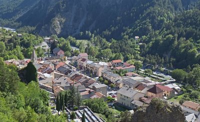
Guillaumes
2. The hike of colours - Le Cians and Daluis circuit - Stage 2
Hard
6h
16,8km
+983m
-727m
Walking breaks
Embed this item to access it offline
1 point of interest
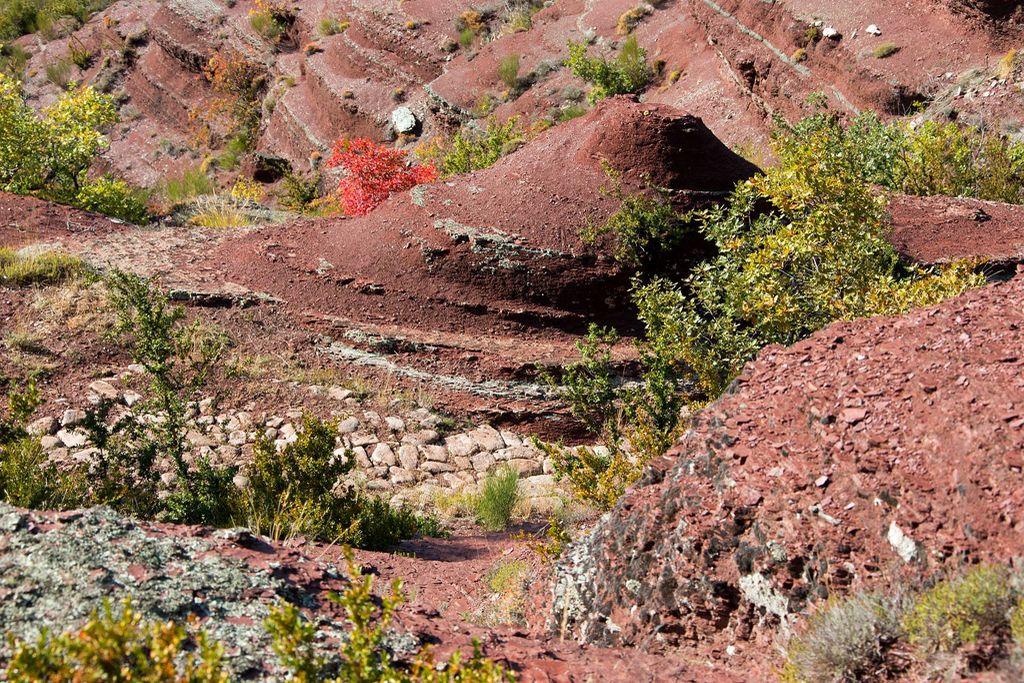
Vaste paysage rive gauche et est des gorges de Daluis non loin du Point Sublime. - LOMBART Guy  Geology
A very compact cliff!
On the other bank of the Berthéou valley, it is possible to see a light-coloured, almost white, cliff: it is made of quartzites from the Triassic period, resting directly on top of the recognisable red pelite of the Paermian era.
This extremely compact rock was used on site to build the beautiful Berthéou viaduct, constructed at the beginning of the 20th century for the steam tramway which ran to Guillaumes.
Quartzites can mainly be found in the “giant’s cauldrons” in the Berthéou valley, where they played an essential abrasive role. These natural swimming pools are a delight for fans of canyoning.
Description
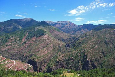
From the square in Guillaumes (marker 15) walk along the path on the left bank of the Var until you reach the Pont des Roberts (767m marker 11). Continue along the path which runs parallel to the road (rectangular yellow markers) to reach the Pont de Cante (marker 11). The itinerary joins the small D88 road, which you should follow until marker 7. Head onto the discovery path towards the Pont de Berthéou and the belvedere over the Daluis gorges. At marker 7a, make a round trip, continuing left (south-east); the path along the ridge leads to the place called “Point sublime”, where, from a secure platform, you can look over the Daluis gorges from over 100m above them; you will be able to see an incredible landscape full of vertical surfaces and opposite, in the cliff face, the remains of the copper mines. Through Mediterranean foliage, you will reach the Berthéou valley (marker 6 and marker 5). Turn right, cross the valley and continue along until you reach the D2202 road. Cross the road (marker 3) and head towards Pont de Durandy (654m), La Salette (marker 60) and Daluis (645m); continue until marker 100 as you leave the village on the D2202. The itinerary crosses the Var and rises rapidly on the hillside towards Saint Léger (marker 102). Continue along the path to reach the middle of the hamlet (marker 247).
- Departure : Guillaumes
- Arrival : Saint-Léger
- Towns crossed : Guillaumes, Sauze, and Daluis
Altimetric profile
Report a problem or an error
If you have found an error on this page or if you have noticed any problems during your hike, please report them to us here:
Close by1
- Information site