The Rifugio Garelli loop
2 points of interest
La stazione botanica Burnat Bicknell - Roberto Pockaj  Flora
FloraThe Burnat Bicknell Botanical Station
The site covers over 10,000 square meters, and is named after Emile Burnat and Clarence Bicknell. Burnat, a Swiss botanist, was the author of the important work 'Flores des Alpes Maritimes'; Bicknell, an English botanist active in Valle Pesio for about thirty years, he was also the first to catalogue the rock engravings of Monte Bego.
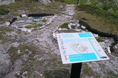
About 500 plant species typical of the Ligurian Alps are collected in the two botanical stations, offering a unique opportunity for both enthusiasts and casual visitors. Illustrative panels describe the various environments and the botanical species are easily recognizable thanks to the scientific name on the labels.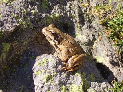
Rana temporaria - Graziano Pala  Fauna
FaunaThe amphibians
Small, helpless and often discreet, amphibians have known our land for hundreds of millions of years, even before the more famous dinosaurs populated the continents and oceans. Even today their biology has something surprising, halfway between a fish and a reptile, they inhabit very humid areas but know how to adapt to very dry environments. There are few species in the Park, some spread over large territories, others very localized: the salamander, the common frog, the toad, the rare geotriton.
Description
From Pian delle Gorre take the dirt road closed to traffic that goes into the Vallone del Saut.
Ignoring various branches and paths, you go up the dirt road to its end, near a small clearing, where you take the mule track to the Garelli Refuge on the left.
The mule track climbs steeply for a long time with a number of hairpin bends; when after a wooden bridge it levels out, it brings you to Rifugio Sestrera sottano (1341 m, 1:00 hour from Pian delle Gorre, fountain).
Leave the trail to the left that goes up to the Garelli refuge via the Vallone di Sestrera (shorter way) and carry straight on towards the Vallone del Marguareis. The path passes a beech wood, crosses the stream, then finally comes out of the woods.
Continue with a long traverse amid large boulders in the pasture, ignoring the junction on the right for the Colle del Prel.
Steep ascents alternate with flatter sections leading first to Gias soprano del Marguareis, then to the Laghetto del Marguareis (1924 m, 1:50 hours from the Rifugio Sestrera sottano).
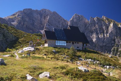
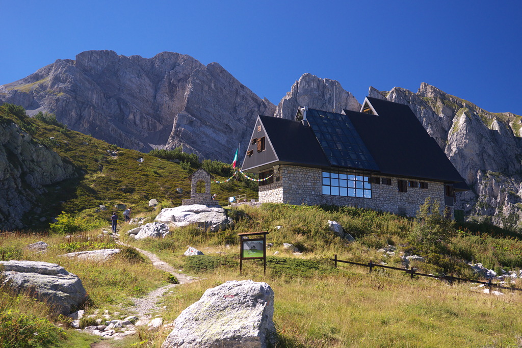
Cross the small emissary of the lake, now climbing up the left side of the valley. With various ups and downs at half-way the path takes a path almost backwards. After crossing a ridge you enter the Vallone di Sestrera at Pian del Lupo, where the Rifugio Garelli appears (1966 m, 0:20 mins from the Laghetto del Marguareis).
From the refuge, take the path that descends west-northwest to Gias soprano di Sestrera below. Continue downhill, initially with narrow stony switchbacks.
When you enter the spruce wood, the hairpin bends lengthen slightly but remain quite steep. The descent continues for a long time through the woods, until you come out into the sun at the clearing by the Rifugio Sestrera sottano (1341 m, 1:05 hours from Gias soprano di Sestrera), already passed by on the way up. From here you return to Pian delle Gorre (1032 m, 0:45 mins from Rifugio Sestrera sottano) retracing your steps.
- Towns crossed : Chiusa di Pesio
Altimetric profile
Access and parking
Report a problem or an error
If you have found an error on this page or if you have noticed any problems during your hike, please report them to us here: