
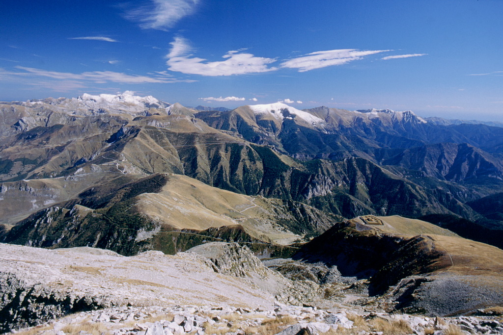
The Rocca dell'Abisso
This is the border between the Maritime Alps and the Ligurian Alps, and the differences are easily noted: the rounded, grassy slopes of the Colle di Tenda pass are gradually replaced by dark and massive rock faces of the Rocca dell'Abisso.
3 points of interest
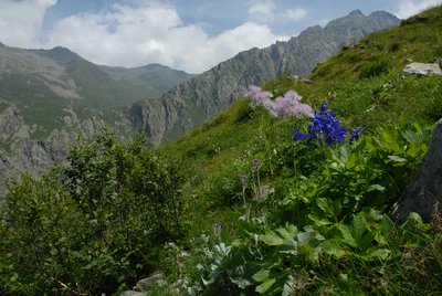
Alneti a ontano verde - Cati Caballo  Flora
FloraGreen alder woods
Settled above the altimetric strip occupied by the wood or interspersed with it at its upper limit of expansion, extend the alneti, the shrubby populations of green alder, which, especially on the cool and shady slopes, leave little room for other species woody. It is a nitrogen-fixing species which, thanks to the symbiosis with particular microorganisms, manages to capture the nitrogen present in the atmosphere both for its own survival and for the enrichment of the soil.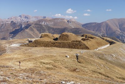
Il Fort de Giaure - Roberto Pockaj  History and historical trail
Forte Giaura
Forte Giaura is located on the homonymous Cima di Giaura. Armed with 8 pieces of artillery, it is still in excellent condition. On the attack front of the fort you can see the five splinter-guard partitions between the emplacements of the pieces in the open ("in barbetta").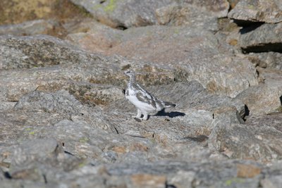
Pernice bianca - Lovera Claudio  Fauna
FaunaThe ptarmigan
The higher slopes facing north, covered with rocky debris, dwarf willows and a few grasses, are the preferred habitats of a rare glacial relict, such as the alpine ptarmigan. Its survival in a climatic phase like the current one is put at risk, its biology does not allow it to adapt so quickly to changing high-altitude environments. It will only survive on the cooler slopes of high mountains, as its ability to move is relatively small.
Description
From Colle di Tenda (1871 m), the route follows the dirt road for Casterino (to the right, coming from Limone).
Continue along the same route as the "Fort Pernante and Fort Giaura" trail to Fort de Giaure (formerly Forte Giaura, 2,254 m, 1 hour and 55 minutes from Colle di Tenda).
Passing by the turnoff for the Lacs de Peïrefique, the route climbs uphill on an old mule track with numerous switchbacks, along the steep grassy slope of Pra Giordano (there is a single shortcut to the left of the switchbacks, which avoids them all).
After the switchbacks, the climb continues fairly straight, still on the grassy slope. After passing by a turnoff on the right, the trail traverses northwest for an extended tract. As the altitude increases, the trail begins to lead through detritus and rubble: when it arrives at the foot of the last detritic slope, it rises in tight turns and then, leading to the left, it leads to the lower peak of the Rocca dell'Abisso (2755 m, 1 hour and 30 minutes from Fort de Giaure), where there is a cross and a weather station.
The primary peak, which is at almost the same altitude, is just a few meters away, but can only be reached by a risky climb along the crest.
- Departure : Colle di Tenda (1871 m)
- Arrival : Rocca dell'Abisso (2755 m)
- Towns crossed : Limone Piemonte and Tende
Altimetric profile
Access and parking
From Borgo San Dalmazzo, drive up the Valle Vermenagna, passing Limone Piemonte. Before coming to the entrance to the tunnel, turn right for Limone 1400, then continue on for the Colle di Tenda pass. Parking spaces are available for many cars.
Report a problem or an error
If you have found an error on this page or if you have noticed any problems during your hike, please report them to us here: