Fort Pernante and Fort Giaura
The trek passes through the middle of the entrenchments of Campo Tenda, dug at the end of the eighteen hundreds to guard against incursions from the Valle Roya and also to defend the newly built tunnel under the pass. In addition to the fortifications, the excursion also offers some lovely panoramas towards the sea and a small lake.
3 points of interest
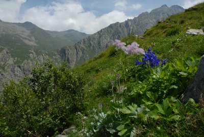
Alneti a ontano verde - Cati Caballo  Flora
FloraGreen alder woods
Settled above the altimetric strip occupied by the wood or interspersed with it at its upper limit of expansion, extend the alneti, the shrubby populations of green alder, which, especially on the cool and shady slopes, leave little room for other species woody. It is a nitrogen-fixing species which, thanks to the symbiosis with particular microorganisms, manages to capture the nitrogen present in the atmosphere both for its own survival and for the enrichment of the soil.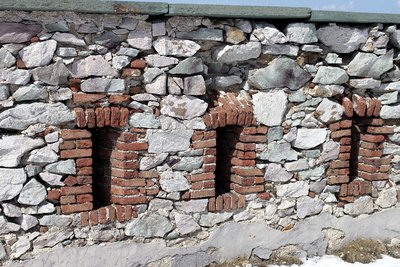
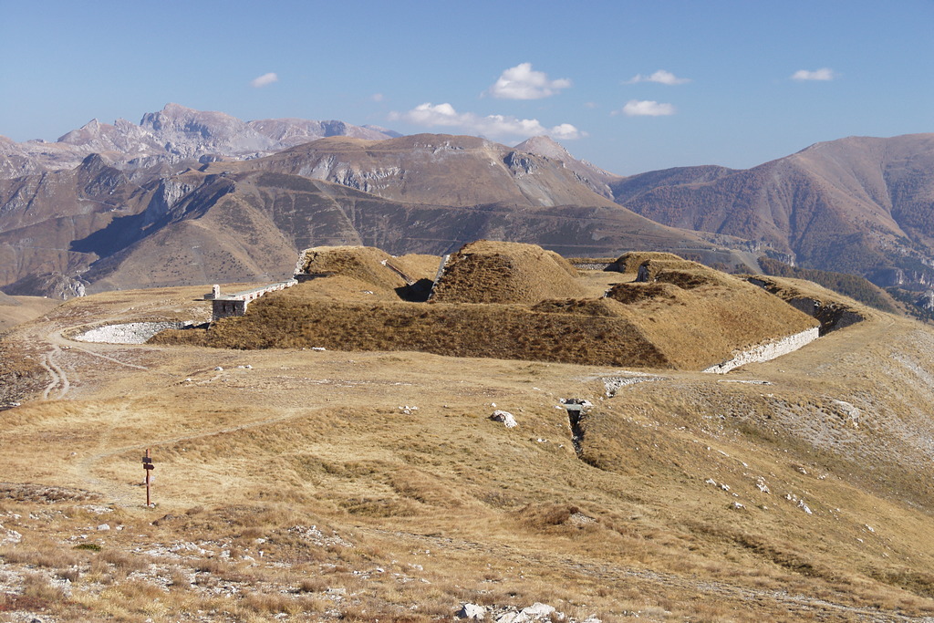
Postazioni per fucilieri sul fronte di gola del Fort Pernante - Roberto Pockaj  History and historical trail
Forte Pernante
Fort Pernante (Forte Pernante), located on the peak of the same name, was equipped with 4 cannons and defended by 120 men. The structure is now showing evident signs of decay.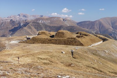
Il Fort de Giaure - Roberto Pockaj History and historical trailForte Giaura
Forte Giaura is located on the homonymous Cima di Giaura. Armed with 8 pieces of artillery, it is still in excellent condition. On the attack front of the fort you can see the five splinter-guard partitions between the emplacements of the pieces in the open ("in barbetta").
Description
----------------------
From Colle di Tenda (1871 m), the route follows the dirt road for Casterino (to the right, coming from Limone), climbing up as far as the hamlet of Colletta, where there is a crossroad with a former military service road, blocked by a crossbar, which leads to Fort Pernante and Fort Giaura.
Between the two roads, the route continues on a clearly visible trail that climbs steeply up the slope along the broad divide, among pastures and copses of alders.
The trail, extremely panoramic, proceeds less steeply until it rejoins the former military service road leading to the fort, which it had brushed up against twice before. Followng this to the left, after a single switchback the road soon comes to Fort Pernante (formerly Forte Pernante, 2114 m, 45 minutes from Colle di Tenda).
On the western slope below the fort, the trail descends through a patch of alders almost to the old road, turning away from it immediately to round the knoll of Cime de Salaute on the left, which the road instead passes to the right (north) side, which is far less exposed to enemy gunfire. The trail traverses flatly mid slope before rejoining the road, now the size of a mule track, near another small pass beyond the Cime de Salaute.
The route follows the mule track to the left and shortly comes to another small pass, the Bassa sovrana di Margheria (2079 m, 35 minutes from Fort Pernante), where, at a signpost marking the border, it is joined from the right by a trail from the Gias Prati della Chiesa and Limonetto.
At the foot of the craggy slope of the Cima di Giaura, the trail passes by a path on the left that climbs up very steeply to the crest of the ridge, staying instead on the mule track that veers eastward and traverses, slightly uphill, on a rocky base. At the first switchback, to the left, the route leaves the old road (which, due to several landslides further uphill, is no longer passable even on foot) and follows the trail to the right, across a scree. The trail leads along the edge of a detritic hollow, through bushes, and passes just uphill of a miniscule lake without a name. After a long traverse, the trail crosses a small stream and reaches the eastern shore of Lake dell'Abisso (2207 m, 25 minutes from the Bassa sovrana di Margheria).
The trail then inverts its direction, proceeding uphill to the southeast until it rejoins the military road it came from, at the last switchback below the fort. With a challenging traverse along rocky cliff walls (attention to the brief tracts over landslides, quite exposed), the trail finally arrives at the grassy flat area on which stands the Fort de Giaure (formerly Forte Giaura, 2254 m, 15 minutes from Lake dell'Abisso).
- Departure : Col de Tenda (1871 m)
- Arrival : Fort de Giaure (2254 m)
- Towns crossed : Limone Piemonte and Tende
Altimetric profile
Access and parking
From Borgo San Dalmazzo, drive up the Valle Vermenagna, passing by Limone Piemonte. Before reaching the entry to the tunnel, turn right for Limone 1400 and then continue on for the Colle di Tenda pass.
Report a problem or an error
If you have found an error on this page or if you have noticed any problems during your hike, please report them to us here: